MyTopo
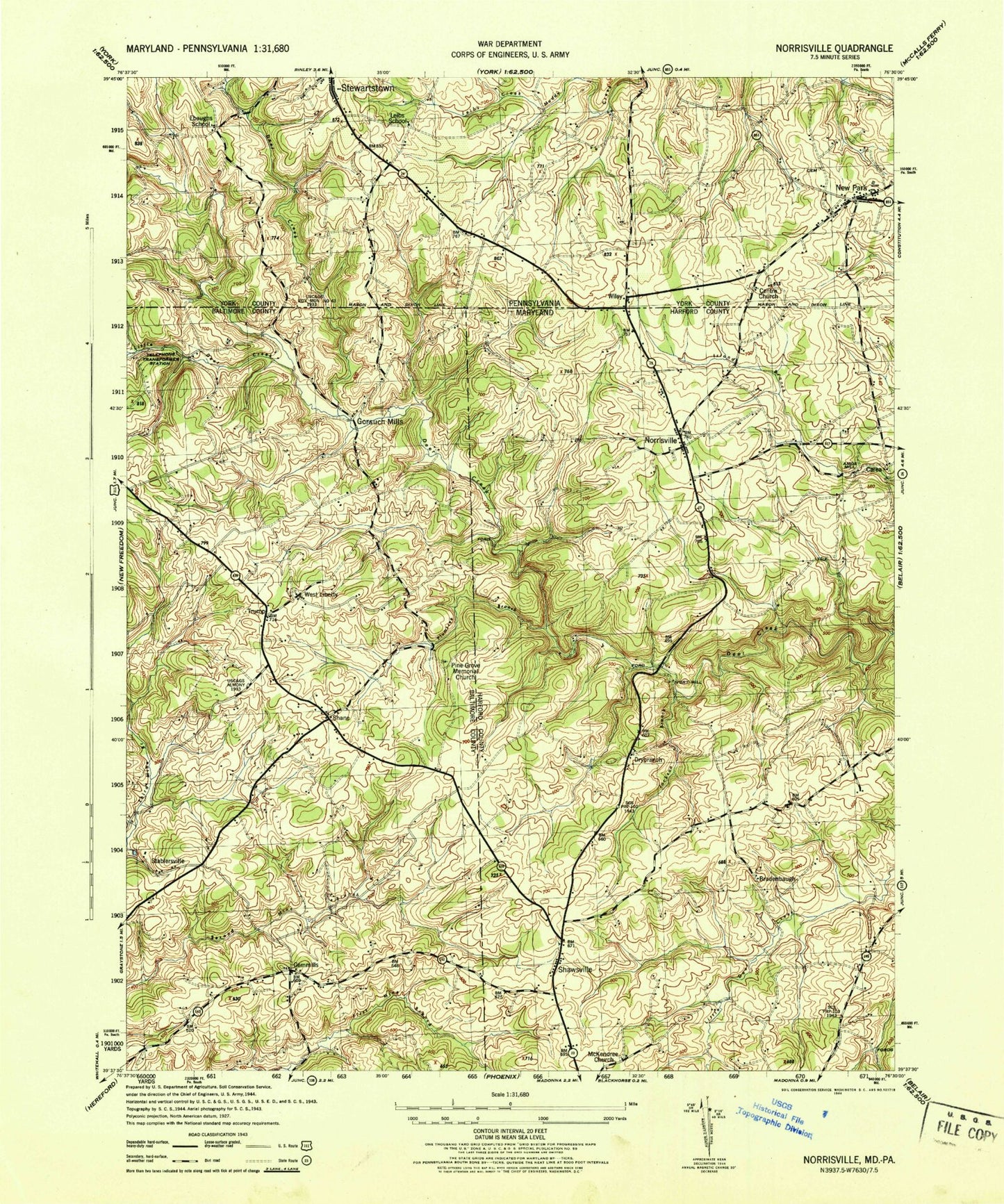
Classic USGS Norrisville Maryland 7.5'x7.5' Topo Map
Couldn't load pickup availability
Historical USGS topographic quad map of Norrisville in the states of Maryland, Pennsylvania. Map scale may vary for some years, but is generally around 1:24,000. Print size is approximately 24" x 27"
This quadrangle is in the following counties: Baltimore, Harford, York.
The map contains contour lines, roads, rivers, towns, and lakes. Printed on high-quality waterproof paper with UV fade-resistant inks, and shipped rolled.
Contains the following named places: Amos Mill, Ayers Chapel, Bradenbaugh, Bradenbaugh Manor, Camp Deer Creek, Carea, Cattail Reservoir, Centre Church, Church Lane Spring, Circadian Farms, Drybranch, Ebaughs Creek, Falling Rocks Branch, Farmington, Gorsuch Mills, Greystone Golf Course, Harford County Public Library - Norrisville Branch, Harford Manor Farms, Harris Mill Creek, Holiday Hills, Hopewell Cemetery, Indian Hills, Indian Meadows, Ivory Mill, Jackson Branch, Jolly Acres Summer Camp, Jordan Mill Farms, Little Deer Creek, Little Deer Creek Reservoir Number 3, Little Deer Creek Reservoir Site, Little Deer Creek Watershed Site Number 3 Dam, Madonna Manor, Manor Hill Farm, Marsteller Airport, McKendree Church, McKendree Methodist Episcopal Church Cemetery, Meadow Stream, Nestling Wind, New Bethel Church, New Park, New Park Post Office, Norrisville, Norrisville Elementary School, Norrisville Reading Center, Norrisville Recreation Complex, North Green Ridge, Nottinghamshire Farms, Oak Valley, Old York Manor, Parker Conservation Area, Pine Grove Memorial Church, Plumtree Branch, Rolling Knolls, Shane, Shane Valley, Shawsville, Shawsville Acres, Stablersville, Township of Hopewell, Trump, Vernon, Vernon Church, Walnut Springs, West Liberty, West Liberty United Methodist Church, Wiley, Wiley Falls, Wileys Corner, ZIP Code: 21161