


MyTopo
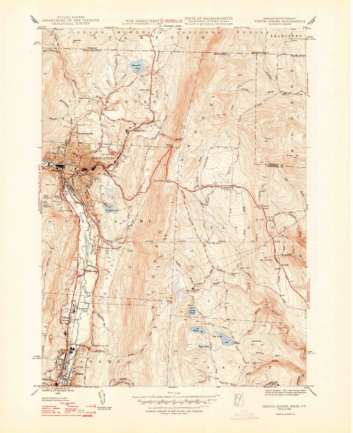
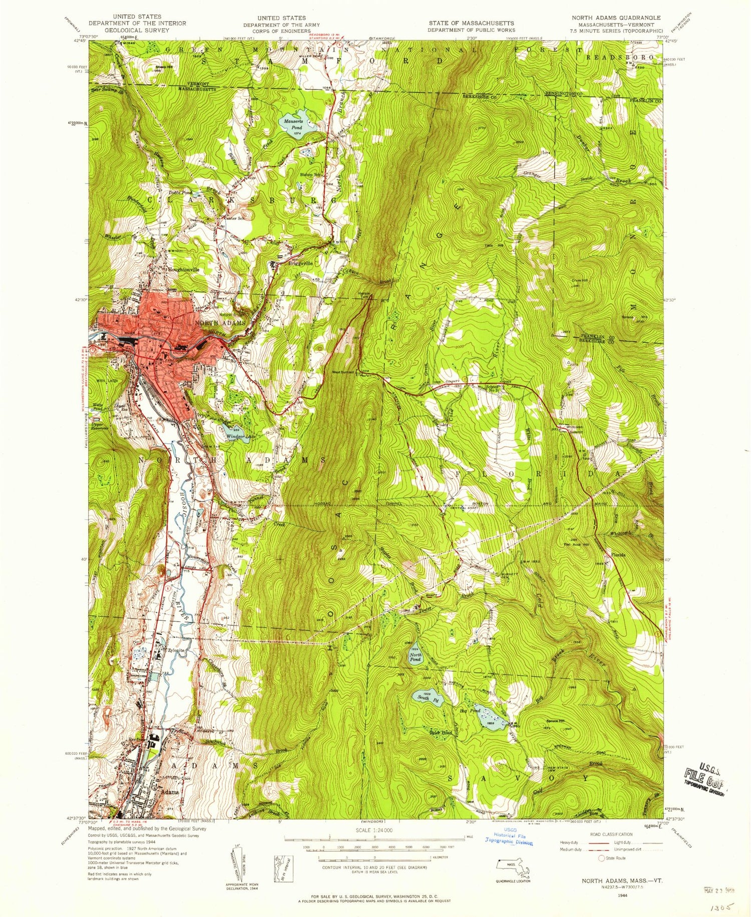
Classic USGS North Adams Massachusetts 7.5'x7.5' Topo Map
Couldn't load pickup availability
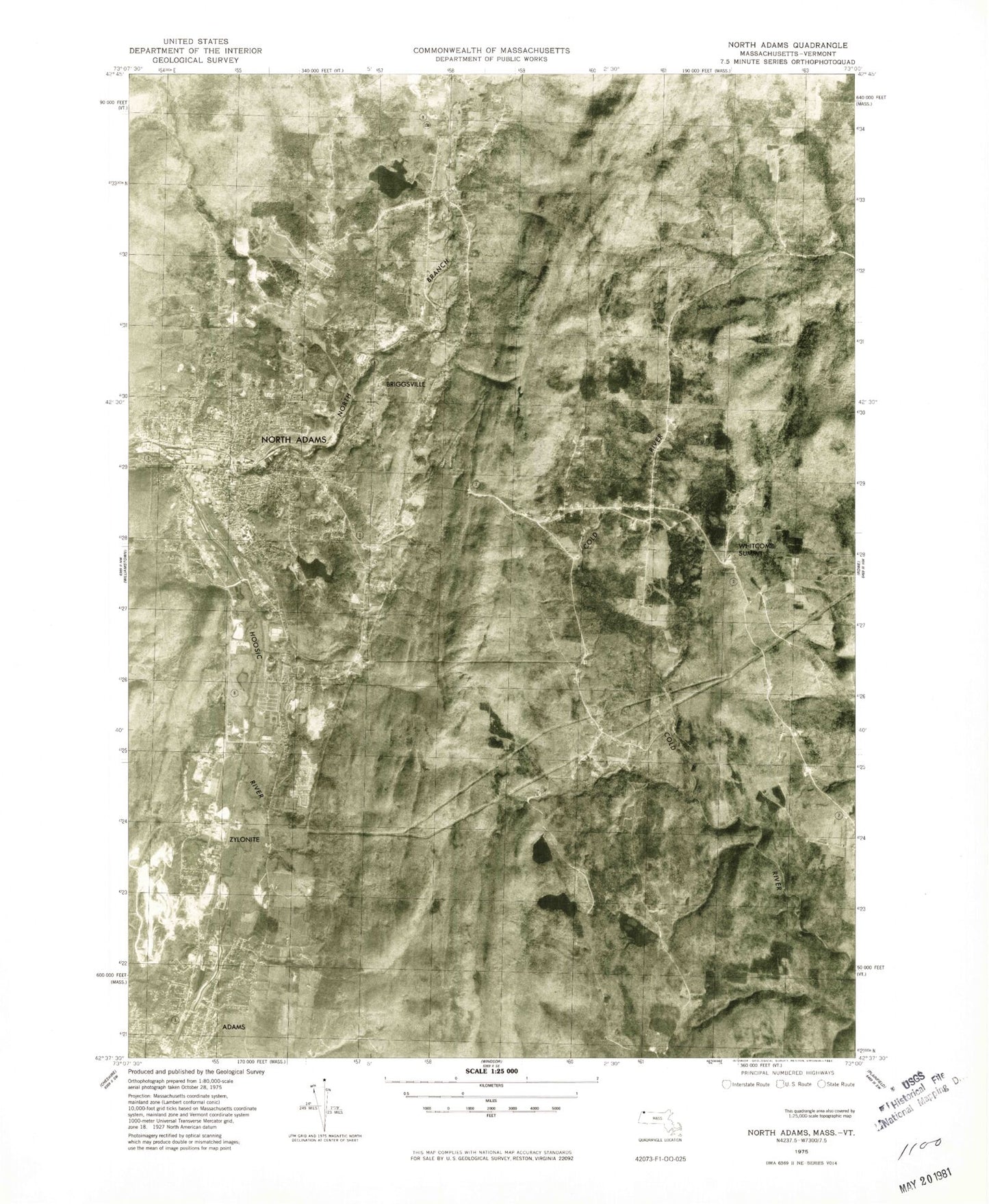
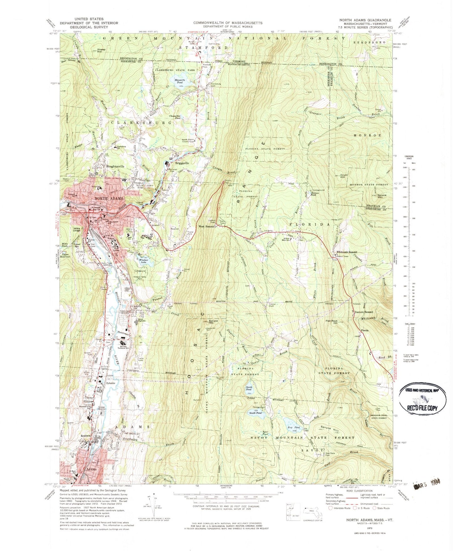
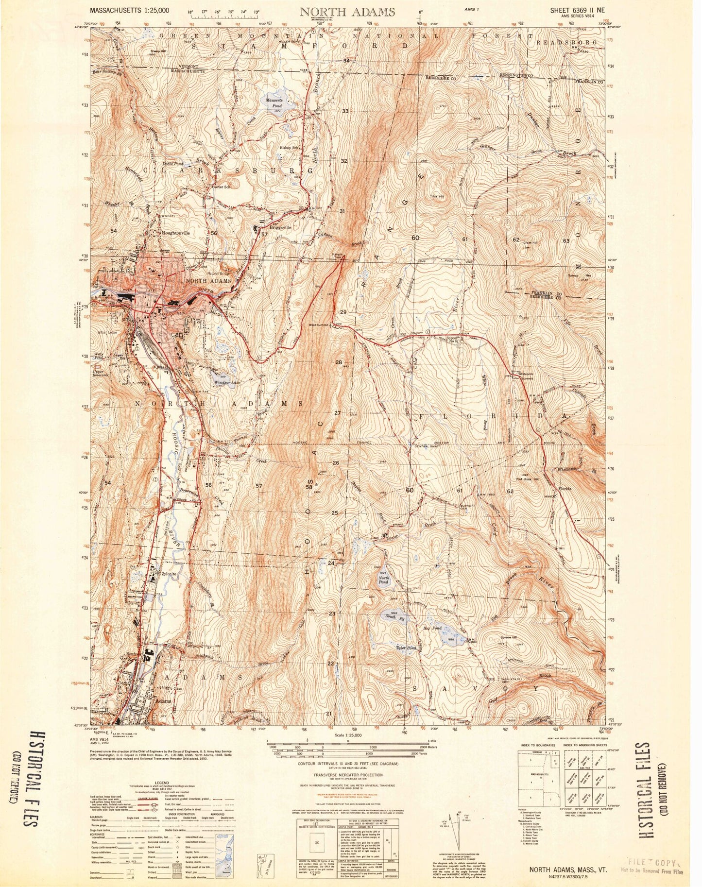
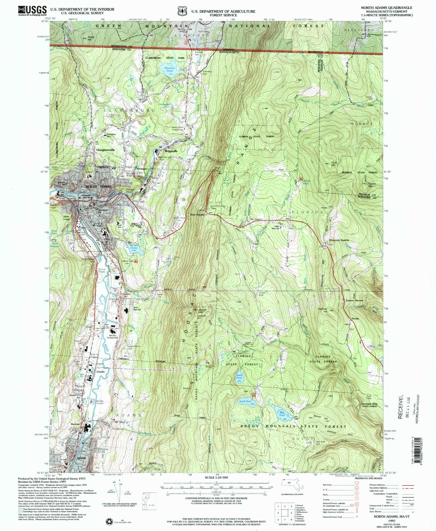
Historical USGS topographic quad map of North Adams in the states of Massachusetts, Vermont. Typical map scale is 1:24,000, but may vary for certain years, if available. Print size: 24" x 27"
This quadrangle is in the following counties: Bennington, Berkshire, Franklin.
The map contains contour lines, roads, rivers, towns, and lakes. Printed on high-quality waterproof paper with UV fade-resistant inks, and shipped rolled.
Contains the following named places: New Tanks, Houghtonville, Historic Valley Park, Florida State Forest, New State Cemetery, Abbott Memorial School, Clarksburg Cemetery, Maple Street Cemetery, Adams Junior High School, Howland Avenue School, Charles McCann Vocational Technical School, Southview Cemetery, Saint Josephs Cemetery, J S Sullivan School, Hopkins School, Notre Dame School, Hillside Cemetery, Johnson School, Beth Israel Cemetery, Advent Cemetery, Clarksburg Elementary School, North Adams City Hall, Clarksburg State Park, North Adams Country Club, Busby Trail, Renfrew Dam, Bog Pond Dam, Upper Reservoir Dam, Windsor Lake Dam, North Branch Hoosic River Reservoir, Eclipse Dam, Mauserts Pond South Dam, Mauserts Pond North Dam, Eastern Summit, Hoosac Tunnel Museum, Serpentine Ledge, Wheeler Brook, Kemp Park, Maple Street Cemetery, Noel Field, North Adams State College Athletic Field, Drury High School, Haskins School (historical), Saint Josephs High School (historical), Massachusetts College of Liberal Arts, Lower Reservoir, Bear Swamp Brook, Beaver Creek, Bog Brook, Bog Pond, Bowerman Creek, Briggsville, Canyon Brook, Cheesbro Brook, Choquettes Pond, Cowan Brook, Crum Hill, Flat Rock Hill, Florida, Granger Brook, Green River, Hairpin Turn, Hudson Brook, Hunterfield Brook, Mauserts Pond, Moores Summit, Natural Bridge of New England, North Adams, North Branch Hoosic River, North Pond, Phillips Creek, Renfrew, South Pond, Southwick Brook, Spruce Hill, Spruce Hill, Spruce Mountain, Staples Brook, Tannery Pond, Tophet Brook, Tower Brook, Tunnel Brook, Twin Cascade, Tyler Pond, Upper Reservoir, West Summit, Wheeler Brook, Whitcomb Hill, Whitcomb Summit, White Brook, Windsor Lake, Witts Ledge, Witts Pond, Zylonite, Chilson Pond, City of North Adams, Azimuth Brook, Miller Brook, Hoosac Range, Town of Adams, Town of Clarksburg, Town of Florida, WNAW-AM (North Adams), WJJW-FM (North Adams), WMNB-FM (North Adams), Hoosac Range, Blackpoll Mountain, Bakke Mountain, Adams Middle School, Artist Center and Gallery, Bowe Memorial Playground, Briggsville Town Hall, Church Street-Cady Hill Historic District, Church Street Historic District, East Renfrew, Eugene L Freel Library, First United Methodist Church, Florida Town Hall, Freeman Grove Historic District, Hardman Industrial Park, Harvard Christian Ministries, Heritage Park, Hoosac Street School, Houghton Memorial Building, Interfaith Church of Cosmogony, Jesus Saves Tabernacle, Massachusetts Museum of Contemporary Art, Natural Bridge State Park, Normal School Historic District, North Adams Center, North Adams Public Library, Berkshire Medical Center, Quaker Meetinghouse, Renfrew Athletic Field, Renfrew Mill Number 2, Renfrew Pond, Saint Thomas Aquinas Roman Catholic Church, Soldiers Memorial Field, Vietnam Veterans Memorial Skating Rink, Warren Brown Zion Church, Willow Lane Adult Trailer Park, Adams Census Designated Place, Adams Ambulance Service, Florida Volunteer Fire Department Headquarters, North Adams Fire Department, Clarksburg Volunteer Fire Company, Adams Forest Wardens, North Adams Ambulance Service, Clarksburg Police Department, North Adams Police Department, North Adams Post Office, Cowan Branch, Miller Cemetery, Sheep Hill, Stamford Town Forest, New Tanks, Houghtonville, Historic Valley Park, Florida State Forest, New State Cemetery, Abbott Memorial School, Clarksburg Cemetery, Maple Street Cemetery, Adams Junior High School, Howland Avenue School, Charles McCann Vocational Technical School, Southview Cemetery, Saint Josephs Cemetery, J S Sullivan School, Hopkins School, Notre Dame School, Hillside Cemetery, Johnson School, Beth Israel Cemetery, Advent Cemetery, Clarksburg Elementary School, North Adams City Hall, Clarksburg State Park, North Adams Country Club, Busby Trail, Renfrew Dam, Bog Pond Dam, Upper Reservoir Dam, Windsor Lake Dam, North Branch Hoosic River Reservoir, Eclipse Dam, Mauserts Pond South Dam, Mauserts Pond North Dam, Eastern Summit, Hoosac Tunnel Museum, Serpentine Ledge, Wheeler Brook, Kemp Park, Maple Street Cemetery, Noel Field, North Adams State College Athletic Field, Drury High School, Haskins School (historical), Saint Josephs High School (historical), Massachusetts College of Liberal Arts, Lower Reservoir, Bear Swamp Brook, Beaver Creek, Bog Brook, Bog Pond, Bowerman Creek, Briggsville, Canyon Brook, Cheesbro Brook, Choquettes Pond, Cowan Brook, Crum Hill, Flat Rock Hill, Florida, Granger Brook, Green River, Hairpin Turn, Hudson Brook, Hunterfield Brook, Mauserts Pond, Moores Summit, Natural Bridge of New England, North Adams, North Branch Hoosic River, North Pond, Phillips Creek, Renfrew, South Pond, Southwick Brook, Spruce Hill, Spruce Hill, Spruce Mountain, Staples Brook, Tannery Pond, Tophet Brook, Tower Brook, New Tanks, New Tanks, New Tanks, New Tanks