MyTopo
Classic USGS North Adams Michigan 7.5'x7.5' Topo Map
Couldn't load pickup availability
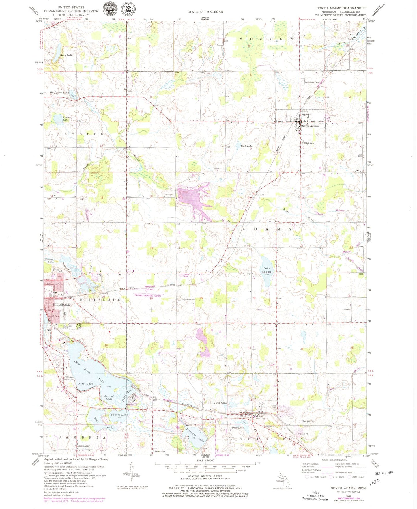
Historical USGS topographic quad map of North Adams in the state of Michigan. Map scale may vary for some years, but is generally around 1:24,000. Print size is approximately 24" x 27"
This quadrangle is in the following counties: Hillsdale.
The map contains contour lines, roads, rivers, towns, and lakes. Printed on high-quality waterproof paper with UV fade-resistant inks, and shipped rolled.
Contains the following named places: Adams Post Office, Barber Lake, Baw Beese Lake, Bible Baptist Church, Boot Lake, Buck Lake, Church Drain, Church of the Universal Light, Deer Lake, East Hill Cemetery, Faith Mennonite Church, Faith Mennonite School, First Baptist Church, First Lake, Fourth Lake, Gray Lake, Half Moon Lake, Hill Cemetery, Hillsdale Country Club, Hillsdale County, Hillsdale Municipal Airport, Holcomb Cemetery, Kekoose Park, Lacore Lake, Lake Adams, Lake View Cemetery, Lewis Emery Park, Mill Pond, Mount Pleasant Cemetery, North Adams, North Adams Community Library, North Adams Fire Department, North Adams Post Office, North Adams Station, North Adams United Methodist Church, North Adams-Jerome High School, North Lawn Cemetery, Osseo, Osseo First Baptist Church, Osseo Free Will Baptist Church, Osseo Methodist Church, Osseo Post Office, Owens Memorial Park, Pleasant Lake, Sandy Beach, Second Lake, Shull Drain, Six Lakes Campground, Steamburg, Steamburg Post Office, Stone School, Third Lake, Township of Adams, Township of Fayette, Trinity Lutheran Church, Twin Lake, Village of North Adams, Will Carleton Poor House Museum, Williams Drain, Winona Lake, ZIP Code: 49242