MyTopo
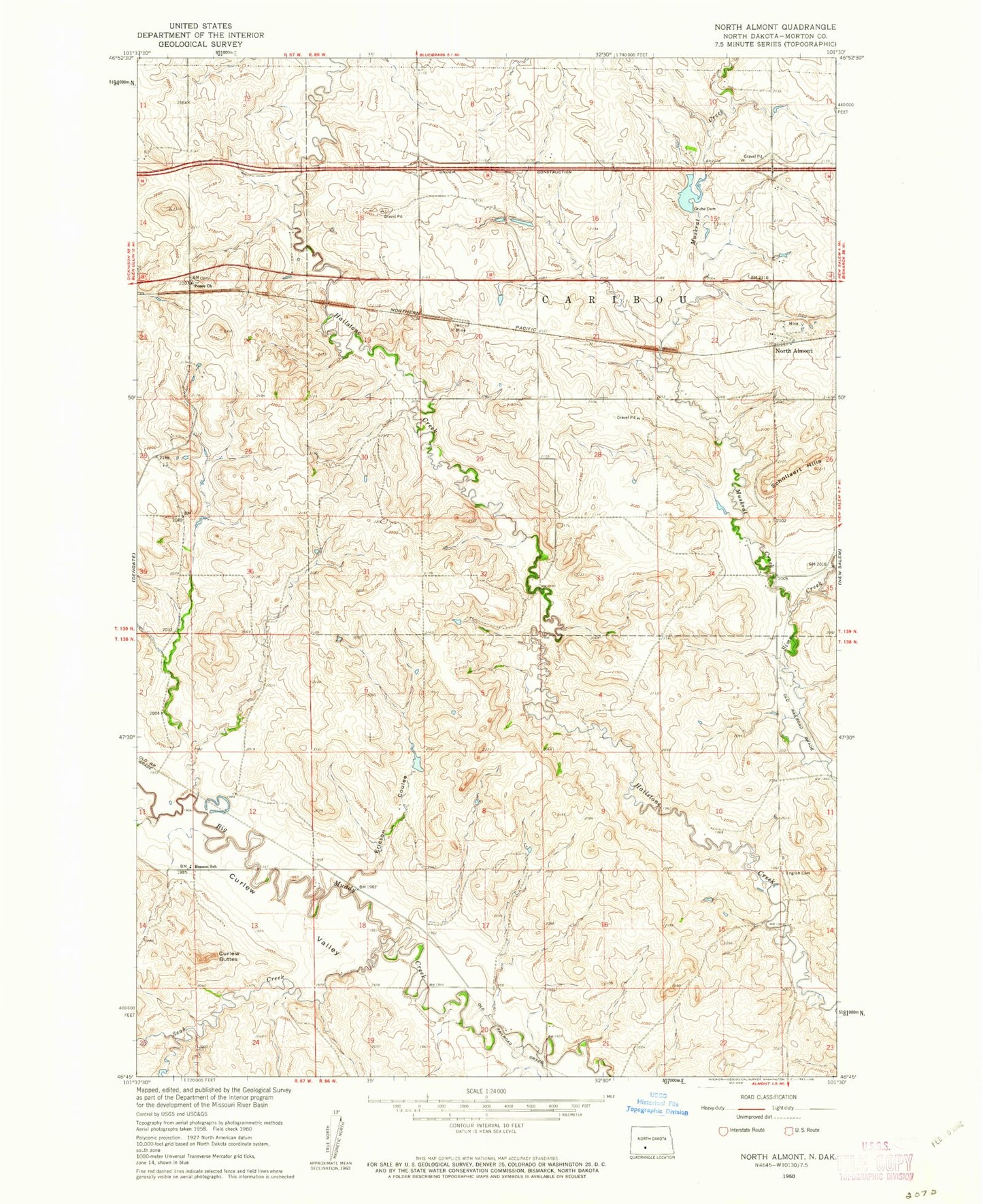
Classic USGS North Almont North Dakota 7.5'x7.5' Topo Map
Regular price
$16.95
Regular price
Sale price
$16.95
Unit price
per
Couldn't load pickup availability
Historical USGS topographic quad map of North Almont in the state of North Dakota. Map scale may vary for some years, but is generally around 1:24,000. Print size is approximately 24" x 27"
This quadrangle is in the following counties: Morton.
The map contains contour lines, roads, rivers, towns, and lakes. Printed on high-quality waterproof paper with UV fade-resistant inks, and shipped rolled.
Contains the following named places: Benson School, Curlew Buttes, English Cemetery, Ericson Coulee, Friendship Community Church Cemetery, Grube Dam, Hailstone Creek East Bound Rest Area, Hailstone Creek West Bound Rest Area, Muskrat Creek, North Almont, Peace Church, Scab Creek, Schollaert Hills