MyTopo
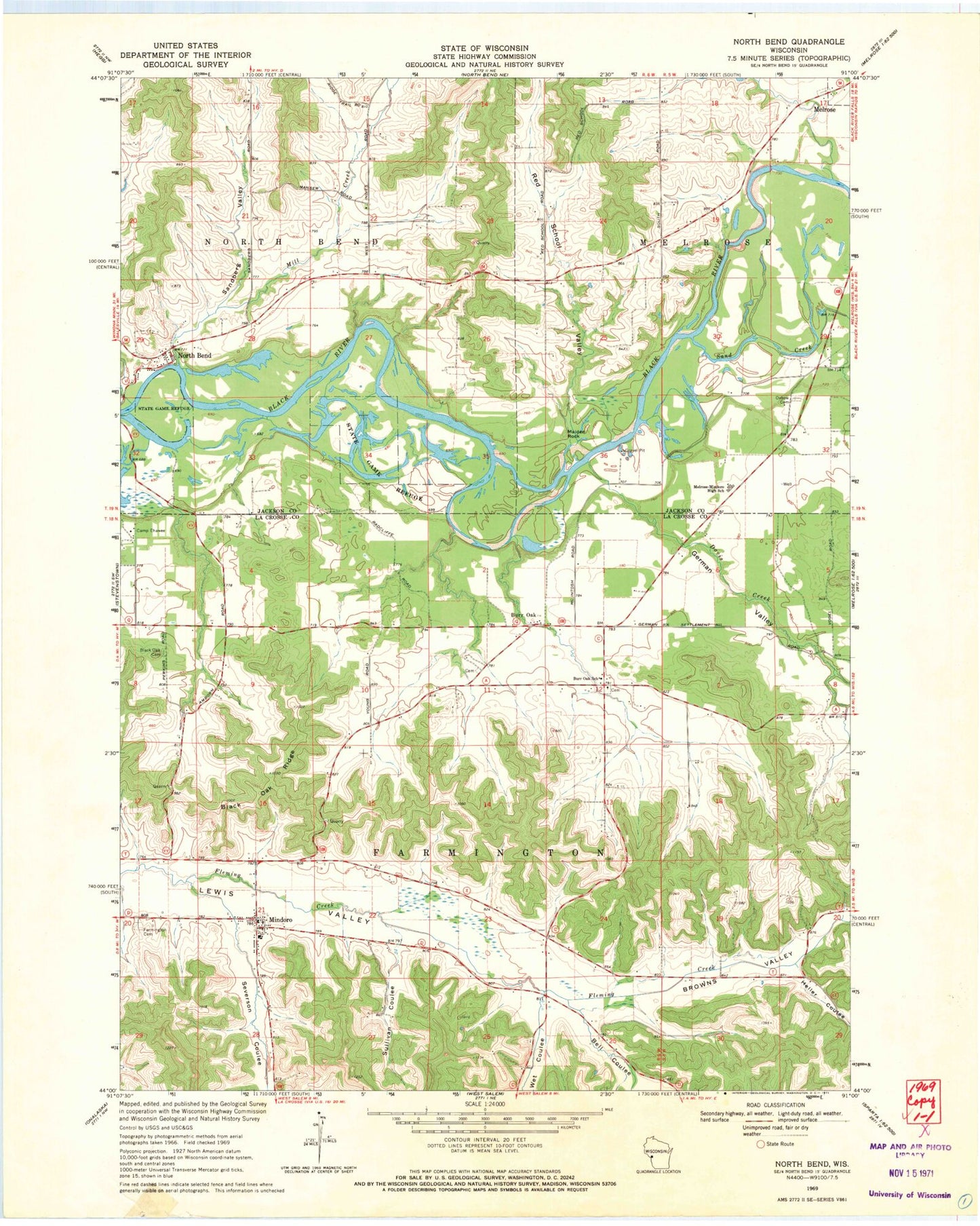
Classic USGS North Bend Wisconsin 7.5'x7.5' Topo Map
Couldn't load pickup availability
Historical USGS topographic quad map of North Bend in the state of Wisconsin. Map scale may vary for some years, but is generally around 1:24,000. Print size is approximately 24" x 27"
This quadrangle is in the following counties: Jackson, La Crosse.
The map contains contour lines, roads, rivers, towns, and lakes. Printed on high-quality waterproof paper with UV fade-resistant inks, and shipped rolled.
Contains the following named places: Bell Coulee, Black Oak Cemetery, Black Oak Ridge, Black Oak School, Browns Valley, Burr Oak, Burr Oak Lutheran Cemetery, Burr Oak Methodist Cemetery, Burr Oak School, Camp Ehawee, Davis Creek, Farmington Cemetery, Farmington Volunteer Fire Department, German Valley, Heller Coulee, Little Red School, Maiden Rock, Melrose - Mindoro High School, Mill Creek, Mill Creek School, Mindoro, Mindoro Census Designated Place, Mindoro Elementary School, Mindoro Post Office, North Bend, Oxbow Cemetery, Oxbow School, Pfaff School, Red School Valley, Rhyme School, Sand Creek, Sandberg Valley, Severson Coulee, Sullivan Coulee, Town of Farmington, Town of Melrose, Town of North Bend, Wet Coulee, Wilson Creek, ZIP Code: 54644