MyTopo
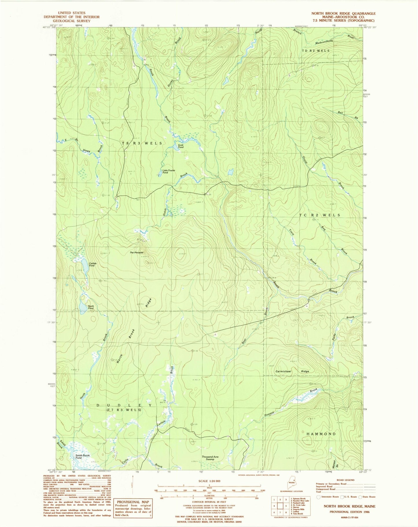
Classic USGS North Brook Ridge Maine 7.5'x7.5' Topo Map
Regular price
$16.95
Regular price
Sale price
$16.95
Unit price
per
Couldn't load pickup availability
Historical USGS topographic quad map of North Brook Ridge in the state of Maine. Map scale may vary for some years, but is generally around 1:24,000. Print size is approximately 24" x 27"
This quadrangle is in the following counties: Aroostook.
The map contains contour lines, roads, rivers, towns, and lakes. Printed on high-quality waterproof paper with UV fade-resistant inks, and shipped rolled.
Contains the following named places: Bear Brook, Carlisle Brook, Carlisle Pond, Carmichael Ridge, Dudley Township, Gulch Brook, Hovey Brook, Little Fowler Pond, Millers Camp, North Brook, North Brook Ridge, North Pond, Scott Pond, Smith Brook Pond, T8 R3 WELS, The Pinnacle, Tracy Brook