MyTopo
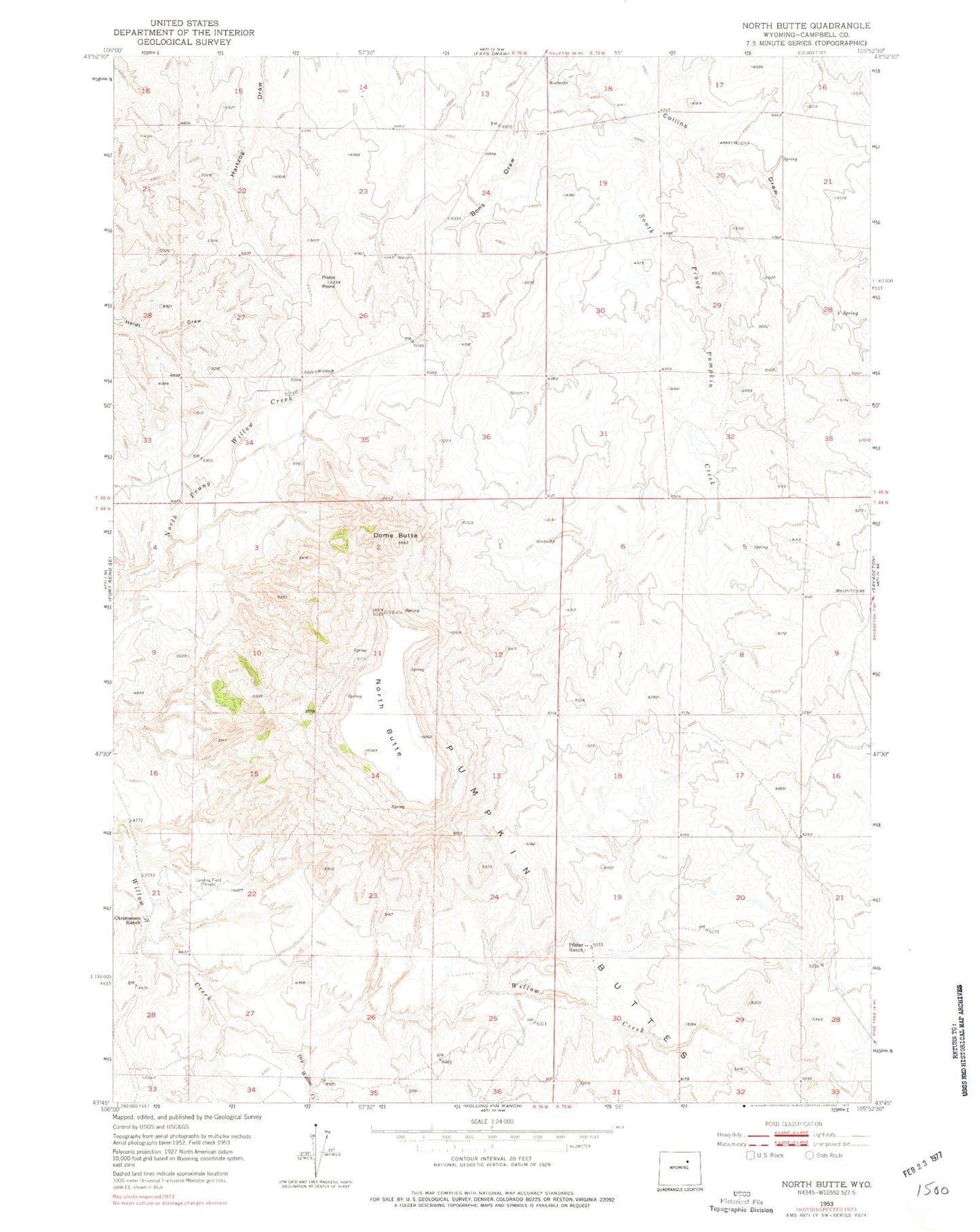
Classic USGS North Butte Wyoming 7.5'x7.5' Topo Map
Couldn't load pickup availability
Historical USGS topographic quad map of North Butte in the state of Wyoming. Map scale may vary for some years, but is generally around 1:24,000. Print size is approximately 24" x 27"
This quadrangle is in the following counties: Campbell.
The map contains contour lines, roads, rivers, towns, and lakes. Printed on high-quality waterproof paper with UV fade-resistant inks, and shipped rolled.
Contains the following named places: Bar None Number Forty Claim, Bashawn Mine, Bons Draw, Camp Number One Claim, Christensen Brothers Ranch Mine, Christensen Ranch, Collins Draw, Discovery Roll Mine, Dome Butte, Dome Butte Mine, Dresher Dam, Dresher Reservoir, Dry Willow Creek, Hawley Numbers One-thirty-two Claims, Kerr-McGee Ed Claims Mine, Kerr-McGee Jim Claim Mine, Kerr-McGee School Lease Mine, Lucky Eight Mine, North Butte, Pfister Ranch, Pistol Point, Quigley and Gall Claims, Quigley and Gall Colorado Number One Mine, Rodabaugh Dam, Rodabaugh Reservoir, Simmons Number Two Mine, Y Spring