MyTopo
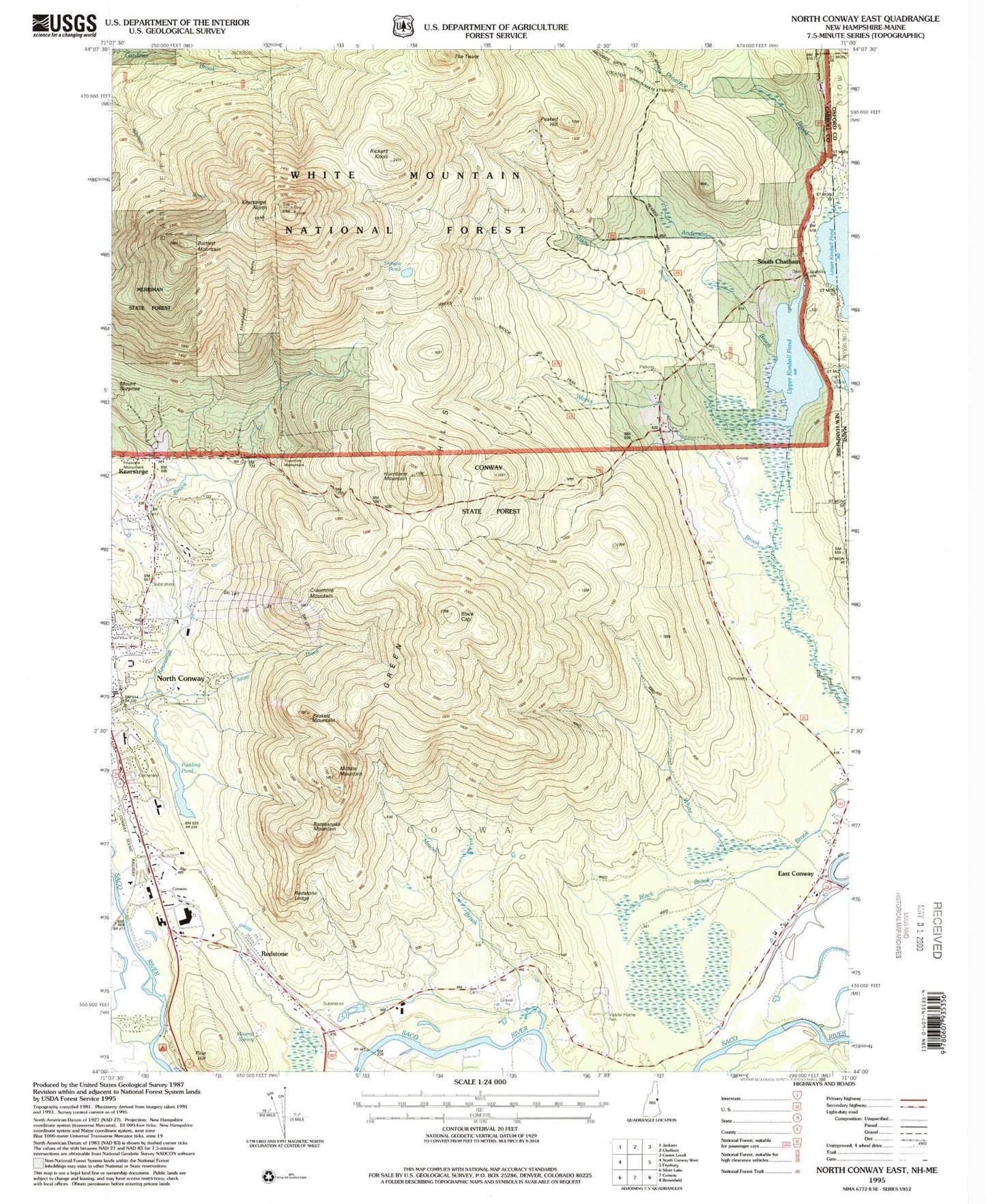
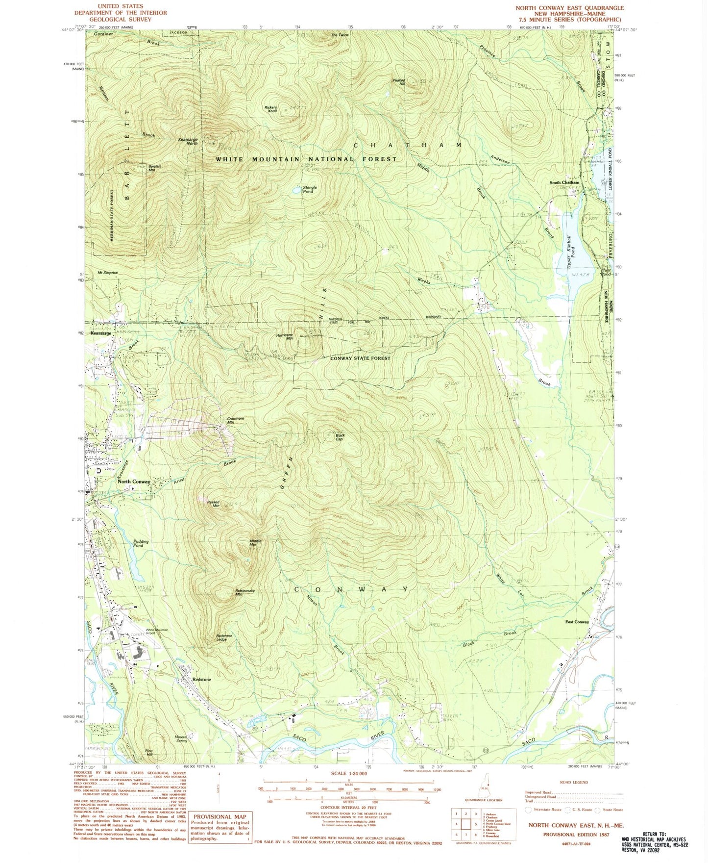
Classic USGS North Conway East New Hampshire 7.5'x7.5' Topo Map
Couldn't load pickup availability
Historical USGS topographic quad map of North Conway East in the states of New Hampshire, Maine. Typical map scale is 1:24,000, but may vary for certain years, if available. Print size: 24" x 27"
This quadrangle is in the following counties: Carroll, Oxford.
The map contains contour lines, roads, rivers, towns, and lakes. Printed on high-quality waterproof paper with UV fade-resistant inks, and shipped rolled.
Contains the following named places: Middle Mountain, Anderson Brook, Artist Brook, Barlett Mountain, Black Brook, Black Cap, Conway State Forest, Cranmore Mountain, East Conway, Gemini Trail, Green Hills, Hurricane Mountain, Kearsarge, Kearsarge North, Kearsarge Trail, Mason Brook, Merriman State Forest, Middle Brook, Moat Brook, Mount Pequawket Trail, Number Five Ski Trail, Peaked Hill, Peaked Mountain, Pine Hill, Province Brook Trail, Pudding Pond, Rattlesnake Mountain, Redstone, Redstone Ledge, Rickers Knoll, Shingle Pond, Shingle Pond Trail, South Chatham, Mount Surprise, Upper Kimball Pond, Weeks Brook Trail, White Mountain Airport (historical), Mack Hill, Hoyt Brook, Cranmore Skimobile Winter Sports Area, Town of Conway, Upper Kimball Lake Dam, Upper Kimball Lake, Kennett High School, Kearsarge Post Office, Mount Cranmore Ski Area, Mountain Valley Mall Shopping Center, North Conway Country Club, North Conway Post Office, Northway Plaza Shopping Center, North Conway Census Designated Place, The Lilliputian School, Redstone Fire Department, East Conway Fire Department, North Conway Ambulance, Conway Police Department, Province Brook