MyTopo
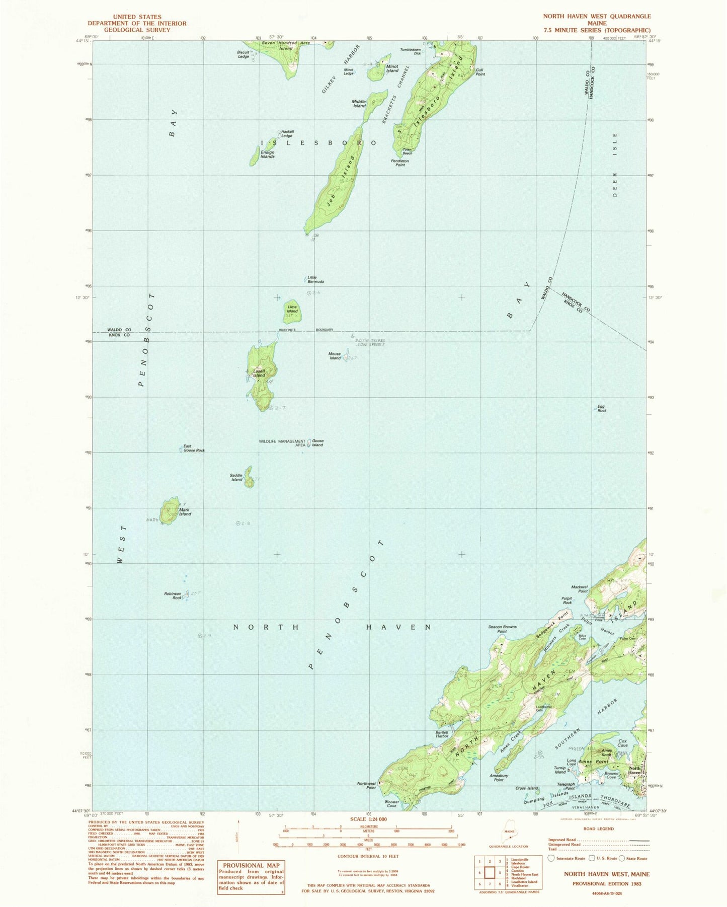
Classic USGS North Haven West Maine 7.5'x7.5' Topo Map
Couldn't load pickup availability
Historical USGS topographic quad map of North Haven West in the state of Maine. Map scale may vary for some years, but is generally around 1:24,000. Print size is approximately 24" x 27"
This quadrangle is in the following counties: Hancock, Knox, Waldo.
The map contains contour lines, roads, rivers, towns, and lakes. Printed on high-quality waterproof paper with UV fade-resistant inks, and shipped rolled.
Contains the following named places: Ames Creek, Ames Knob, Ames Point, Amesbury Point, Bartlett Harbor, Billys Cove, Biscuit Ledge, Browns Cove, Calf Point, Cox Cove, Crockett Cove, Cross Island, Deacon Brown Point, Dumpling Island, East Goose Rock, Egg Rock, Egg Rock Ledge, Ensign Island, Fuller Cemetery, Goose Island, Gull Point, Haskell Ledge, Job Island, Lasell Island, Leadbetter Cemetery, Lime Island, Little Bermuda, Lobster Island, Long Cove, Mackerel Point, Mark Island, McIntosh Ledge, Middle Island, Ministers Creek, Minor Ledge, Minot Island, Mouse Island, North Haven Community School, Northwest Point, Nortons Cove, Pendleton Point, Penobscot Bay, Pulpit Harbor, Pulpit Rock, Robinson Rock, Saddle Island, Seal Ledge, Sedgewick Point, Southern Harbor, Telegraph Point, Town of North Haven, Tumble down Dick, Turnip Island, Witherspoons Landing Strip, Wooster Cove