MyTopo
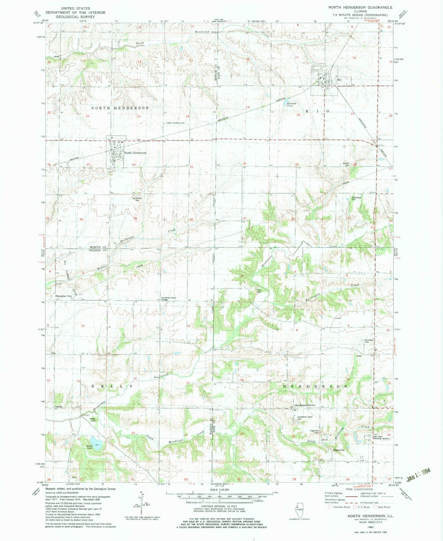
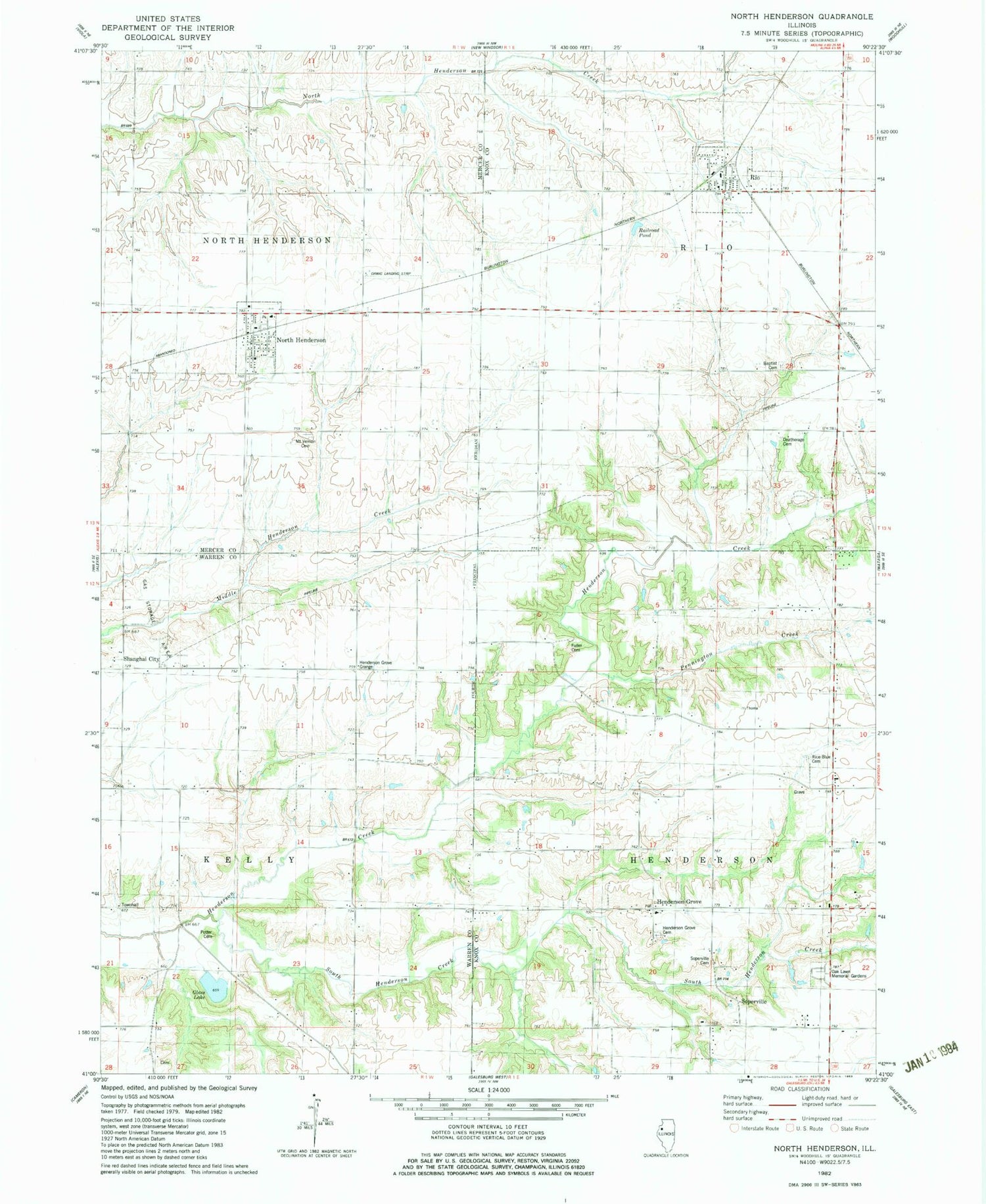
Classic USGS North Henderson Illinois 7.5'x7.5' Topo Map
Couldn't load pickup availability
Historical USGS topographic quad map of North Henderson in the state of Illinois. Map scale may vary for some years, but is generally around 1:24,000. Print size is approximately 24" x 27"
This quadrangle is in the following counties: Knox, Mercer, Warren.
The map contains contour lines, roads, rivers, towns, and lakes. Printed on high-quality waterproof paper with UV fade-resistant inks, and shipped rolled.
Contains the following named places: Alexis North Henderson Ambulance Service, Deatherage Cemetery, Ernest E Orwig Airport, Ethel School, Forest Flower School, Fuller Cemetery, Glass Lake, Greenleaf School, Henderson Grove, Henderson Grove Cemetery, Henderson Grove Grange, Mount Joy School, Mount Vernon Cemetery, Mount Vernon School, New Salem School, North Henderson, North Henderson Fire Department, North Henderson Post Office, Oak Lawn Memorial Gardens, Pennington Creek, Pleasant Grove School, Potter Cemetery, Prairie Flower School, Railroad Pond, Rice - Blue Cemetery, Rio, Rio Baptist Cemetery, Rio Cemetery, Rio Elementary School, Rio Fire Department, Rio Post Office, Shanghai City, Soperville, Soperville Cemetery, South Henderson Creek, Starr School, Township of Henderson, Township of Kelly, Township of North Henderson, Township of Rio, Tri - County Ambulance District, Union School, Village of North Henderson, Village of Rio, ZIP Codes: 61466, 61472