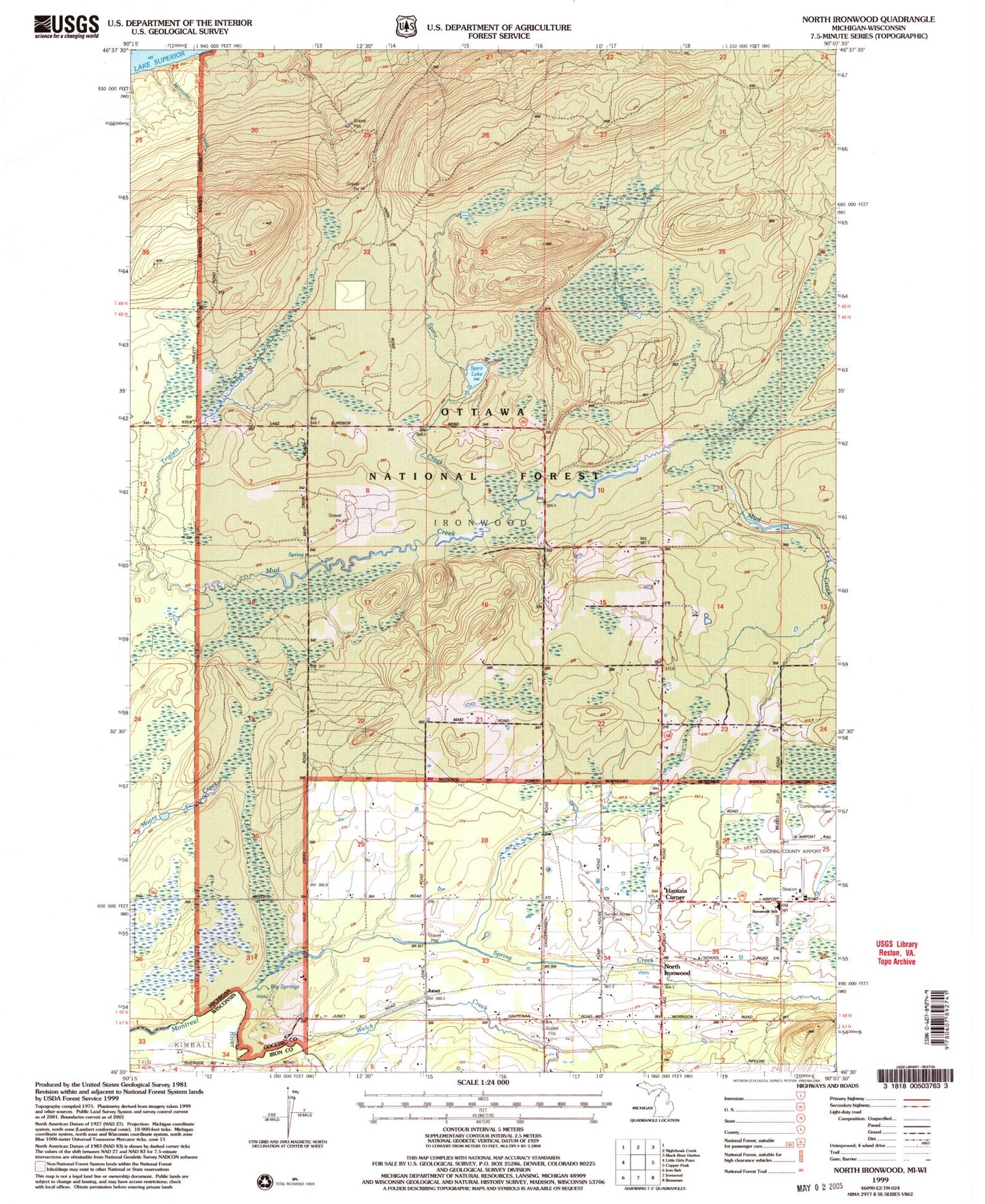
MyTopo
Classic USGS North Ironwood Michigan 7.5'x7.5' Topo Map
Couldn't load pickup availability
Historical USGS topographic quad map of North Ironwood in the states of Michigan, Wisconsin. Map scale may vary for some years, but is generally around 1:24,000. Print size is approximately 24" x 27"
This quadrangle is in the following counties: Gogebic, Iron.
The map contains contour lines, roads, rivers, towns, and lakes. Printed on high-quality waterproof paper with UV fade-resistant inks, and shipped rolled.
Contains the following named places: Big Springs, Charter Township of Ironwood, Defer School, Foley Creek, Gogebic-Iron County Airport, Hautala Corner, Junet, Junet Station, Kaari Creek, Montana Creek, Montreal Post Office, Montreal Station, North Ironwood, Roosevelt School, Spirit Creek, Spirit Lake, Spring Creek, Triplett Creek, Welch Creek, ZIP Code: 49938