MyTopo
Classic USGS North Island South Carolina 7.5'x7.5' Topo Map
Couldn't load pickup availability
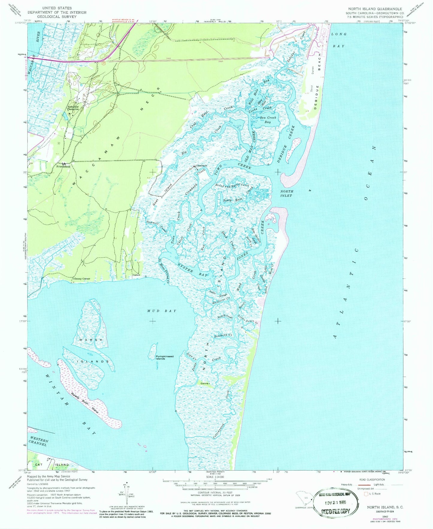
Historical USGS topographic quad map of North Island in the state of South Carolina. Typical map scale is 1:24,000, but may vary for certain years, if available. Print size: 24" x 27"
This quadrangle is in the following counties: Georgetown.
The map contains contour lines, roads, rivers, towns, and lakes. Printed on high-quality waterproof paper with UV fade-resistant inks, and shipped rolled.
Contains the following named places: Bass Hole Creek, Bass Hole Bay, Bly Creek, Bobs Garden Creek, Boor Creek, Bread and Butter Creek, Clambank Creek, Collins Island, Cooks Creek, Crab Haul Creek, Cutoff Creek, Debidue Creek, Dividing Creek, Double Prong Creek, Duck Creek, Goat Island, Haulover Creek, Jones Creek, Little Jones Creek, Little Wood Creek, Malady Bush Island, Marsh Islands, Mud Creek, Nancy Creek, No Mans Friend Creek, Noble Slough, North Inlet, Old Man Creek, Oyster Bay, Perry Creek, Sawmill Creek, Sea Creek Bay, Sign Creek, Sixty Bass Creek, Town Creek, Wood Creek, Denny Corner, North Island, Caines, Clambank, Friendfield, Baruch-North Island Reserve, Big Marsh Island, Clifton Plantation, De Bordieu, De Bordieu Colony, Friendship Plantation, Friendship Presbyterian Church, Hobcaw Barony Nature Center, Marsh Island, Yahany Inlet (historical), Bellefield Plantation, Cottonpatch Creek, Mud Bay, Pumpkinseed Islands, Waccamaw Neck, Winyah Bay, Debidue Island, DeBordieu, DeBordieu Colony Census Designated Place