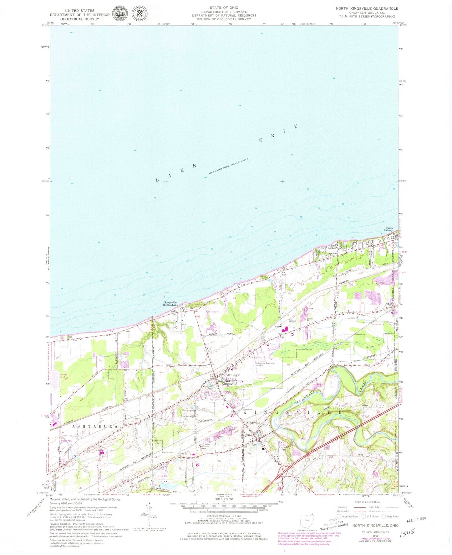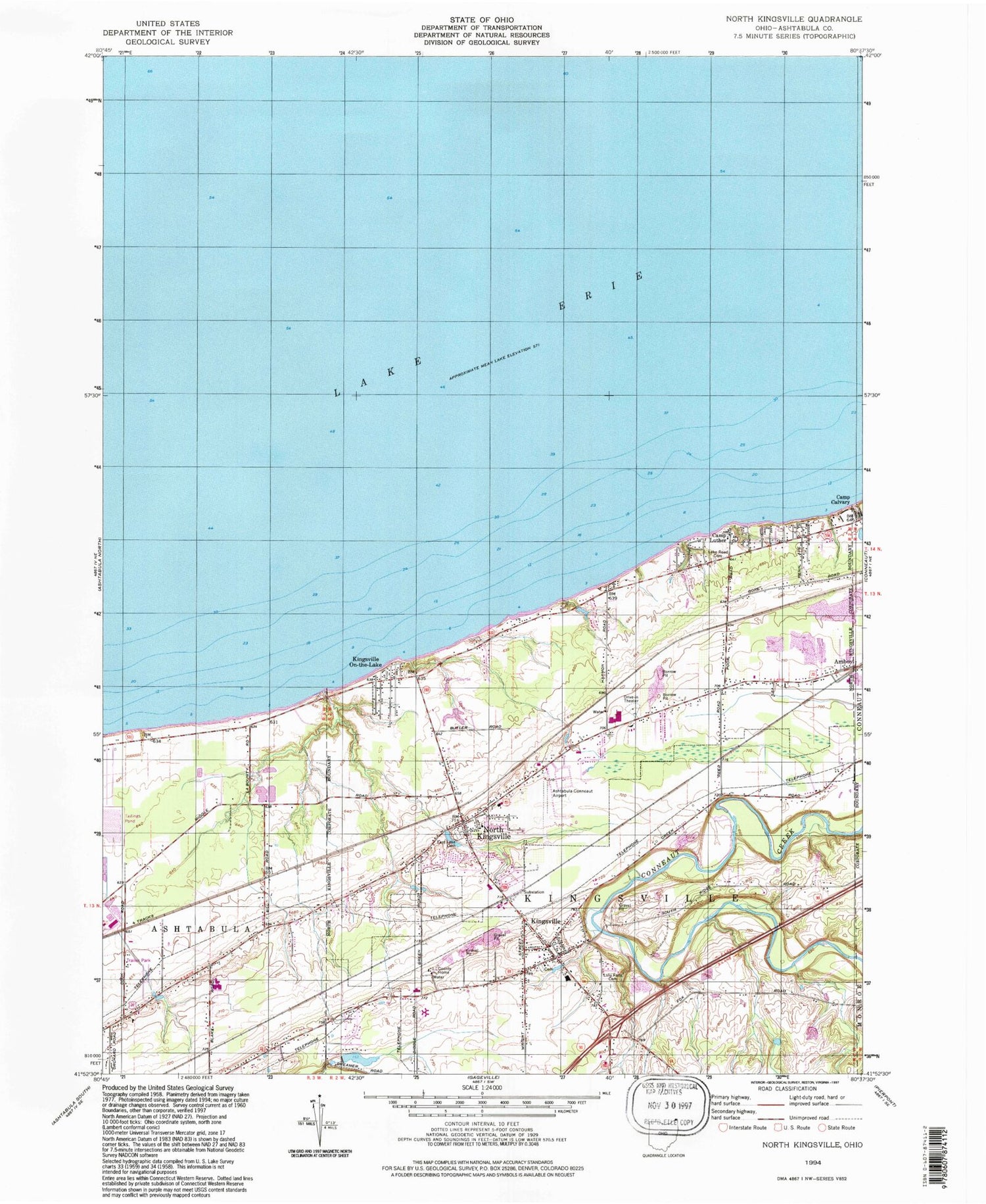

MyTopo
Classic USGS North Kingsville Ohio 7.5'x7.5' Topo Map
Couldn't load pickup availability
Historical USGS topographic quad map of North Kingsville in the state of Ohio. Typical map scale is 1:24,000, but may vary for certain years, if available. Print size: 24" x 27"
This quadrangle is in the following counties: Ashtabula.
The map contains contour lines, roads, rivers, towns, and lakes. Printed on high-quality waterproof paper with UV fade-resistant inks, and shipped rolled.
Contains the following named places: Kingsville Census Designated Place, Camp Calvary, East Lake Cemetery, Kingsville On-the-Lake, Lake Road Cemetery, Lulu Falls Cemetery, North Kingsville Elementary School, Ashtabula County Home, Kingsville Elementary School, Edgewood High School, Camp Luther, North Kingsville, First Baptist Church, Ashtabula-Conneaut Airport (historical), North Kingsville Presbyterian Church, Kingsville, Davis Pond Dam, Davis Pond, Ashtabula County Outdoor Club Lake Dam, Ashtabula County Outdoor Club Lake, Effluent Treatment Pond Number Four Dam, Effluent Treatment Pond Number Four, Township of Kingsville, Village of North Kingsville, Greenlawn Memory Gardens, Kingsville Presbyterian Church, Old Kingsville Corners Cemetery, Sunset Park, Village Green Park, Kingsville Post Office, North Kingsville Post Office, Edgewood Census Designated Place, Mobile Acres, Taylor Mobile Home Park, North Kingsville Volunteer Fire Department Station 2, Kingsville Township Fire Department, North Kingsville Volunteer Fire Department Station 1 Headquarters, Kingsville Census Designated Place, Belding Pit, Meadowlake Farm, North Kingsville Police Department, Green Acres, Southwood Colony