
MyTopo
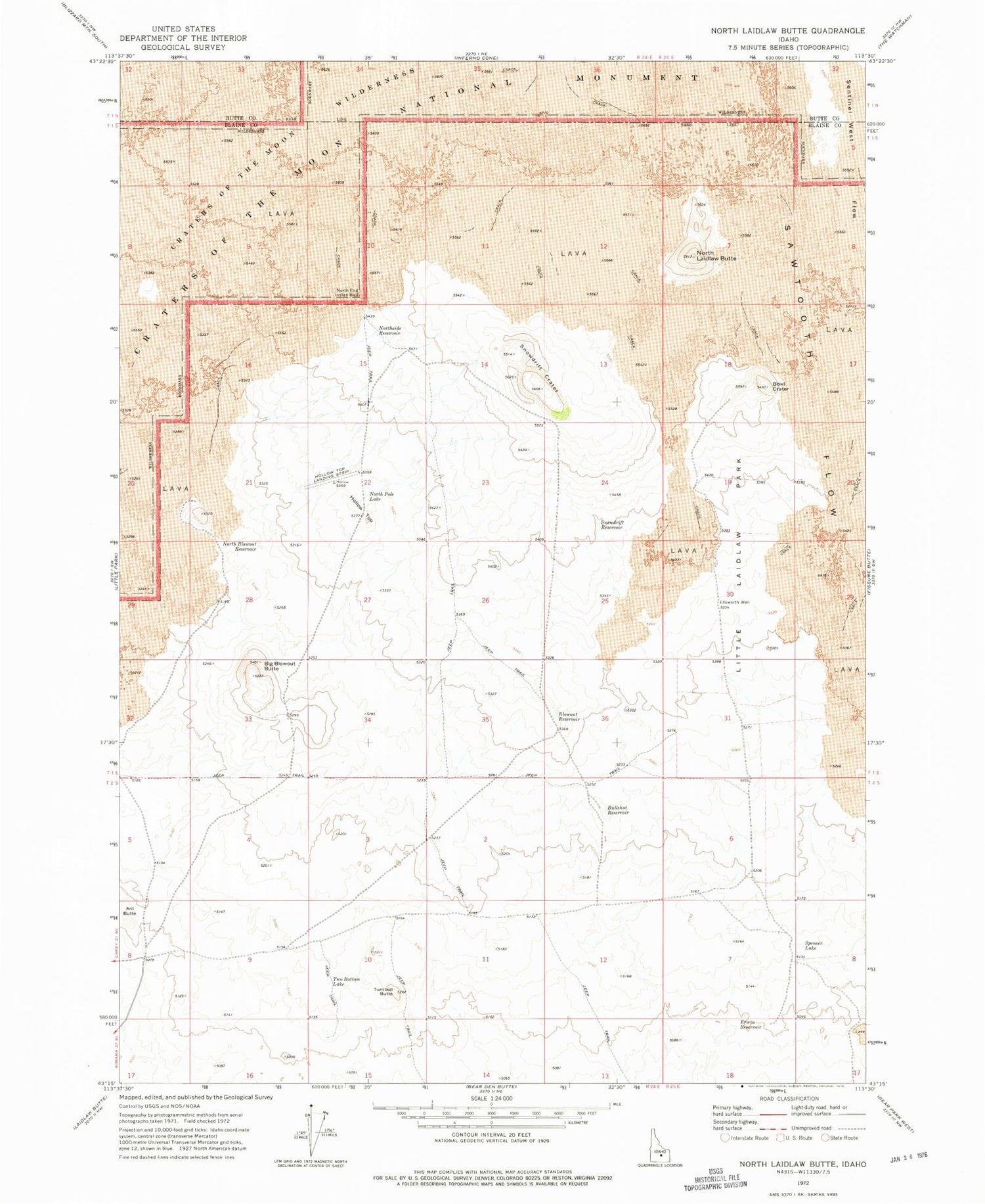
Classic USGS North Laidlaw Butte Idaho 7.5'x7.5' Topo Map
Couldn't load pickup availability
Historical USGS topographic quad map of North Laidlaw Butte in the state of Idaho. Map scale may vary for some years, but is generally around 1:24,000. Print size is approximately 24" x 27"
This quadrangle is in the following counties: Blaine, Butte.
The map contains contour lines, roads, rivers, towns, and lakes. Printed on high-quality waterproof paper with UV fade-resistant inks, and shipped rolled.
Contains the following named places: Ant Butte, Big Blowout Butte, Blowout Reservoir, Bowl Crater, Bullshot Reservoir, Carey Division, Ellsworth Well, Erwin Reservoir, Hawk Reservoir, Hollow Top, Hollow Top Airport, Little Laidlaw Park, North Blowout Reservoir, North End Indian Well, North Laidlaw Butte, North Pole Lake, Northside Reservoir, Snowdrift Crater, Snowdrift Reservoir, Spencer Lake, Turnbull Butte, Two Bottom Lake


