MyTopo
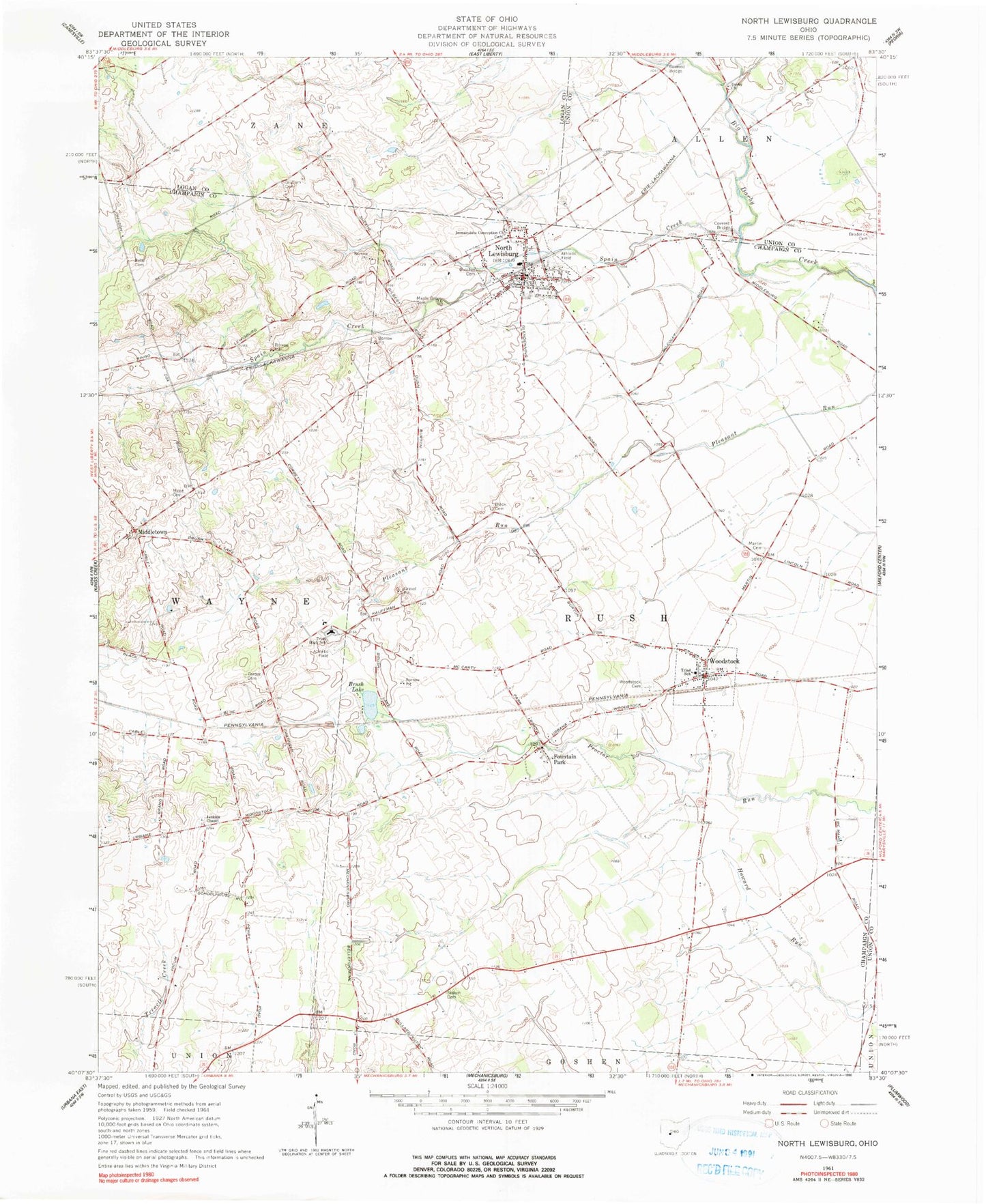
Classic USGS North Lewisburg Ohio 7.5'x7.5' Topo Map
Couldn't load pickup availability
Historical USGS topographic quad map of North Lewisburg in the state of Ohio. Map scale may vary for some years, but is generally around 1:24,000. Print size is approximately 24" x 27"
This quadrangle is in the following counties: Champaign, Logan, Union.
The map contains contour lines, roads, rivers, towns, and lakes. Printed on high-quality waterproof paper with UV fade-resistant inks, and shipped rolled.
Contains the following named places: Beltz Cemetery, Black Cemetery, Broderick Cemetery, Brush Lake, Butcher Cemetery, Corbet Cemetery, Crimville, Darby Church, Fountain Park, Fountain Park Post Office, Friends Cemetery, Graham Cemetery, Immaculate Conception Church, Jenkins Chapel, Jenkins Chapel Cemetery, Maple Grove Cemetery, Martin Cemetery, Mead Cemetery, Meadows of North Lewisburg, Middletown, North East Champaign County Fire District, North Lewisburg, North Lewisburg Post Office, Sodom Cemetery, Spain Creek, Spain Creek Bridge, Township of Rush, Triad Elementary School, Triad High School, Triad School, Upper Darby Bridge, Village of North Lewisburg, Village of Woodstock, White School, Woodstock, Woodstock Cemetery, Woodstock Post Office, ZIP Codes: 43060, 43084