MyTopo
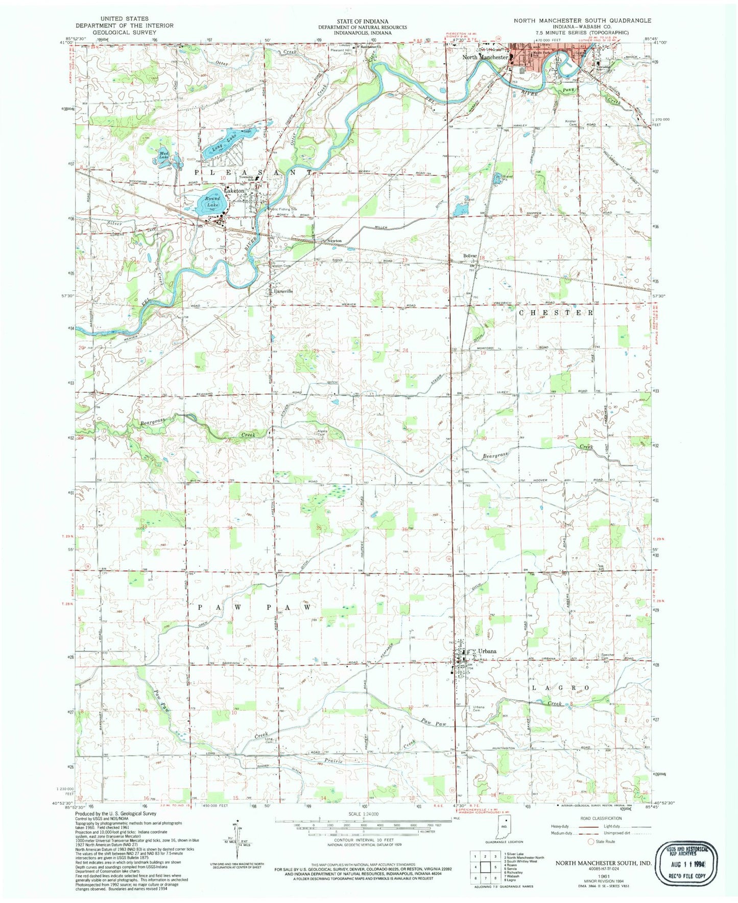
Classic USGS North Manchester South Indiana 7.5'x7.5' Topo Map
Couldn't load pickup availability
Historical USGS topographic quad map of North Manchester South in the state of Indiana. Map scale may vary for some years, but is generally around 1:24,000. Print size is approximately 24" x 27"
This quadrangle is in the following counties: Wabash.
The map contains contour lines, roads, rivers, towns, and lakes. Printed on high-quality waterproof paper with UV fade-resistant inks, and shipped rolled.
Contains the following named places: Algers Cemetery, Bolivar, Chester Elementary School, Clear Creek, Hamilton Ditch, Ijamsville, Keafaber Ditch, Krisher Cemetery, Laketon, Laketon Cemetery, Laketon Census Designated Place, Laketon Elementary School, LifeMed Emergency Medical Services, Long Cemetery, Long Lake, Maple Park Elementary School, Miller Ditch, Mud Lake, Newton, North Manchester Fire Department, North Manchester Police Department, Oren Ditch, Otter Creek, Pleasant Hill Cemetery, Pleasant Township Fire Department, Pony Creek, Prairie Creek, Round Lake, Sharp Ditch, Silver Creek, Speicher Cemetery, Staver Ditch, Township of Paw Paw, Township of Pleasant, Urbana, Urbana Post Office, Urbana Volunteer Fire Department, West Manchester Church, Zion Evangelical Lutheran Church, ZIP Codes: 46943, 46962