MyTopo
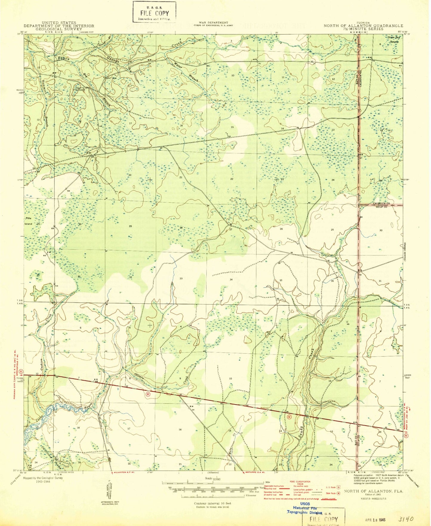
Classic USGS North of Allanton Florida 7.5'x7.5' Topo Map
Regular price
$16.95
Regular price
Sale price
$16.95
Unit price
per
Couldn't load pickup availability
Historical USGS topographic quad map of North of Allanton in the state of Florida. Map scale may vary for some years, but is generally around 1:24,000. Print size is approximately 24" x 27"
This quadrangle is in the following counties: Bay, Calhoun, Gulf.
The map contains contour lines, roads, rivers, towns, and lakes. Printed on high-quality waterproof paper with UV fade-resistant inks, and shipped rolled.
Contains the following named places: Beefwood Branch, Big Branch, Crash Island, Cushion Creek, Grape Swamp, Hammock Branch, Horseford Branch, Island Branch, Kent Family Cemetery, Lloyd Hall Park, Majette Lookout Tower, Olivers Creek, Water Branch, WBKL-FM (Callaway), White Buck Branch