MyTopo
Classic USGS North of Oildale California 7.5'x7.5' Topo Map
Regular price
$16.95
Regular price
Sale price
$16.95
Unit price
per
Couldn't load pickup availability
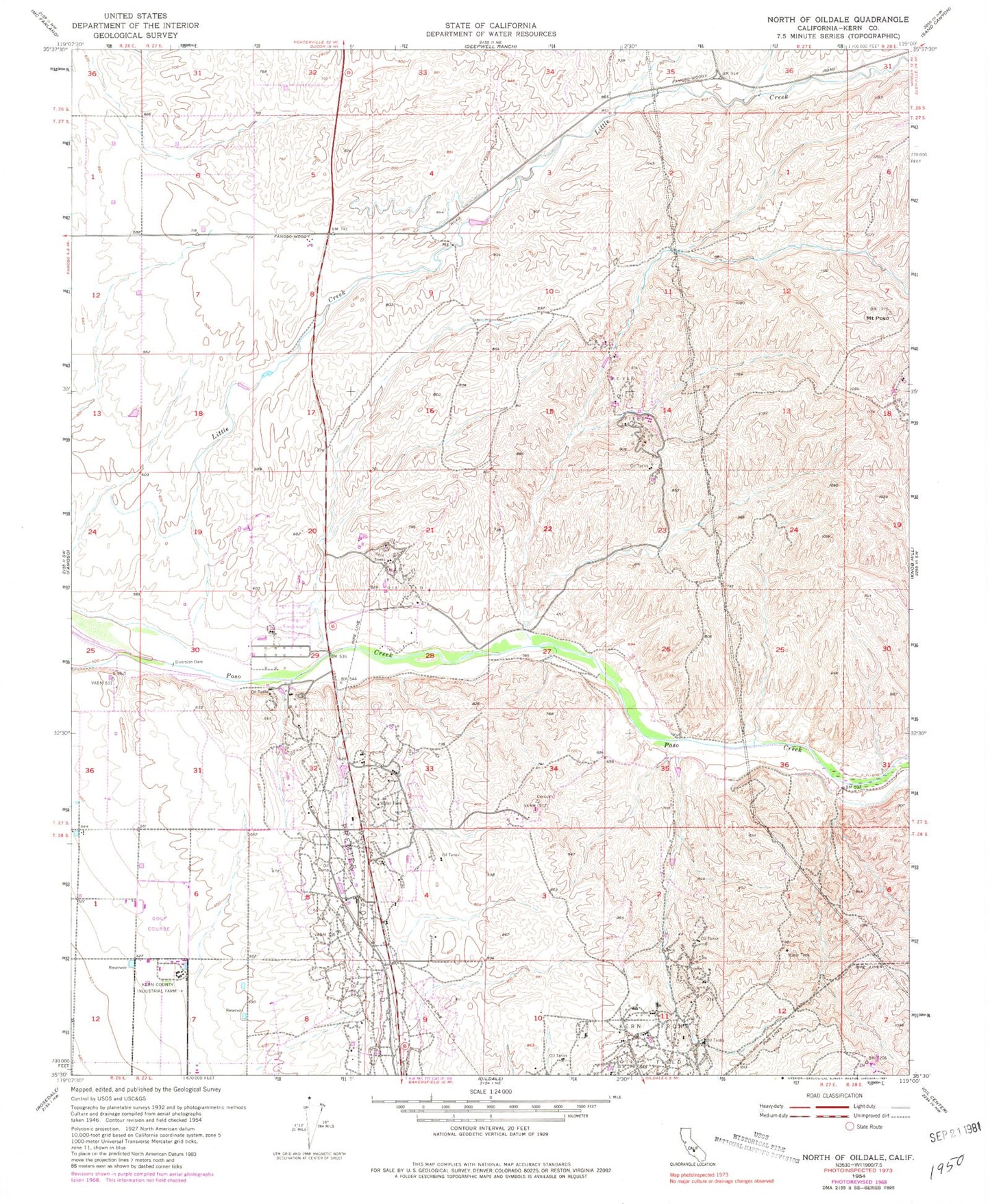
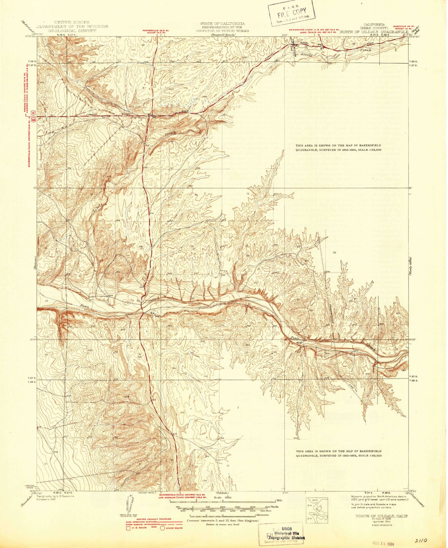
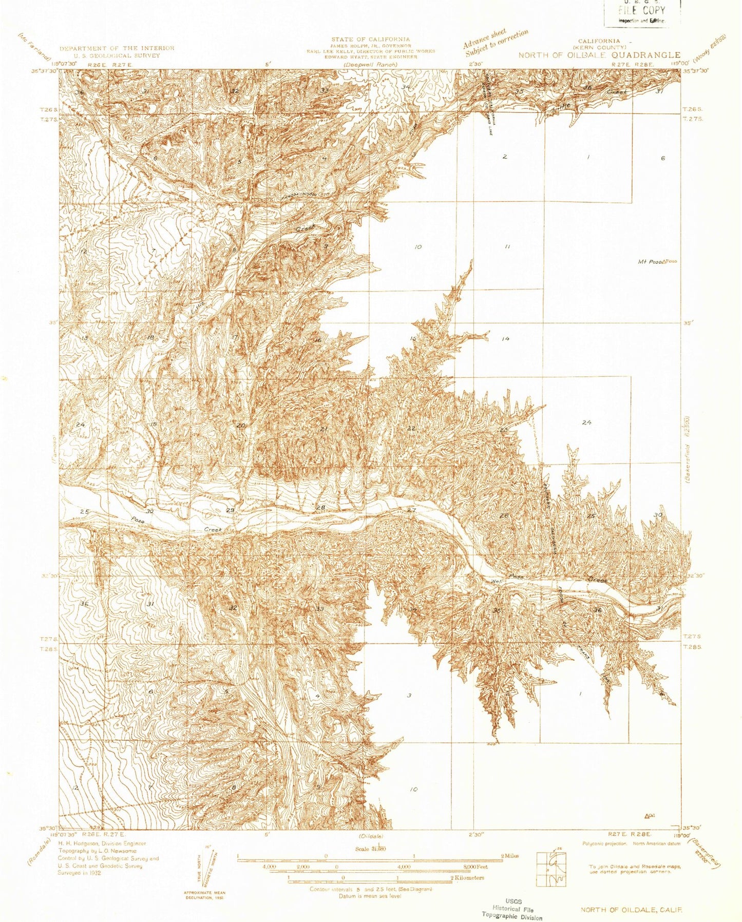
Historical USGS topographic quad map of North of Oildale in the state of California. Map scale may vary for some years, but is generally around 1:24,000. Print size is approximately 24" x 27"
This quadrangle is in the following counties: Kern.
The map contains contour lines, roads, rivers, towns, and lakes. Printed on high-quality waterproof paper with UV fade-resistant inks, and shipped rolled.
Contains the following named places: Brushy Hill, Kern County Industrial Farm, Kern County Sheriff's Office - Lerdo Facility, KKXX-FM (Delano), Little Creek, Majors Airport, McVan Oil Field, Mount Poso, Premier Oil Field