MyTopo
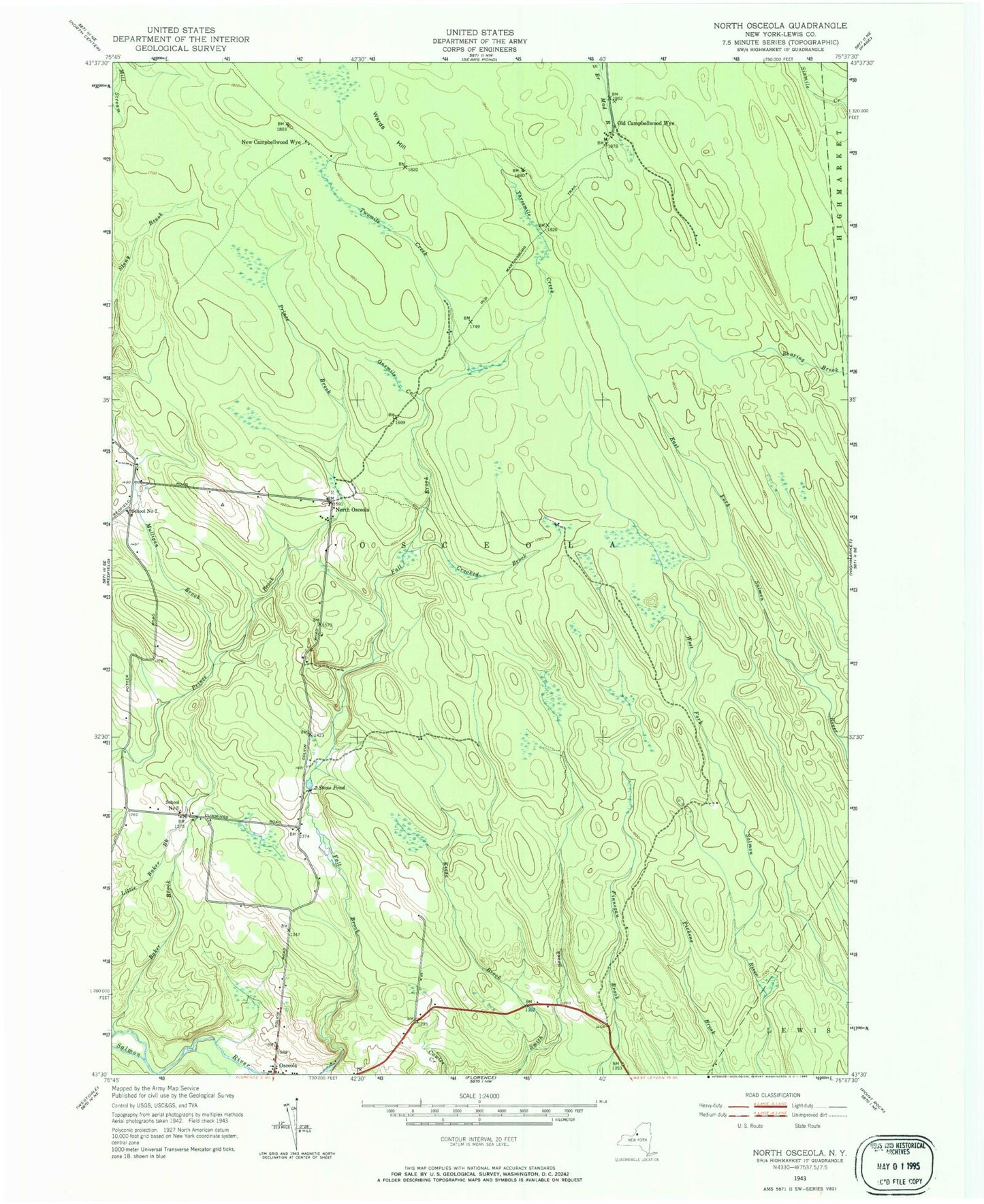
Classic USGS North Osceola New York 7.5'x7.5' Topo Map
Couldn't load pickup availability
Historical USGS topographic quad map of North Osceola in the state of New York. Typical map scale is 1:24,000, but may vary for certain years, if available. Print size: 24" x 27"
This quadrangle is in the following counties: Lewis.
The map contains contour lines, roads, rivers, towns, and lakes. Printed on high-quality waterproof paper with UV fade-resistant inks, and shipped rolled.
Contains the following named places: Baker Brook, Crooked Brook, Keese Brook, Mulligan Brook, Onemile Creek, Osceola, Stone Pond, Threemile Creek, Twomile Creek, Wards Hill, New Campbellwood Wye, North Osceola, Old Campbellwood Wye, School Number 3 (historical), School Number 7 (historical), Town of Osceola, School Number 4 (historical), Osceola Public Library