MyTopo
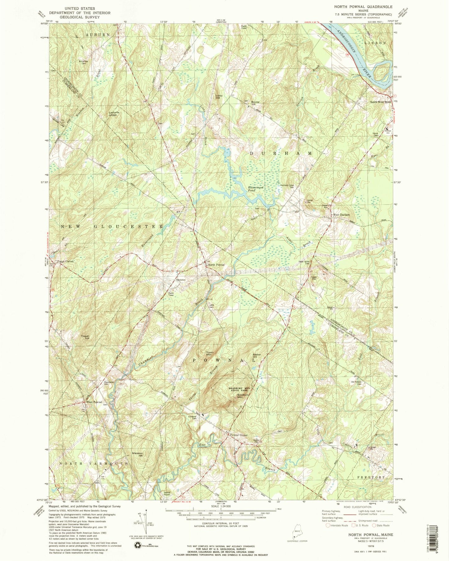
Classic USGS North Pownal Maine 7.5'x7.5' Topo Map
Couldn't load pickup availability
Historical USGS topographic quad map of North Pownal in the state of Maine. Typical map scale is 1:24,000, but may vary for certain years, if available. Print size: 24" x 27"
This quadrangle is in the following counties: Androscoggin, Cumberland.
The map contains contour lines, roads, rivers, towns, and lakes. Printed on high-quality waterproof paper with UV fade-resistant inks, and shipped rolled.
Contains the following named places: Alder Brook, Bibber Hill, Bowie Hill, Bradbury Mountain, Bradbury Mountain State Park, Cedar Grove Cemetery, Collins Brook, Durham Community School, Dyer Brook, Elmwood Cemetery, Gerrish Brook, Harmony Grove Cemetery, Lake Cemetery, Lauraffe Ledge, Libby Brook, Libby Hill, Maplewood Cemetery, Marston Hill, McKenney Cemetery, North Pownal, Old Friends Cemetery, Pisgah Hill, Pownal Center, Runaround Brook, Runaround Pond, South West Bend, Strout Cemetery, Thoits Branch, Tryon Mountain, West Durham, West Pownal, Foggs Corner, Margerison Airport, Pownal Airport (historical), Town of Durham, Town of Pownal, Runaround Pond Dam, First Congregational Church, Blueberry Pond Campground, Blueberry Pond Observatory, Pownal Elementary School, Durham Fire and Rescue Station, Pownal Fire and Rescue North Station, Pownal Fire and Rescue Center Station, Parker Cemetery, Plummer Cemetery, Ruby Cemetery, Waterhouse Cemetery, Bowie Cemetery, Bradbury Cemetery, Libby Number 2 Cemetery, Tuttle Cemetery, Warren Cemetery, Pownal Center Cemetery, Pownal Post Office, Talking Brook