MyTopo
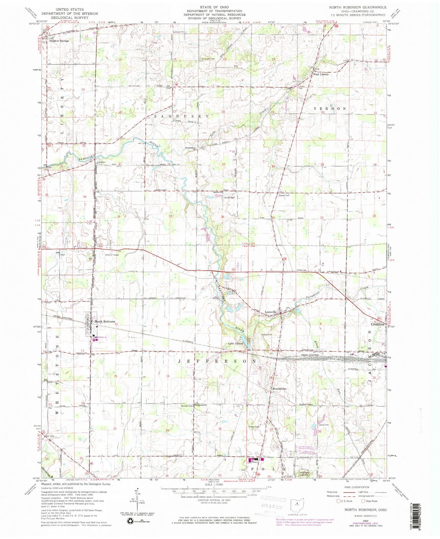
Classic USGS North Robinson Ohio 7.5'x7.5' Topo Map
Couldn't load pickup availability
Historical USGS topographic quad map of North Robinson in the state of Ohio. Map scale may vary for some years, but is generally around 1:24,000. Print size is approximately 24" x 27"
This quadrangle is in the following counties: Crawford.
The map contains contour lines, roads, rivers, towns, and lakes. Printed on high-quality waterproof paper with UV fade-resistant inks, and shipped rolled.
Contains the following named places: Allen Run, Biddle, Biddle Cemetery, Biddle Church, Biddle Mills Post Office, Cole Airfield, Colonel Crawford High School, Colonel Crawford Intermediate School, Crawford County Memory Garden, Crawford County Sanitary Landfill, Dapper Cemetery, Evangelical Church, Fairview Cemetery, Fisher School, Immanuel Church, Jefferson Township Volunteer Fire Department, Kile School, Lake Galion, Leesville, Leesville Cemetery, Leesville Elementary School, Liberty Cemetery, Loss Creek, Luke Cemetery, Middletown, Middletown Cemetery, North Robinson, North Robinson Post Office, Olentangy, Pabst Lake, Pabst Lake Dam, Paramour Creek, Sandusky Cemetery, School Number 1, School Number 2, School Number 3, School Number 4, School Number 5, Tabernacle of Praise, Township of Jefferson, Township of Sandusky, Township of Vernon, Valley View Golf Course, Village of North Robinson, WAPQ-FM (Crestline), West Liberty, WGLX-AM (Galion), Windfall Cemetery, WQLX-FM (Galion), ZIP Codes: 44827, 44856