MyTopo
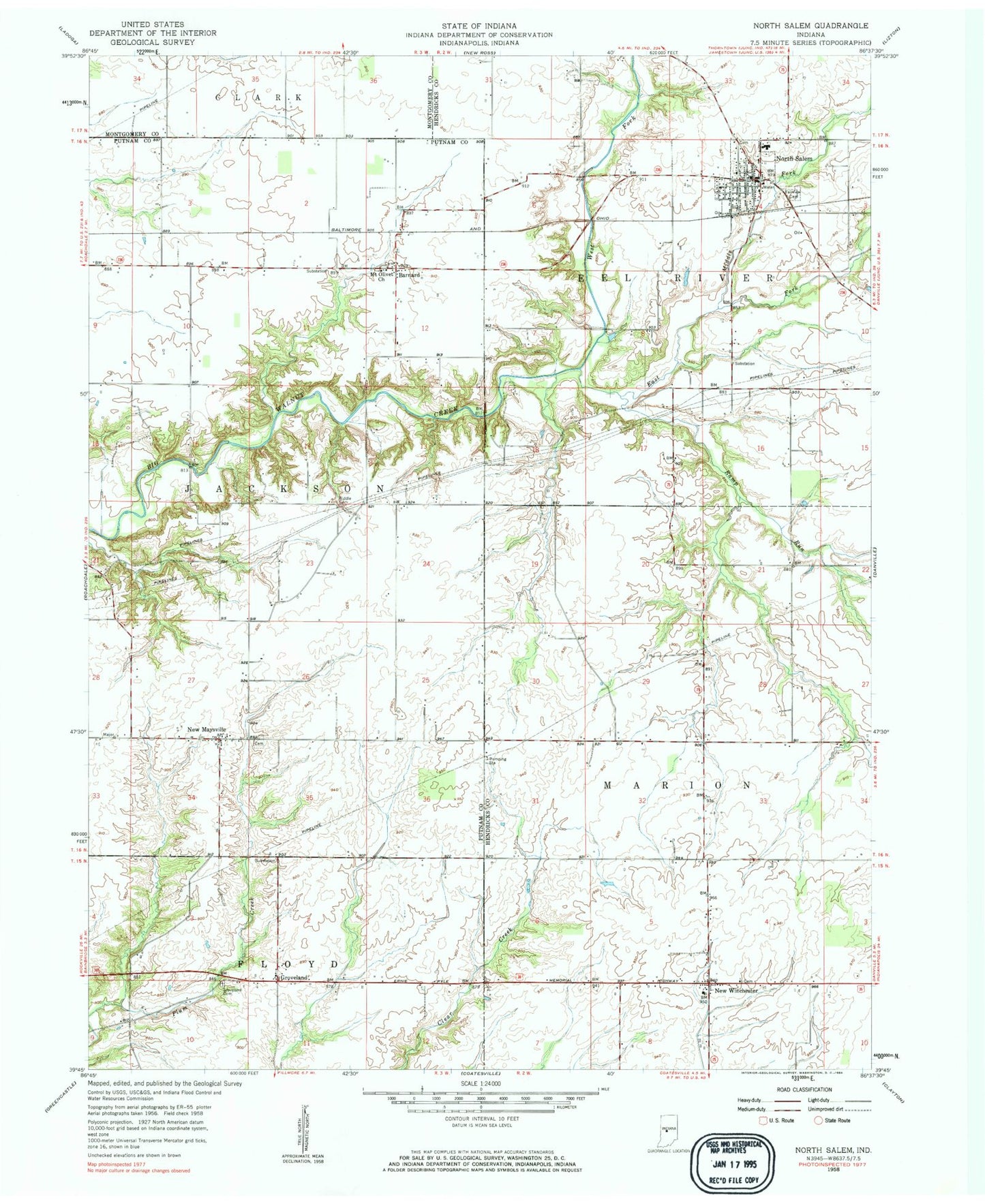
Classic USGS North Salem Indiana 7.5'x7.5' Topo Map
Couldn't load pickup availability
Historical USGS topographic quad map of North Salem in the state of Indiana. Map scale may vary for some years, but is generally around 1:24,000. Print size is approximately 24" x 27"
This quadrangle is in the following counties: Hendricks, Montgomery, Putnam.
The map contains contour lines, roads, rivers, towns, and lakes. Printed on high-quality waterproof paper with UV fade-resistant inks, and shipped rolled.
Contains the following named places: Abner - Ragan Cemetery, Barnard, Biddle Cemetery, Campbell Cemetery, Dickerson Cemetery, East Fork Big Walnut Creek, Eel River Township Fire and Rescue, Fairview Cemetery, Fleece Cemetery, Groveland, Groveland Cemetery, Higgins Cemetery, Hunt Creek, Middle Fork Big Walnut Creek, Mount Olivet Church, New Maysville, New Winchester, New Winchester Baptist Cemetery, North Salem, North Salem Baptist Cemetery, North Salem Fire Department, North Salem Post Office, North Salem School, Page Cemetery, Ramp Run, Richardson Cemetery, Robbins Cemetery, Roundtown Cemetery, Ryner Cemetery, Town of North Salem, Township of Eel River, Township of Jackson, Township of Marion, Turner Cemetery, Turner Farm Cemetery, Vannice Cemetery, Zimmerman Cemetery, ZIP Code: 46165