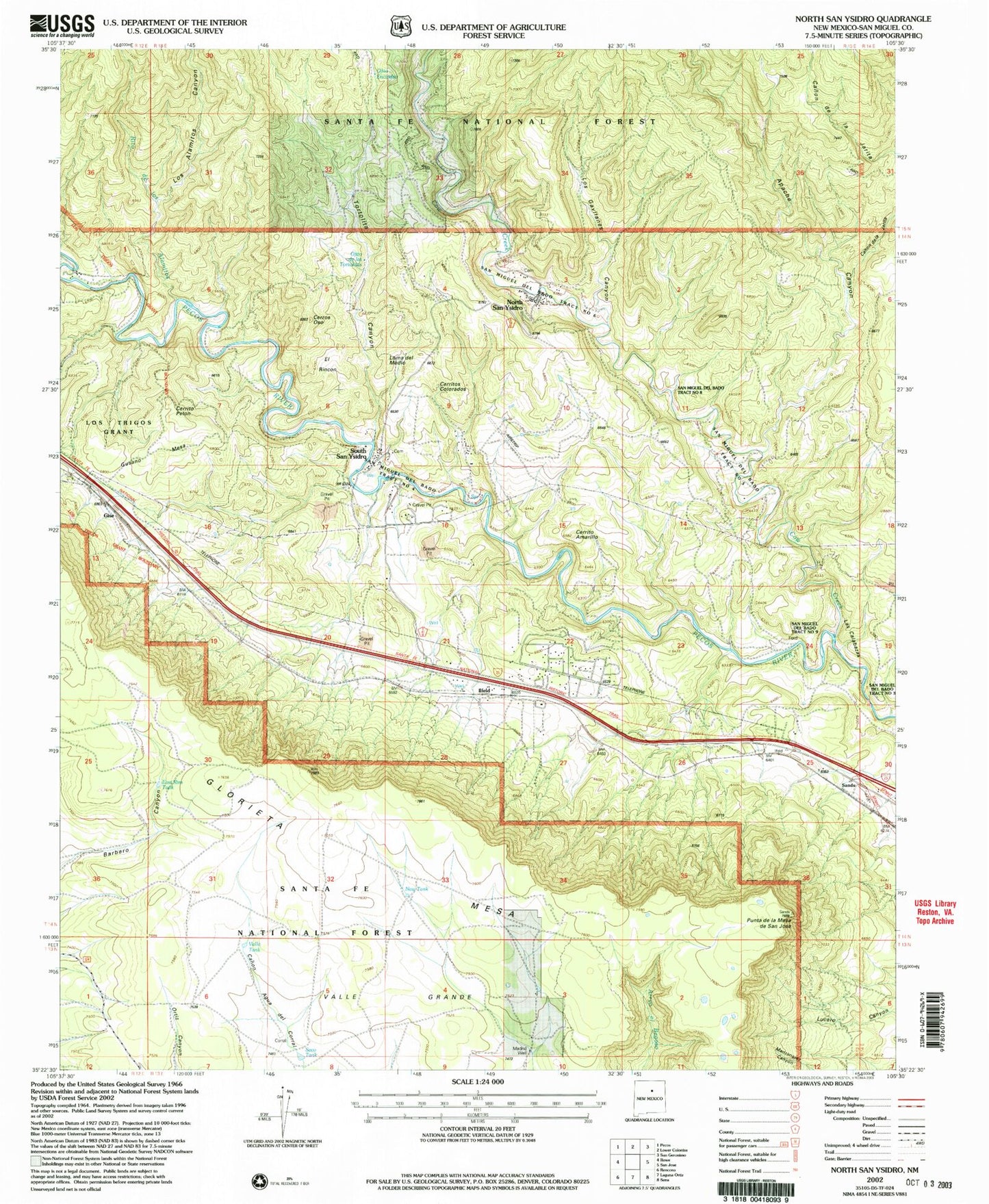
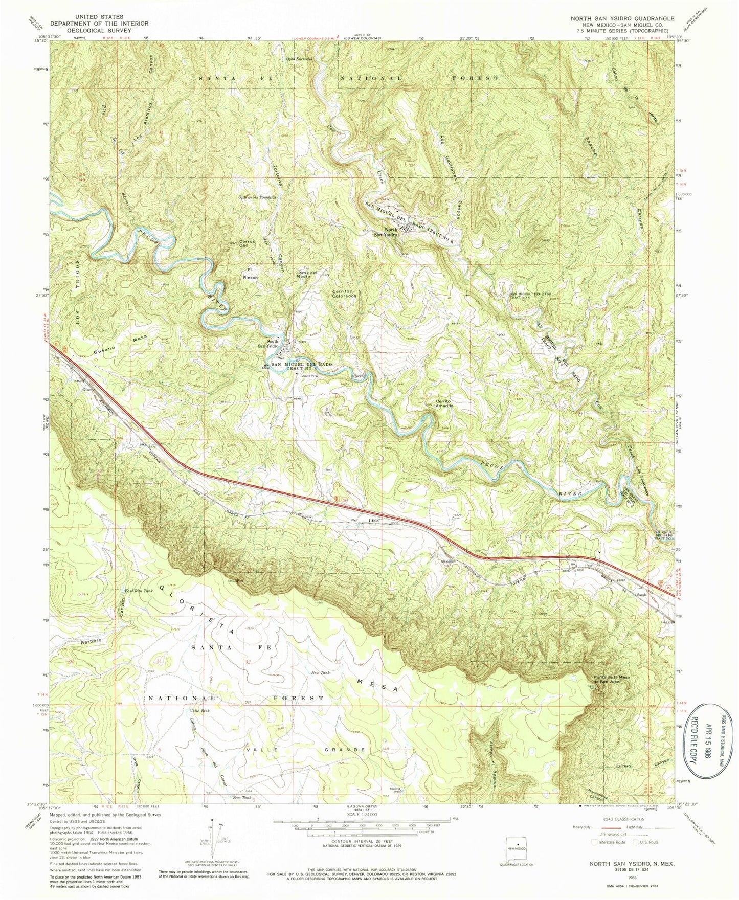
MyTopo
Classic USGS North San Ysidro New Mexico 7.5'x7.5' Topo Map
Couldn't load pickup availability
Historical USGS topographic quad map of North San Ysidro in the state of New Mexico. Map scale may vary for some years, but is generally around 1:24,000. Print size is approximately 24" x 27"
This quadrangle is in the following counties: San Miguel.
The map contains contour lines, roads, rivers, towns, and lakes. Printed on high-quality waterproof paper with UV fade-resistant inks, and shipped rolled.
Contains the following named places: Apache Canyon, Canon de la Jarita, Cerrito Amarillo, Cerrito Pelon, Cerritos Colorados, Cerro del Oso, Cerros Oso, Cow Creek, East Rim Tank, El Rincon, Gise, Gusano Mesa, Ilfeld, Ilfeld Census Designated Place, Ilfeld Post Office, Las Calabazas, Loma del Medio, Los Alamitos Canyon, Los Gavilanes Canyon, Madrid Well, New Tank, North San Ysidro, North San Ysidro Census Designated Place, Ojito de las Tortolitas, Ojito Encindso, Punta de la Mesa de San Juan Jose, Rito de los Alamitos, San Miguel County Fire District Ilfeld Fire Department, San Miguel Del Bado Tract Number 4, San Miguel Del Bado Tract Number 5, San Miguel Del Bado Tract Number 6, San Miguel Del Bado Tract Number 8, San Miguel Del Bado Tract Number 9, Seco Tank, South San Ysidro, South San Ysidro Census Designated Place, Tortolita Canyon, Valle Grande, Valle Tank, ZIP Code: 87538