MyTopo
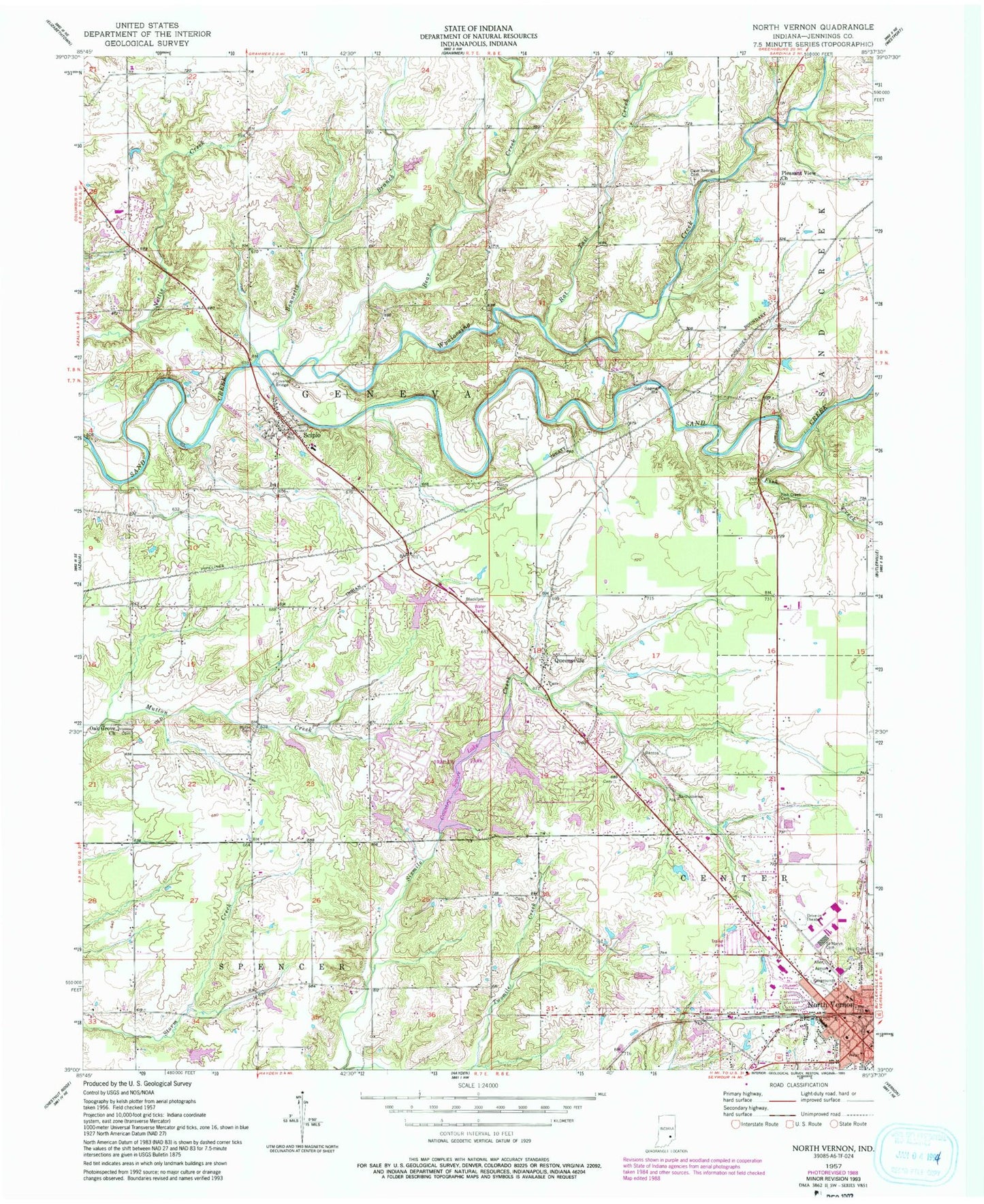
Classic USGS North Vernon Indiana 7.5'x7.5' Topo Map
Couldn't load pickup availability
Historical USGS topographic quad map of North Vernon in the state of Indiana. Map scale may vary for some years, but is generally around 1:24,000. Print size is approximately 24" x 27"
This quadrangle is in the following counties: Jennings.
The map contains contour lines, roads, rivers, towns, and lakes. Printed on high-quality waterproof paper with UV fade-resistant inks, and shipped rolled.
Contains the following named places: Ascension Saint Vincent Jennings Hospital, Bear Creek, Bennetts Branch, Cave Springs Cemetery, City of North Vernon, Country Squire Lake, Country Squire Lake Dam, Country Squire Lakes, Country Squire Lakes Census Designated Place, Fish Creek, Fish Creek Cemetery, Henry Cemetery, Hulse Cemetery, Miller and Sons Farm Supply Airport, North Vernon Fire Department Station 62, North Vernon Police Department, North Vernon Post Office, Oak Grove Church, PHI Air Medical - North Vernon, Pleasant View Church, Queensville, Rattail Creek, Saint Marys Cemetery, Scipio, Scipio - Geneva Township Fire Department, Scipio Census Designated Place, Scipio Elementary School, Scipio Post Office, Tannersville, Township of Geneva, Twomile Creek, Wyaloosing Creek, ZIP Codes: 47265, 47273