MyTopo
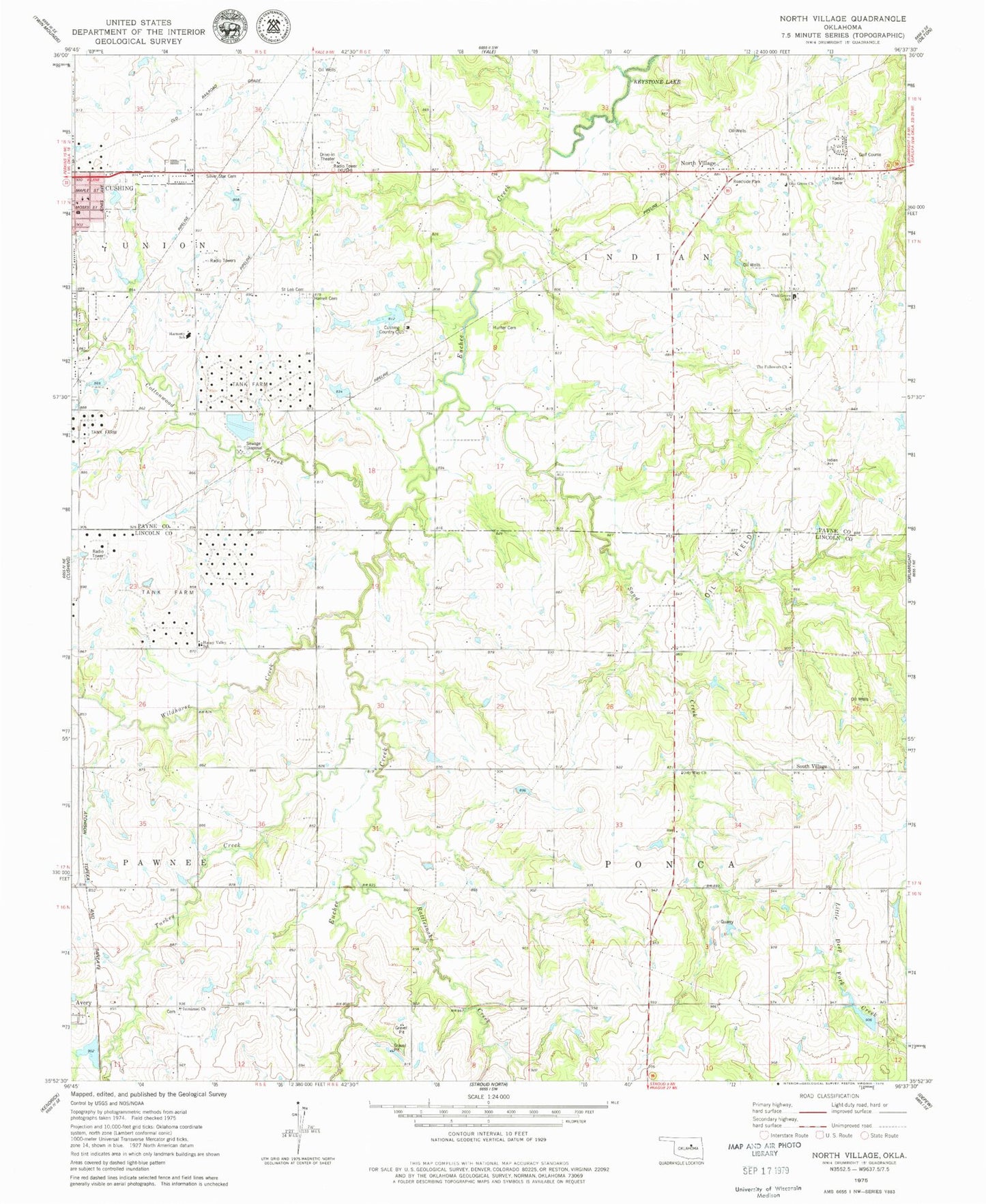
Classic USGS North Village Oklahoma 7.5'x7.5' Topo Map
Couldn't load pickup availability
Historical USGS topographic quad map of North Village in the state of Oklahoma. Map scale may vary for some years, but is generally around 1:24,000. Print size is approximately 24" x 27"
This quadrangle is in the following counties: Lincoln, Payne.
The map contains contour lines, roads, rivers, towns, and lakes. Printed on high-quality waterproof paper with UV fade-resistant inks, and shipped rolled.
Contains the following named places: Cottonwood Creek, Cushing Christian Church, Cushing Country Club, Cushing High School, Cushing Lower Elementary School, Euchee Valley Memorial Park, Happy Valley School, Harrell Cemetery, Henry Hunter Cemetery, Immanuel Church, Immanuel Lutheran Cemetery, KUSH-AM (Cushing), Little Deep Fork Creek Site 1 Dam, Little Deep Fork Creek Site 1 Reservoir, Little Deep Fork Creek Site 2 Dam, Little Deep Fork Creek Site 2 Reservoir, Little Deep Fork Creek Site 3 Dam, Little Deep Fork Creek Site 3 Reservoir, Living Word Church, North Village, Oak Grove Church, Oak Grove Elementary School, Oak Street Baptist Church, Only Way Church, Rattlesnake Creek, Saint Leo Cemetery, Sand Creek, Silver Star Cemetery, South Village, Summit Ridge, Summit Ridge Shopping Center, The Followers Church, Township of Indian, Township of Ponca, Turkey Creek, United Pentecostal Church, Wildhorse Creek