MyTopo
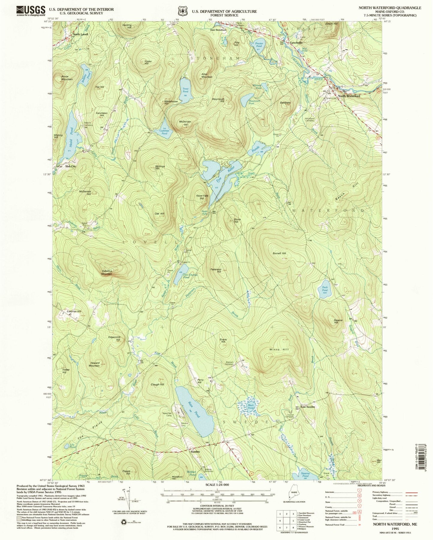
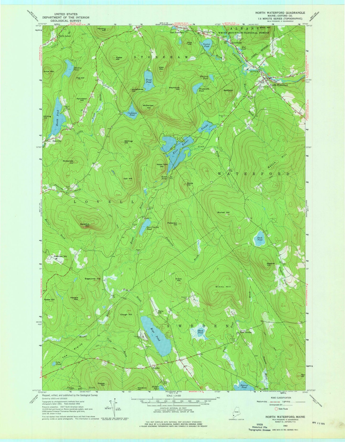
Classic USGS North Waterford Maine 7.5'x7.5' Topo Map
Couldn't load pickup availability
Historical USGS topographic quad map of North Waterford in the state of Maine. Typical map scale is 1:24,000, but may vary for certain years, if available. Print size: 24" x 27"
This quadrangle is in the following counties: Oxford.
The map contains contour lines, roads, rivers, towns, and lakes. Printed on high-quality waterproof paper with UV fade-resistant inks, and shipped rolled.
Contains the following named places: Allen Mountain, Amos Mountain, Baldpate, Beech Hill, Black Pond, Brackett Cemetery, Bradley Pond, Burnell Hill, Clough Hill, Cold Brook, Cushman Pond, Dan Charles Pond, Duck Pond, Duck Pond Brook, East Sweden, Eastman Hill, Edgecomb Hill, Evans Hill, Five Kezar Ponds, Flat Hill, Foster Hill, Foster Hill, Green Brook, Harding Hill, Haskell Cemetery, Heald Pond, Hillside Cemetery, Howard Mountain, Kenniston Hill, Keyes Brook, Keyes Pond, Kezar Falls, Kezar Falls Hill, Lily Pond, Little Trout Brook, Lynchville, Marr Hill, McDaniels Hill, McDaniels Hill, Mill Brook, Mud Pond, North Waterford, Oak Hill, Patterson Brook, Patterson Hill, Perry Hill, Pine Hill, Popple Hill, Powers Brook, Proctor Pond, Sabattus Mountain, Skillings Hill, Slab City, Stearns Cemetery, Stearns Hill, Stevens Cemetery, Stone Hill, Sweden, Tapawingo Camp, Trout Pond, Warren Brook, Webber Cemetery, Weymouth Hill, Weymouth Pond, Whitehouse Hill, Whiting Hill, Whitney Pond, Winns Hill, Woodlawn Cemetery, Town of Sweden, Heald Pond Dam, Cushman Pond Dam, Kezar Falls Gorge, Stoneham Post Office, North Waterford Congregational Church, North Waterford Fairgrounds, Sweden Volunteer Fire Department, Lovell Volunteer Fire Department North Station, Lewis Dana Hill Memorial Library