MyTopo
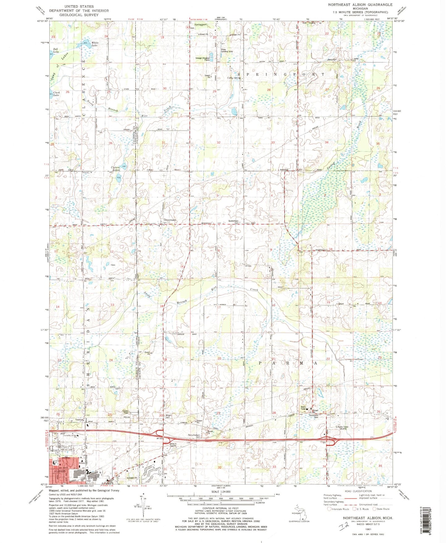
Classic USGS Northeast Albion Michigan 7.5'x7.5' Topo Map
Couldn't load pickup availability
Historical USGS topographic quad map of Northeast Albion in the state of Michigan. Map scale may vary for some years, but is generally around 1:24,000. Print size is approximately 24" x 27"
This quadrangle is in the following counties: Calhoun, Jackson.
The map contains contour lines, roads, rivers, towns, and lakes. Printed on high-quality waterproof paper with UV fade-resistant inks, and shipped rolled.
Contains the following named places: Albion Church of Christ, Albion Church of the Nazarene, Assembly of God Church, Cistern Lakes, Colby Spring, Country Town Golf Course, Devereaux, Devereaux Post Office, Devereaux Station, Free Methodist Church, Gay School, Grace Freewill Baptist Church, Graham Cemetery, Island School, King Cemetery, Kopp School, Landon School, Quaker School, Quakertown Cemetery, Reed Family Cemetery, Riske Airport, Sheridan Township Fire Department, Smithfield Cemetery, Smithfield Post Office, Smithfield School, Springport Cemetery, Township of Parma, Twin Pine Mobile Home Park, White Lake, White School, Wright Cemetery, Wright School, WUFN-FM (Albion), ZIP Code: 49224