MyTopo
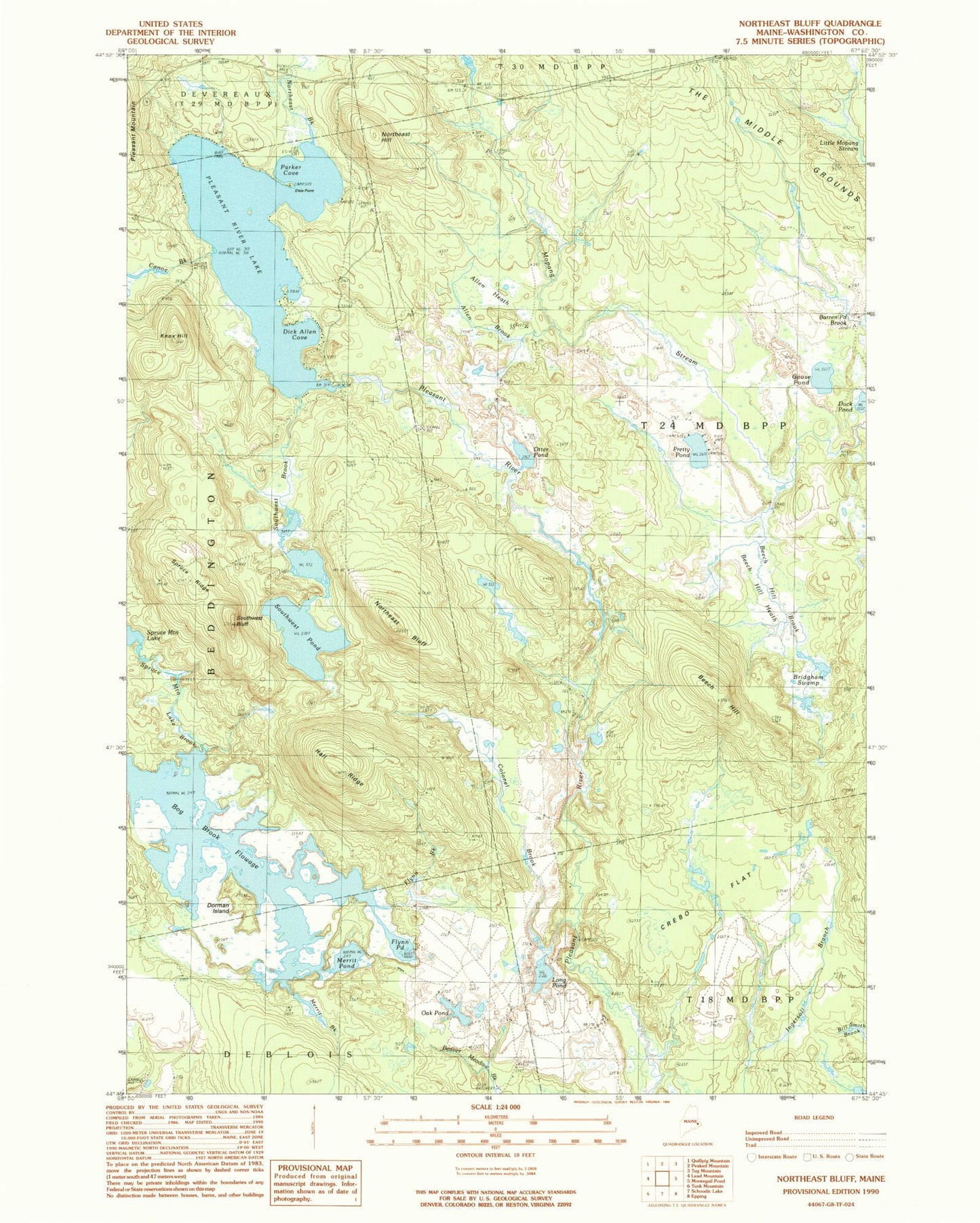
Classic USGS Northeast Bluff Maine 7.5'x7.5' Topo Map
Couldn't load pickup availability
Historical USGS topographic quad map of Northeast Bluff in the state of Maine. Typical map scale is 1:24,000, but may vary for certain years, if available. Print size: 24" x 27"
This quadrangle is in the following counties: Washington.
The map contains contour lines, roads, rivers, towns, and lakes. Printed on high-quality waterproof paper with UV fade-resistant inks, and shipped rolled.
Contains the following named places: Allen Brook, Allen Heath, Allison Worcester Camp, Beech Hill, Beech Hill Brook, Beech Hill Heath, Bridgham Swamp, Canoe Brook, Colonel Brook, Crebo Flat, Davis Camp, Dick Allen Cove, Dorman Island, Elsie Point, Flynn Brook, Flynn Pond, Goose Pond, Hall Ridge, Hartford Camp, Irving Worcester Camp, Knox Hill, Long Pond, Merrit Brook, Merrit Pond, Morse Camp, Morse Camp, Northeast Bluff, Northeast Brook, Northeast Hill, Oak Pond, Otter Pond, Parker Cove, Pineo Camp, Pleasant River Lake, Pretty Pond, Southwest Bluff, Southwest Brook, Southwest Pond, Sprague Camp, Spruce Mountain Lake Brook, Spruce Ridge, Stewart Camp, Bog Brook Flowage, Pleasant River Lake Water Dam, T24 MD BPP