
MyTopo
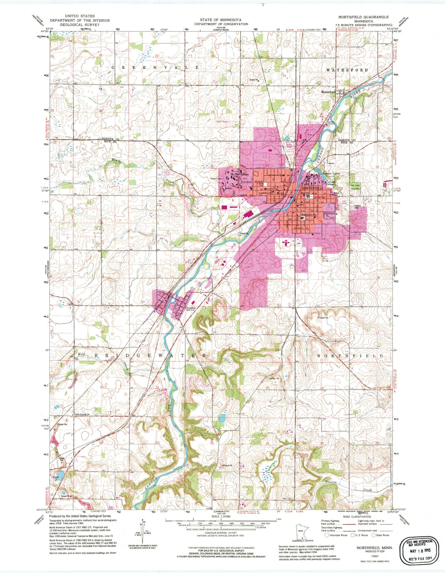
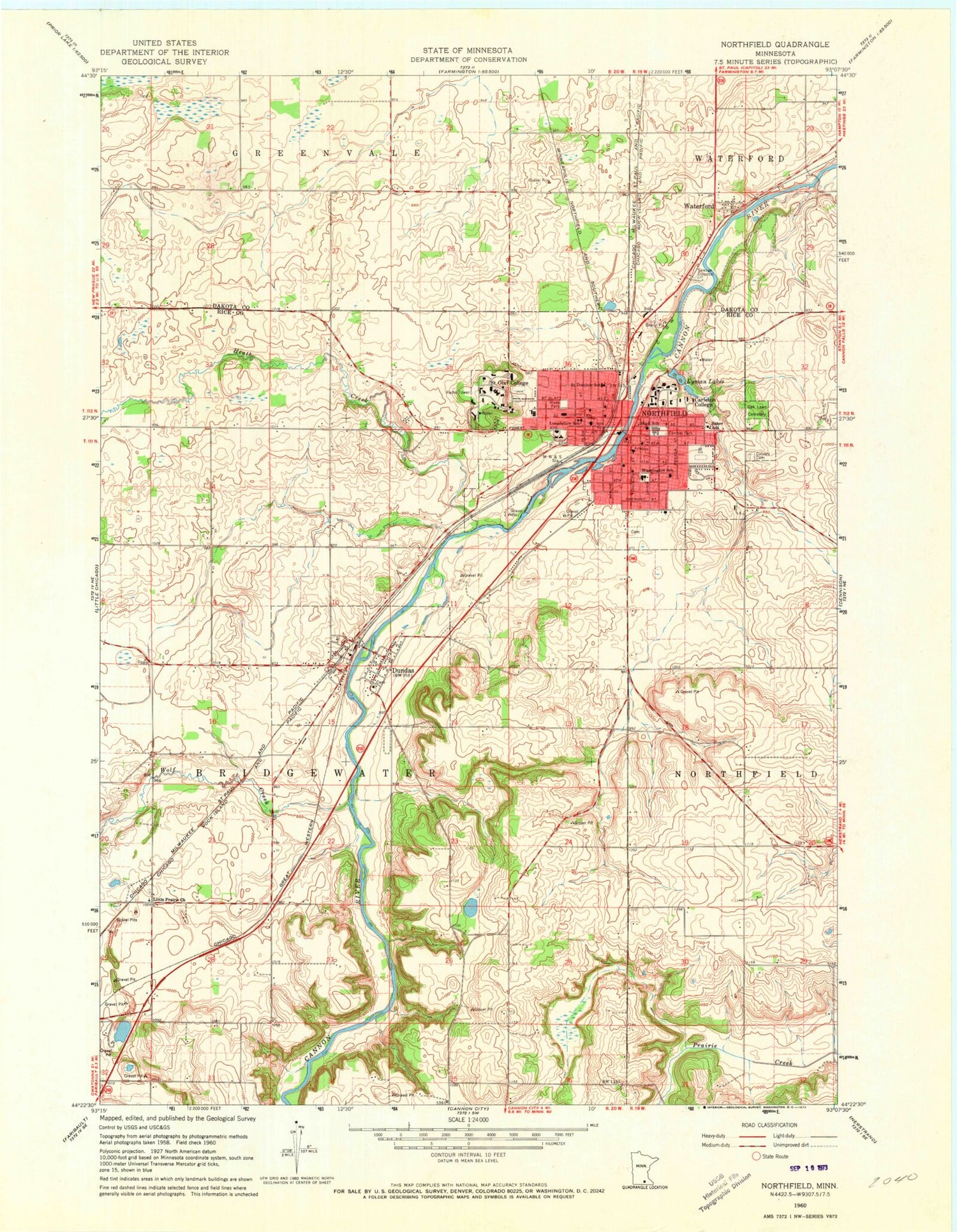
Classic USGS Northfield Minnesota 7.5'x7.5' Topo Map
Couldn't load pickup availability
Historical USGS topographic quad map of Northfield in the state of Minnesota. Typical map scale is 1:24,000, but may vary for certain years, if available. Print size: 24" x 27"
This quadrangle is in the following counties: Dakota, Rice.
The map contains contour lines, roads, rivers, towns, and lakes. Printed on high-quality waterproof paper with UV fade-resistant inks, and shipped rolled.
Contains the following named places: Baker School, C G W Station, Calvary Cemetery, Carleton College, Central Park, Dundas, Heath Creek, Little Prairie Church, Longfellow School, Lyman Lakes, Northfield, Oaklawn Cemetery, Saint Dominic School, Saint Olaf College, Wade Park, Washington School, Waterford, Wolf Creek, WCAL-AM (Northfield), WCAL-FM (Northfield), KRLX-FM (Northfield), Township of Bridgewater, Saint Dominic School, Cannon River Dam, Cannon River Reservoir, Cannon River Dam, Cannon River Reservoir, Thomas Anderson Veblen and Kari Bunde Veblen Farmstead, Archibald Mill Historical Marker, Thomas Anderson Veblen and Kari Bunde Veblen Farmstead, Waterford Post Office (historical), John North Park, City of Dundas, City of Northfield, Saint Olaf College, Carleton College, Bridgewater Elementary School, Sibley Elementary School, Greenvale Park Elementary School, Northfield High School, Laura Baker School, Area Learning Center, Longfellow School, Northfield Middle School, Northfield Fire and Rescue, Northfield Hospital, Northfield Police Dept, Dundas Police Department, Dundas Post Office, Northfield Post Office, Northfield Cemetery, Northfield Carrier Annex Post Office


