MyTopo
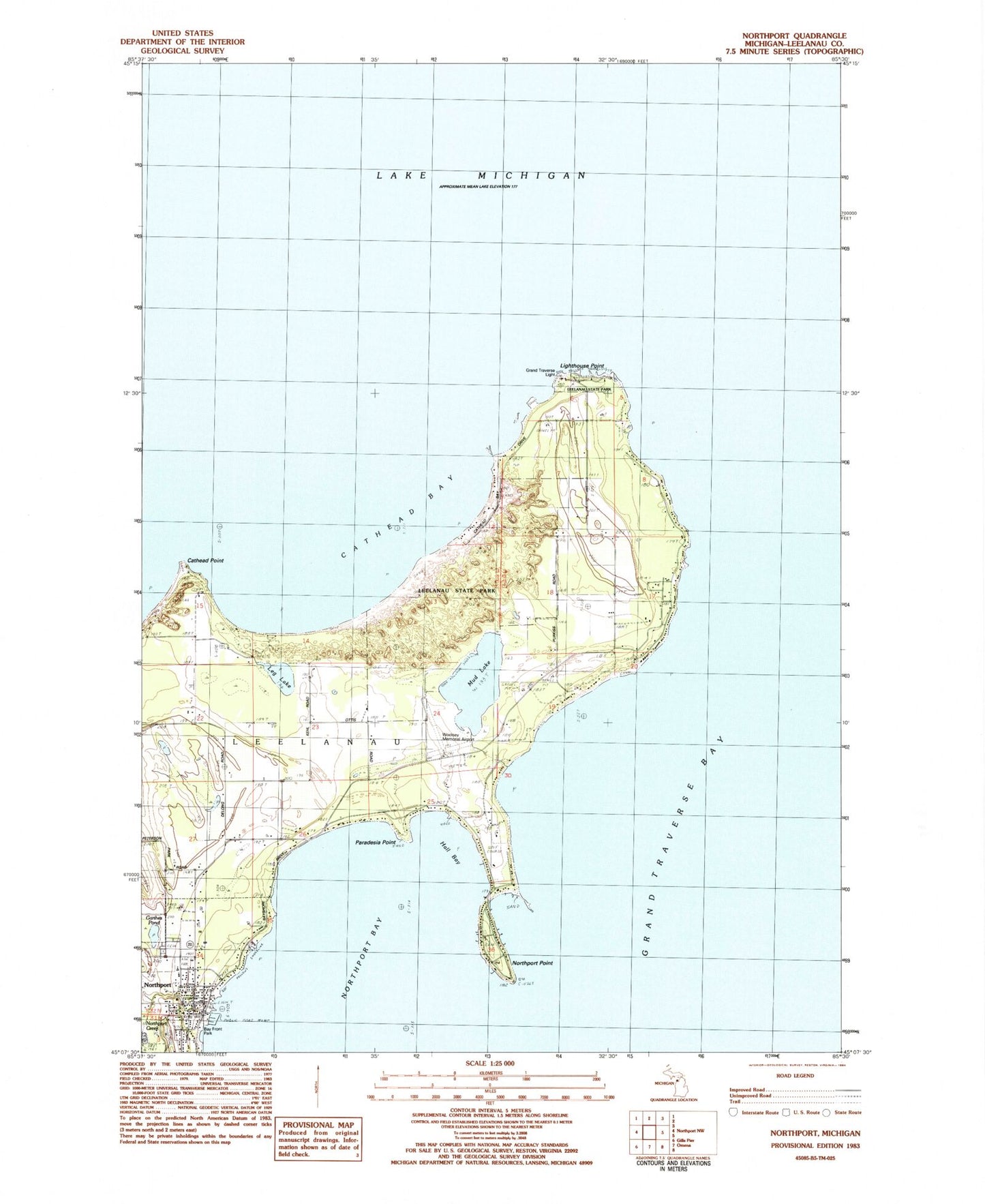
Classic USGS Northport Michigan 7.5'x7.5' Topo Map
Couldn't load pickup availability
Historical USGS topographic quad map of Northport in the state of Michigan. Map scale may vary for some years, but is generally around 1:24,000. Print size is approximately 24" x 27"
This quadrangle is in the following counties: Leelanau.
The map contains contour lines, roads, rivers, towns, and lakes. Printed on high-quality waterproof paper with UV fade-resistant inks, and shipped rolled.
Contains the following named places: Atwill Memorial Chapel Cemetery, Bay Front Park, Bethany Lutheran Church, Cat Head Bay, Cat Head Point, Cherry Home Post Office, Craker Boat Yard, G Marsten Dame Marina, Garthes Pond, Grand Traverse Light, Great Lakes Sport Fishery Historical Marker, Hall Bay, Haserot Park, Leelanau Memorial Health Center, Leelanau Peninsula, Leelanau State Park, Leelanau Township Fire Department, Leelanau Township Library, Leelanau Township Number One and Two Cemetery, Leg Lake, Lighthouse Point, Mud Lake, Northport, Northport Bay Boat Yard, Northport Creek, Northport Medical Clinic, Northport Park, Northport Point, Northport Point Columbarium Cemetery, Northport Point Golf Club, Northport Point Post Office, Northport Post Office, Northport Public School, Northport Station, Paradesia Point, Saint Gertrude Church, Trinity Church, Village of Northport, Woolsey Memorial Airport