MyTopo
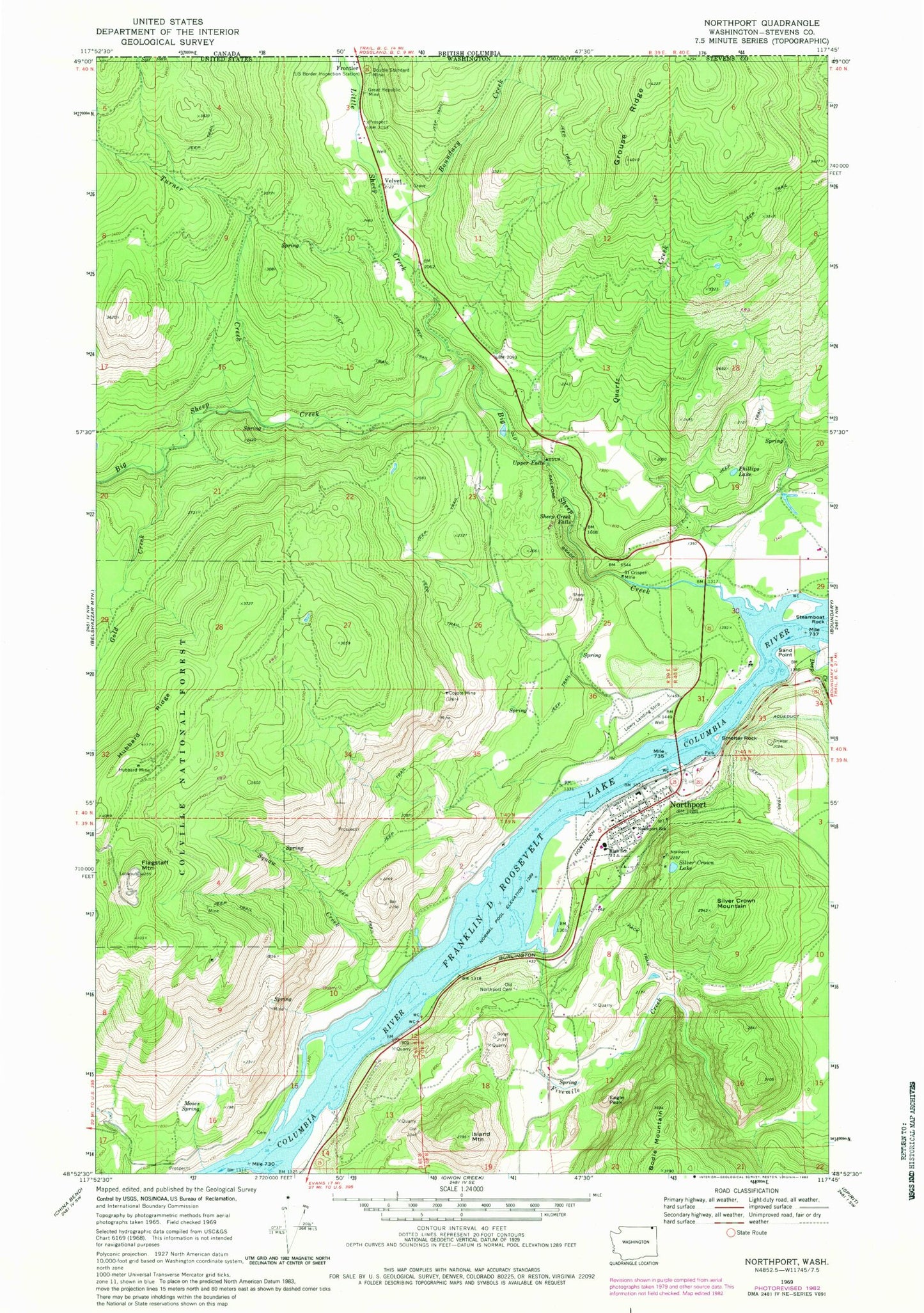
Classic USGS Northport Washington 7.5'x7.5' Topo Map
Couldn't load pickup availability
Historical USGS topographic quad map of Northport in the state of Washington. Typical map scale is 1:24,000, but may vary for certain years, if available. Print size: 24" x 27"
This quadrangle is in the following counties: Stevens.
The map contains contour lines, roads, rivers, towns, and lakes. Printed on high-quality waterproof paper with UV fade-resistant inks, and shipped rolled.
Contains the following named places: Boundary Creek, Coyote Mine, Deep Creek, Double Standard Mine, Eagle Peak, Fivemile Creek, Flagstaff Mountain, Frontier, Gold Creek, Great Republic Mine, Grouse Ridge, Hubbard Mine, Hubbard Ridge, Island Mountain, Little Sheep Creek, Moses Spring, Northport, Northport School, Old Northport Cemetery, Phillips Lake, Quartz Creek, Saint Crispen Mine, Sand Point, Sheep Creek Falls, Silver Crown Lake, Silver Crown Mountain, Smelter Rock, Squaw Creek, Steamboat Rock, Turner Creek, Upper Falls, Bear Creek, Sheep Creek Recreation Site, Hudson, Velvet, Big Sheep Creek, Town of Northport, Sherve Quarry, Northport Post Office, Northport Community Health Center, Columbia River Bridge, Frontier Port of Entry, New Hope Assembly of God Church, Northport Seventh Day Adventist Church, Northport Community Library, Stevens County Fire District 11 Northport Station 2, Upper Columbia RV Park and Campground