
MyTopo
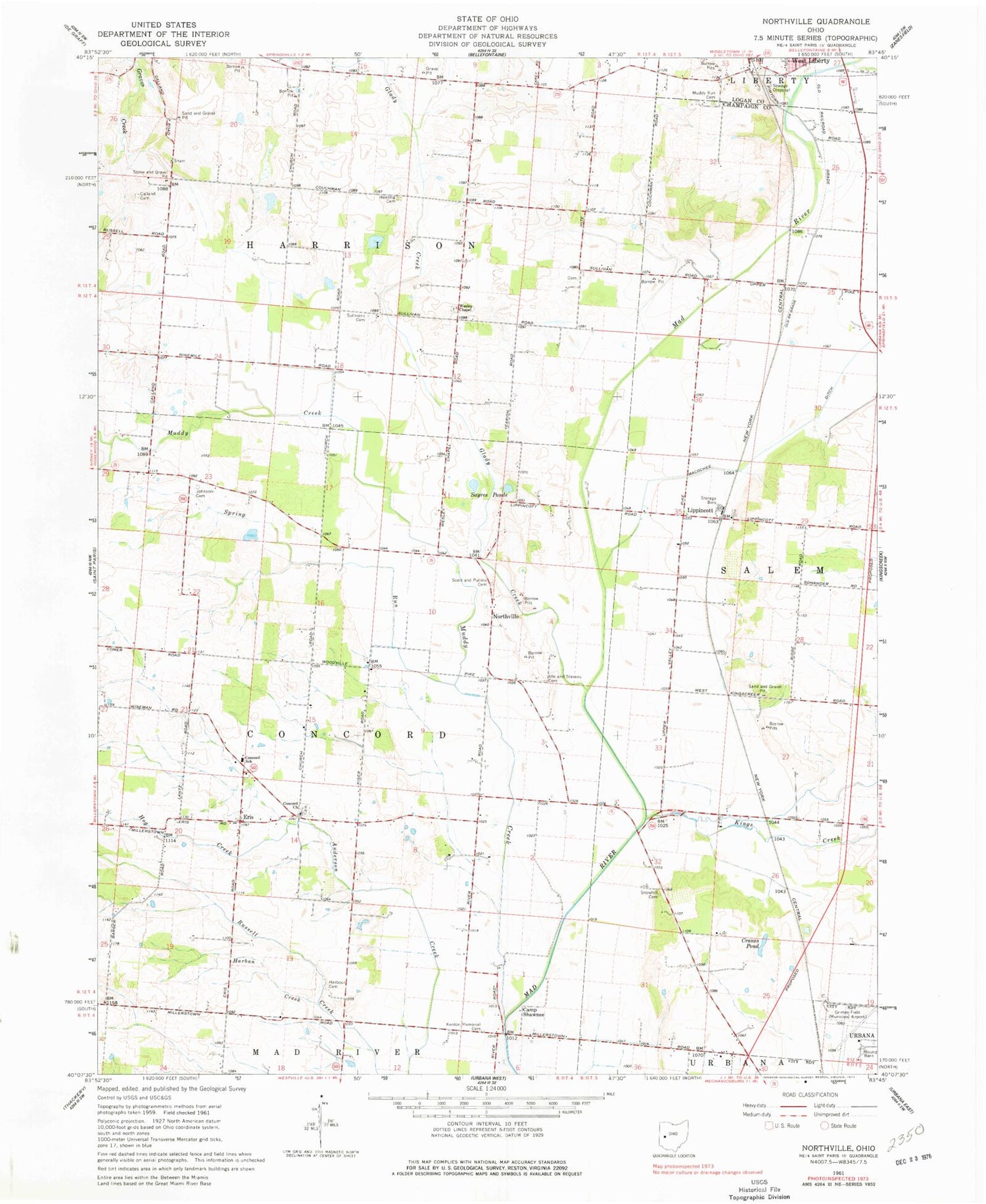
Classic USGS Northville Ohio 7.5'x7.5' Topo Map
Couldn't load pickup availability
Historical USGS topographic quad map of Northville in the state of Ohio. Typical map scale is 1:24,000, but may vary for certain years, if available. Print size: 24" x 27"
This quadrangle is in the following counties: Champaign, Logan.
The map contains contour lines, roads, rivers, towns, and lakes. Printed on high-quality waterproof paper with UV fade-resistant inks, and shipped rolled.
Contains the following named places: Calland Cemetery, Cranes Pond, Harban Creek, Harbour Cemetery, Hog Creek, Idle - Stevens Cemetery, Johnson Cemetery, Macochee Ditch, Muddy Creek, Muddy Run Cemetery, Scott and Pullins Cemetery, Snowhill Cemetery, Spring Run, Sullivans Cemetery, Wesley Chapel, West Liberty-Salem High School, Eris, Northville, Camp Shawnee, Concord School, Old Pimtown (historical), Concord United Methodist Church, Lippincott, Kings Creek, Champaign County, Macochee Creek, Siegenthaler-Kaestner Esker State Nature Preserve, Couchman School (historical), Craft School (historical), School Number 5 (historical), Snow Hill School (historical), Wesley Chapel School (historical), Sayres Ponds, Glady Creek, Township of Concord, Township of Harrison, Concord Cemetery, Hewling Cemetery, Kenton Memorial Cemetery, Wesley Chapel Cemetery, Ziegler Cemetery, Lippincott Post Office (historical), Eris Post Office (historical), Northville Post Office (historical)


