MyTopo
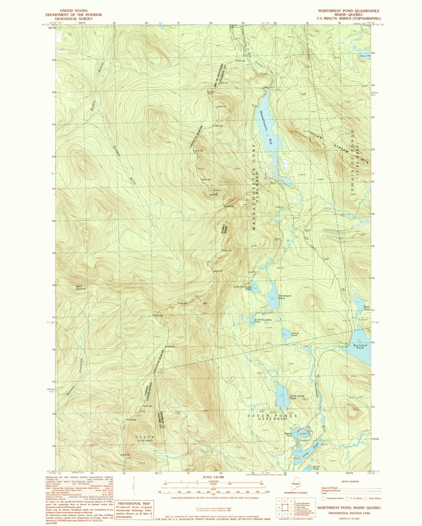
Classic USGS Northwest Pond Maine 7.5'x7.5' Topo Map
Couldn't load pickup availability
Historical USGS topographic quad map of Northwest Pond in the state of Maine. Typical map scale is 1:24,000, but may vary for certain years, if available. Print size: 24" x 27"
This quadrangle is in the following counties: Franklin, Oxford.
The map contains contour lines, roads, rivers, towns, and lakes. Printed on high-quality waterproof paper with UV fade-resistant inks, and shipped rolled.
Contains the following named places: Beaver Pond, Grants Pond, Little Island Pond, Little Northwest Pond, Long Pond, Massachusetts Bog, Northwest Pond, Otter Pond, Rock Pond, Secret Pond, South Boundary Pond, Massachusetts Bog Dam, Long Pond Dam, Beaver Pond Dam, Little Island Pond Dam Number 3, Big Island Pond Dam Number 4, Big Island Pond, Massachusetts Gore