MyTopo
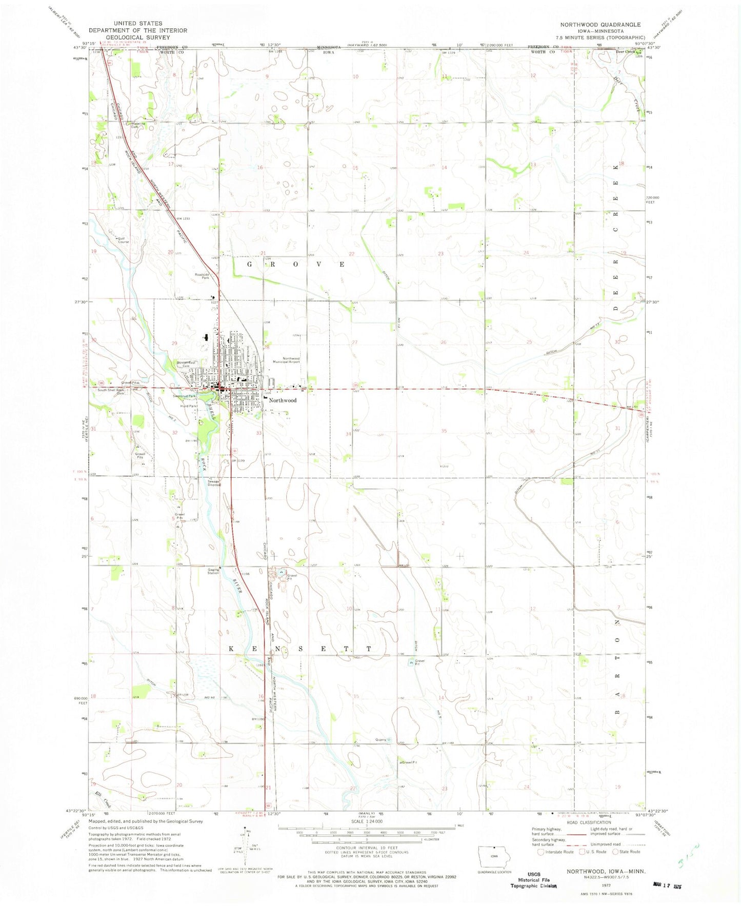
Classic USGS Northwood Iowa 7.5'x7.5' Topo Map
Couldn't load pickup availability
Historical USGS topographic quad map of Northwood in the state of Iowa. Map scale may vary for some years, but is generally around 1:24,000. Print size is approximately 24" x 27"
This quadrangle is in the following counties: Freeborn, Worth.
The map contains contour lines, roads, rivers, towns, and lakes. Printed on high-quality waterproof paper with UV fade-resistant inks, and shipped rolled.
Contains the following named places: Anderson Chiropractic Office, Central Park, City of Northwood, Deer Creek, Deercreek Post Office, Dental Associates Building, Ditch Number 11, Ditch Number 13, Ditch Number 40, Ditch Number 5, First Lutheran Church, First Shell Rock Church, Harris Quarry, Hurd Park, Kuennen Quarry Wildlife Area, KYTC-FM (Northwood), Lutheran Retirement Home, Mercy Family Care Center - Northwood, Northwood, Northwood - Kensett Elementary School, Northwood - Kensett Junior / Senior High School, Northwood Baptist Church, Northwood Clinic - Mayo Health, Northwood Co-op Elevator, Northwood Country Club, Northwood Municipal Airport, Northwood Police Department, Northwood Post Office, Northwood Public Library, Northwood Volunteer Fire Company, Seater Family Plot, Slosson Cemetery, South Shell Rock Cemetery, Stateline Cemetery, Sunset Rest Cemetery, Swensrud Park, Swensrud School Museum, Township of Grove, Township of Kensett, Turkeyfoot Prairie, United Methodist Church, Welsh Chiropractic Center, Worth County Courthouse, Worth County Historical Museum, Worth County Sheriff's Office