MyTopo
Classic USGS Norvell Michigan 7.5'x7.5' Topo Map
Couldn't load pickup availability
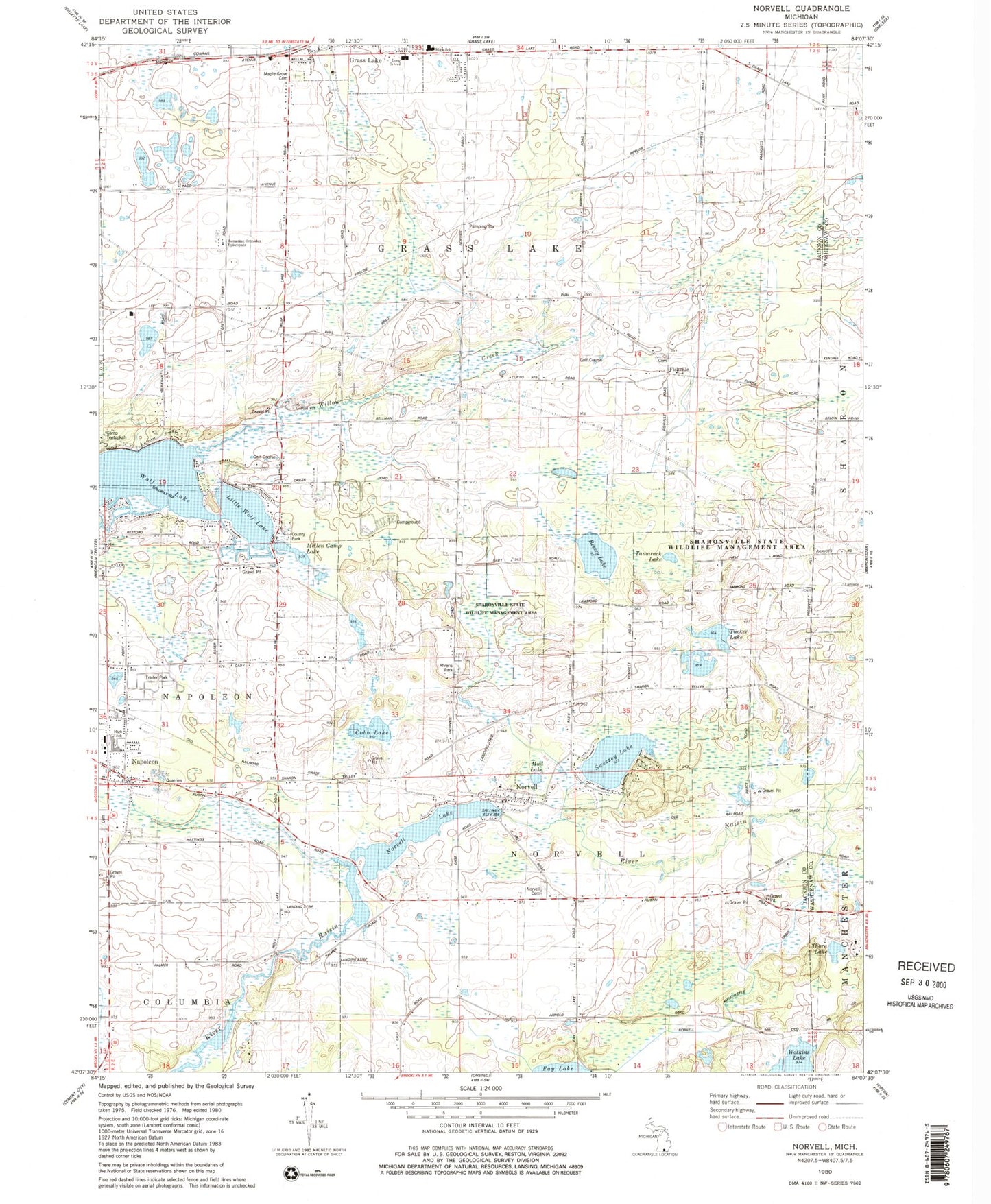
Historical USGS topographic quad map of Norvell in the state of Michigan. Typical map scale is 1:24,000, but may vary for certain years, if available. Print size: 24" x 27"
This quadrangle is in the following counties: Jackson, Washtenaw.
The map contains contour lines, roads, rivers, towns, and lakes. Printed on high-quality waterproof paper with UV fade-resistant inks, and shipped rolled.
Contains the following named places: Bessey Lake, Close School, Coppernoll School, Dorr School, Fishville School, Maple Grove Cemetery, Grey Tower, Little Wolf Lake, Mud Lake, Napoleon, Norvell, Norvell Lake, Norvell Plains School, Prospect Hill School, Sweezey lake, Tamarack Lake, Thorn Lake, Tucker Lake, Willow Creek, Wolf Lake, Charter Township of Grass Lake, Township of Norvell, Norvell Manchester Drain, Sharonville State Wildlife Management Area, Cobb Lake, Mellen Camp Lake, Jackson County Park, Fishville, Romanian Orthodox Episcopate, Long School, Napoleon Census Designated Place, Norvell Post Office, Norvell Community Baptist Church, Norvell Station (historical), Napoleon Station (historical), Napoleon United Methodist Church, First Baptist Church, Napolean Post Office, Eby Elementary School, Napoleon Middle School, Napoleon High School, Grass Lake High School, Twin Knolls Golf Course, Apple Creek Resort and RV Park, Ray Cemetery, Saint Marys Cemetery, Norvell Cemetery, Oak Grove Cemetery, Fishville Cemetery, Wolf Lake Airport, Jude Stone Quarry, Jackson County Waterfowl Production Area