MyTopo
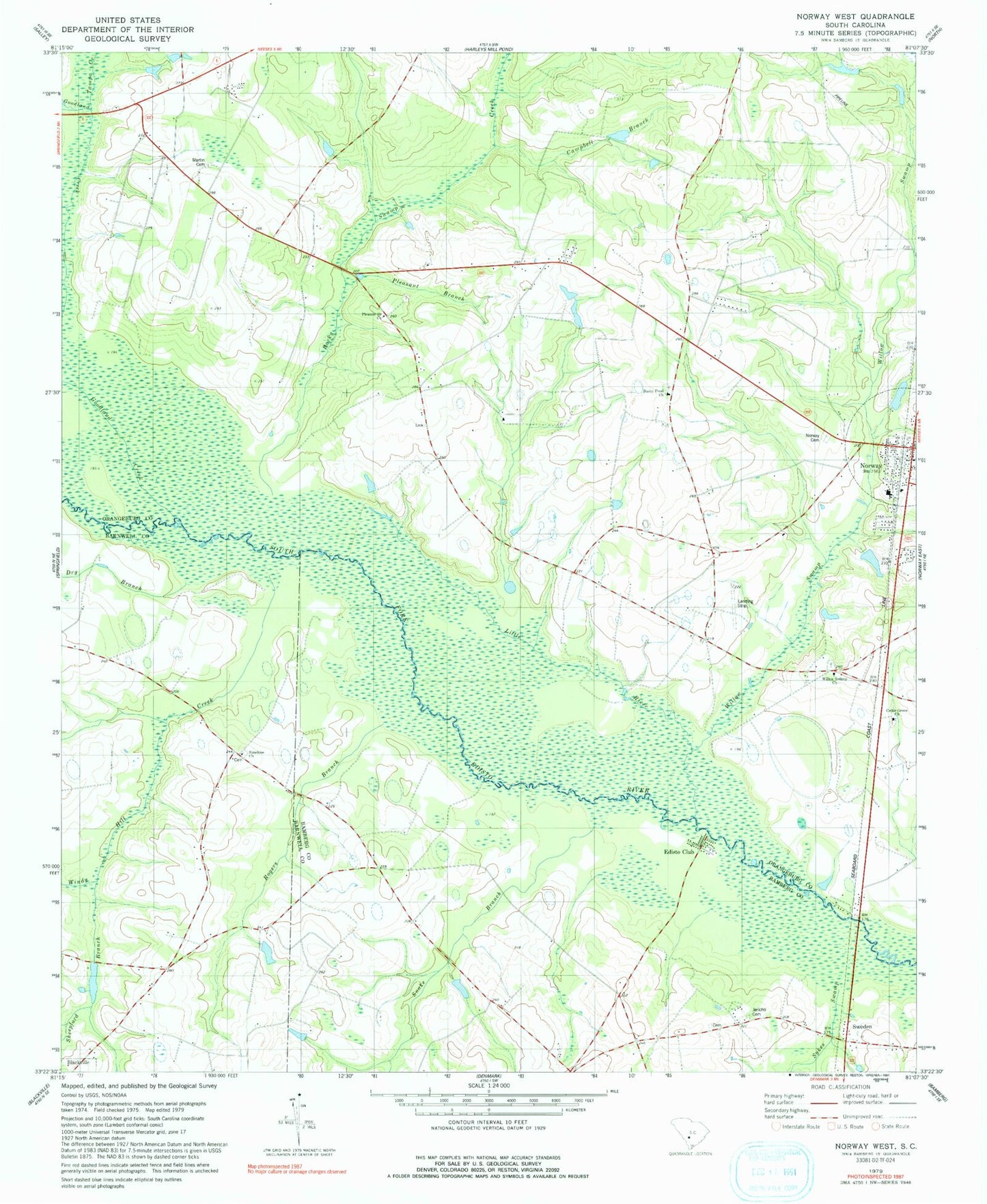
Classic USGS Norway West South Carolina 7.5'x7.5' Topo Map
Couldn't load pickup availability
Historical USGS topographic quad map of Norway West in the state of South Carolina. Map scale may vary for some years, but is generally around 1:24,000. Print size is approximately 24" x 27"
This quadrangle is in the following counties: Bamberg, Barnwell, Orangeburg.
The map contains contour lines, roads, rivers, towns, and lakes. Printed on high-quality waterproof paper with UV fade-resistant inks, and shipped rolled.
Contains the following named places: Bull Branch, Bushy Pond Church, Campbell Branch, Campbell Branch School, Cedar Grove Church, Collums Pond D-3071 Dam, Creco, Dry Branch, Duncans Bridge, Edisto Club, Good Will School, Goodland Creek, Hairs Pond D-3060 Dam, Holman Bridge, Hunter-Kinard-Tyler High School, Jericho Cemetery, Jericho Church, Jericho School, Kittrell Landing, Little Ponderosa Lake Dam D-3748, Little River, Martin Cemetery, Morgan Family Cemetery, Nicks Lake, Norway, Norway Cemetery, Norway Fire Department, Norway Post Office, Oak Ridge School, Oakland School, Pardees Pond Dam D-3747, Pleasant Branch, Pleasant Branch Church, Pleasant Branch School, Rocky Swamp Creek, Rocky Swamp School, Rogers Branch, Sheepford Branch, Slaughter Field, Snake Branch, South Carolina Noname 38068 D-3764 Dam, Sunshine Baptist Church, Sunshine School, Sweden, Sykes Swamp, Tampa Creek, Town of Norway, Tylers Landing, Waynor, West Willow School, Willow Swamp Baptist Church, Willow Swamp Baptist Church Cemetery, Windy Hill Creek, Youngs Island, ZIP Code: 29113