MyTopo
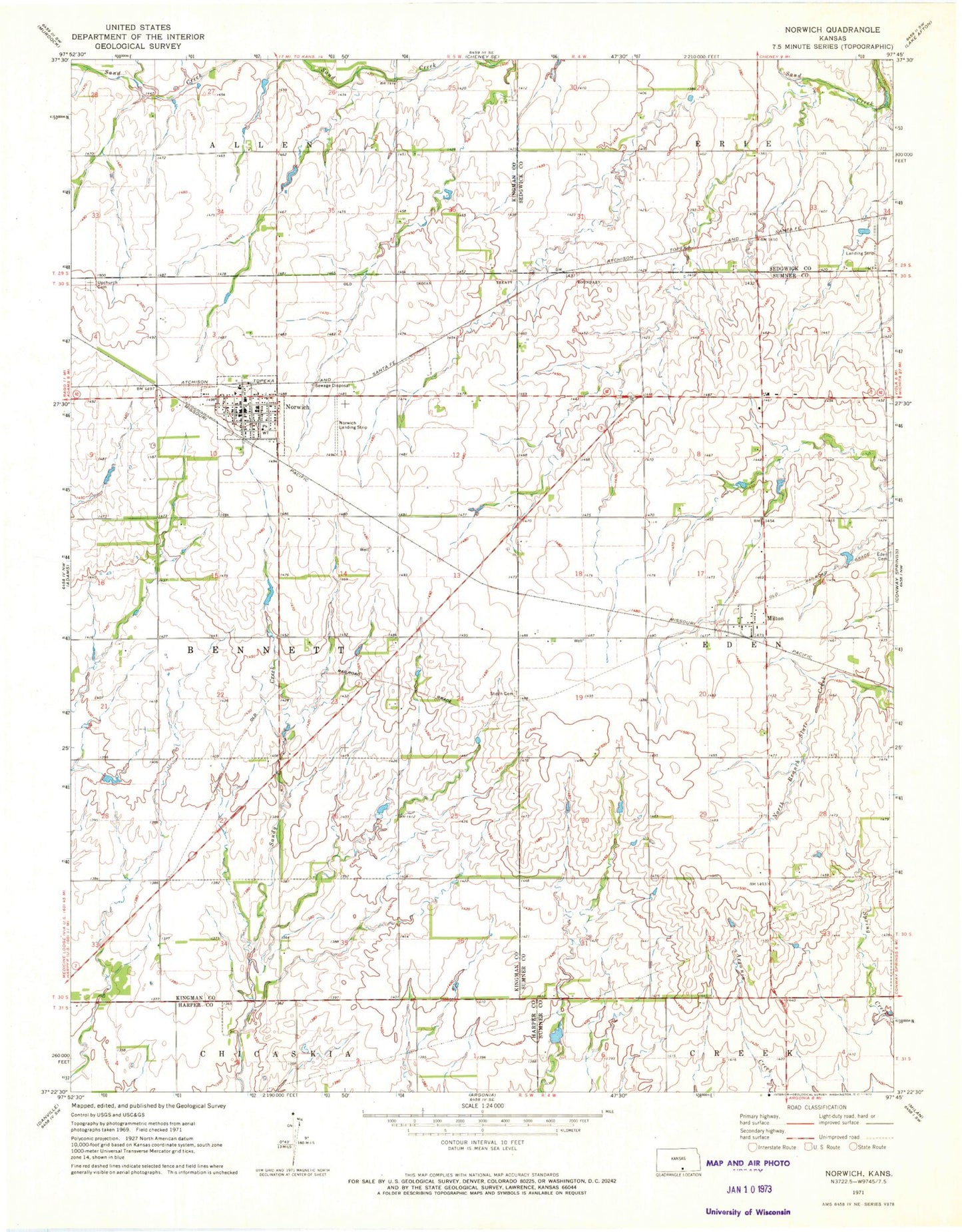
Classic USGS Norwich Kansas 7.5'x7.5' Topo Map
Couldn't load pickup availability
Historical USGS topographic quad map of Norwich in the state of Kansas. Map scale may vary for some years, but is generally around 1:24,000. Print size is approximately 24" x 27"
This quadrangle is in the following counties: Harper, Kingman, Sedgwick, Sumner.
The map contains contour lines, roads, rivers, towns, and lakes. Printed on high-quality waterproof paper with UV fade-resistant inks, and shipped rolled.
Contains the following named places: City of Norwich, Dotzour Senior Center, Eden Cemetery, First Baptist Church, Judson School, Milton, Milton Baptist Church, Milton Census Designated Place, Milton Post Office, Milton United Methodist Church, Norwich, Norwich Airport, Norwich Christian Church, Norwich Church of Christ, Norwich City Hall, Norwich Community Library, Norwich Elementary School, Norwich High School, Norwich Middle School, Norwich Police Department, Norwich United Methodist Church, Norwich Volunteer Fire Department, Norwich Wastewater Plant, Stitch Cemetery, Suppesville, Suppesville Golf Course, Suppesville Wastewater Plant, Township of Bennett, Township of Eden, Upchurch Cemetery, ZIP Codes: 67106, 67118