MyTopo
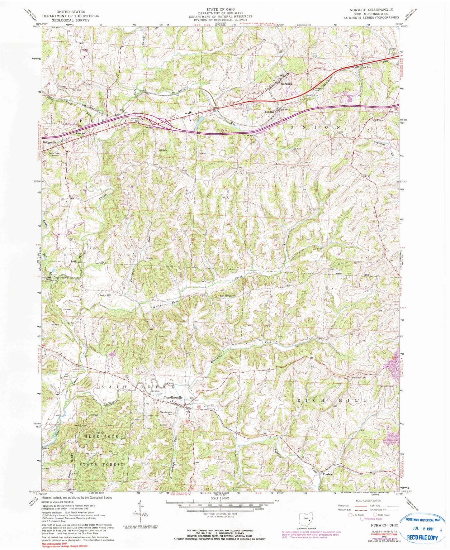
Classic USGS Norwich Ohio 7.5'x7.5' Topo Map
Couldn't load pickup availability
Historical USGS topographic quad map of Norwich in the state of Ohio. Map scale may vary for some years, but is generally around 1:24,000. Print size is approximately 24" x 27"
This quadrangle is in the following counties: Muskingum.
The map contains contour lines, roads, rivers, towns, and lakes. Printed on high-quality waterproof paper with UV fade-resistant inks, and shipped rolled.
Contains the following named places: Bakers Pond, Bakers Pond Dam, Bridgeville, Bridgeville Post Office, Buck Run, Buffalo Fork, Chandlersville, Chandlersville Cemetery, Chandlersville Post Office, Chandlersville Presbyterian Church, Chandlersville School, Chandlersville United Methodist Church, Coon Ridge, Derry Landing Strip Airport, Forestdale School, Franklin School, Freeland, Freeland Post Office, Frog Run, Georges Run, Green Valley School, Lawton, Lawton Post Office, Lepage Run, Little Salt Creek, National Road Museum, Norwich, Norwich Methodist Cemetery, Norwich Post Office, Norwich School, Norwich United Presbyterian Cemetery, Perry Elementary School, Pike School, Pleasant Run, Pleasant Valley School, Rich Hill, Rich Hill Cemetery, Rich Hill Church, Rich Hill Post Office, Rock Spring Cemetery, Salt Creek Baptist Church, Salt Creek Bridge, Salt Creek Cemetery, Salt Creek Church, Seawright, Shuck School, Smith, Smith Mill, Spry School, Sun Dale Post Office, Sundale, Township of Perry, Township of Salt Creek, Township of Union, Village of Norwich, West Union School, White Eyes Creek, Williams Fork