MyTopo
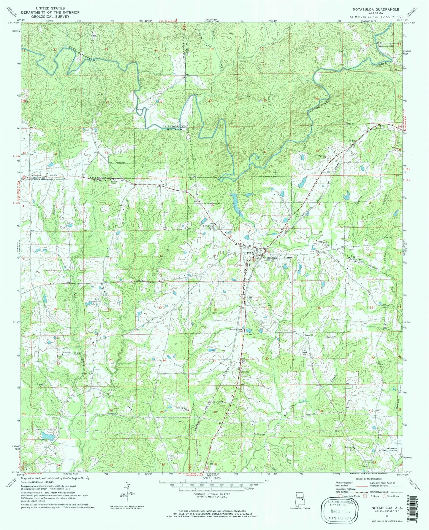
Classic USGS Notasulga Alabama 7.5'x7.5' Topo Map
Couldn't load pickup availability
Historical USGS topographic quad map of Notasulga in the state of Alabama. Map scale may vary for some years, but is generally around 1:24,000. Print size is approximately 24" x 27"
This quadrangle is in the following counties: Lee, Macon, Tallapoosa.
The map contains contour lines, roads, rivers, towns, and lakes. Printed on high-quality waterproof paper with UV fade-resistant inks, and shipped rolled.
Contains the following named places: Adcock, Antioch Cemetery, Antioch Methodist Church, Apostolic Faith Mission Church, Apple Grove Church, Bethlehem Cemetery, Buloh Church, Cane Creek, Concord Cemetery, Concord Church, East Alabama Bible College, East Branch Wolfe Creek, Faith Tabernacle Church, G E Kimbrough Dam, Hays Mill, Kimbrough Lake, Liberty City, Lockets Chapel, Macedonia School, McCrary Cemetery, McCrary Church, McElder School, McRitchie Mill, Mount Zion Cemetery, Mount Zion Church, Mount Zion School, New Prospect Church, Nostalgic Police Department, Notasulga, Notasulga Block School, Notasulga City Cemetery, Notasulga City Lake, Notasulga City Lake Dam, Notasulga Division, Notasulga High School, Notasulga Post Office, Notasulga Volunteer Fire Department, Oliver Creek, Page Bridge, Ropes Creek, Saint John Church, Salem Macon Baptist Church, Salem Macon Cemetery, Shiloh Cemetery, Shiloh Church, Shiloh School, The House of Prayer Church, Town Creek, Town of Notasulga, West Branch Wolfe Creek, Williams Dam, ZIP Code: 36866