MyTopo
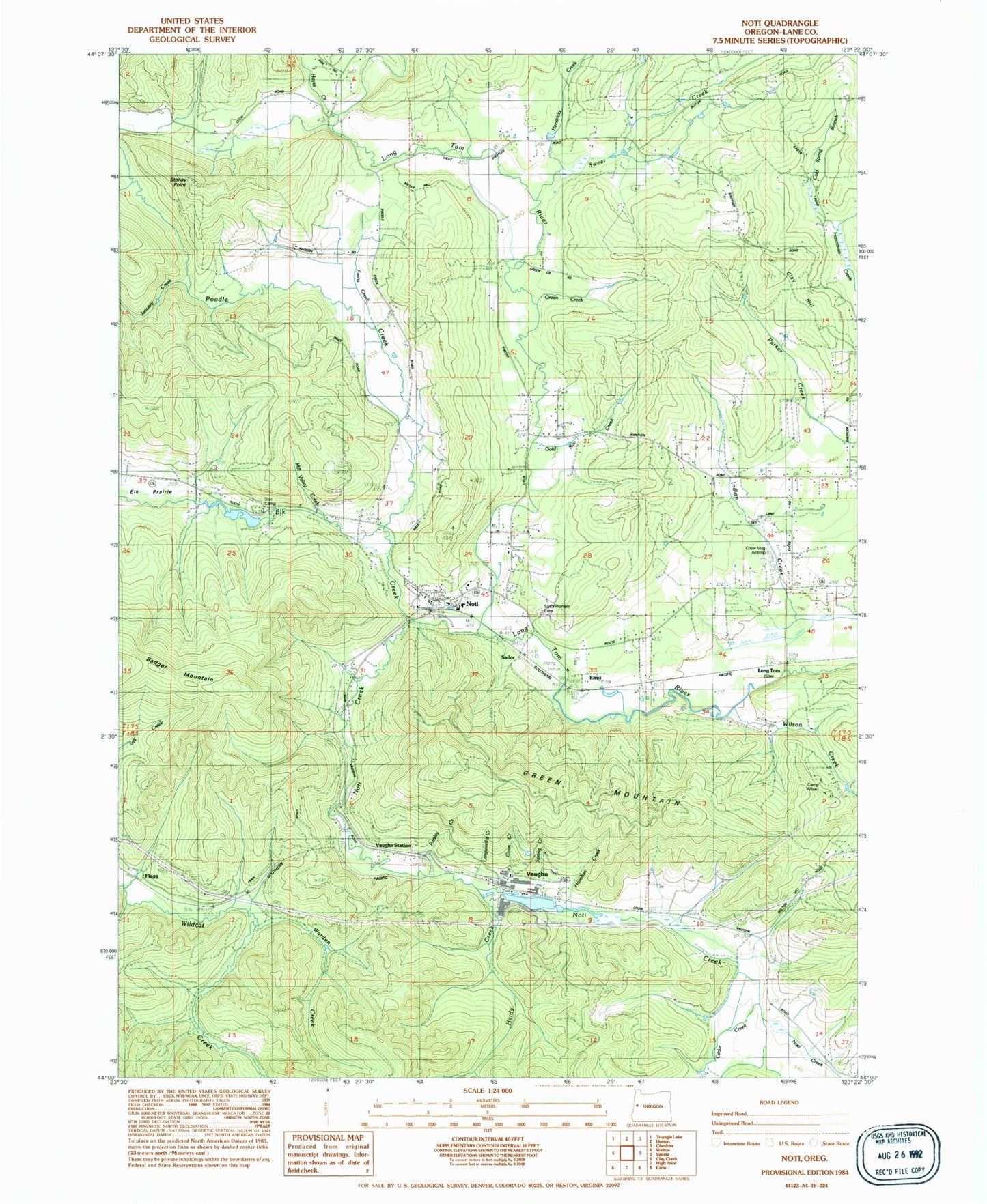
Classic USGS Noti Oregon 7.5'x7.5' Topo Map
Couldn't load pickup availability
Historical USGS topographic quad map of Noti in the state of Oregon. Map scale may vary for some years, but is generally around 1:24,000. Print size is approximately 24" x 27"
This quadrangle is in the following counties: Lane.
The map contains contour lines, roads, rivers, towns, and lakes. Printed on high-quality waterproof paper with UV fade-resistant inks, and shipped rolled.
Contains the following named places: Badger Mountain Division, Berkley Post Office, Camp Wilani, Capps, Cedar Creek, Clay Hill, Cram Creek, Crow-Mag Airport, Determination Creek, Elk Creek, Elrus, Evans Creek, Flagg, Forcia and Larsen Dam, Forcia and Larsen Reservoir, Gold Run Creek, Green Creek, Green Mountain, Hale, Hale Post Office, Hardy Creek, Hayes Creek, Hendricks Branch, Hoselton Creek, Ivison, Ivison Post Office, January Creek, Jones Creek, Lane County Fire District 1 Station 103, Lane County Fire District 1 Station 104, Langworthy Creek, Little Hahnee Reservoir, Long Tom, Long Tom Post Office, Mill Valley Creek, Noel Creek, Noti, Noti Creek, Noti Creek Reservoir, Noti Post Office, Oregon Country Fairgrounds, Orth, Parsley Creek, Poodle Creek, Sailor, Sailor Pioneer - Noti Cemetery, Spring Creek, Star Camp, Stephens S S Heirs Cemetery, Stoney Point, Sweet Creek, Varien Post Office, Vaughn, Vaughn Log Dam, Vaughn Station, Warden Creek, Wilson Creek, ZIP Codes: 97437, 97461