MyTopo
Classic USGS Nottbusch Butte Arizona 7.5'x7.5' Topo Map
Regular price
$16.95
Regular price
Sale price
$16.95
Unit price
per
Couldn't load pickup availability
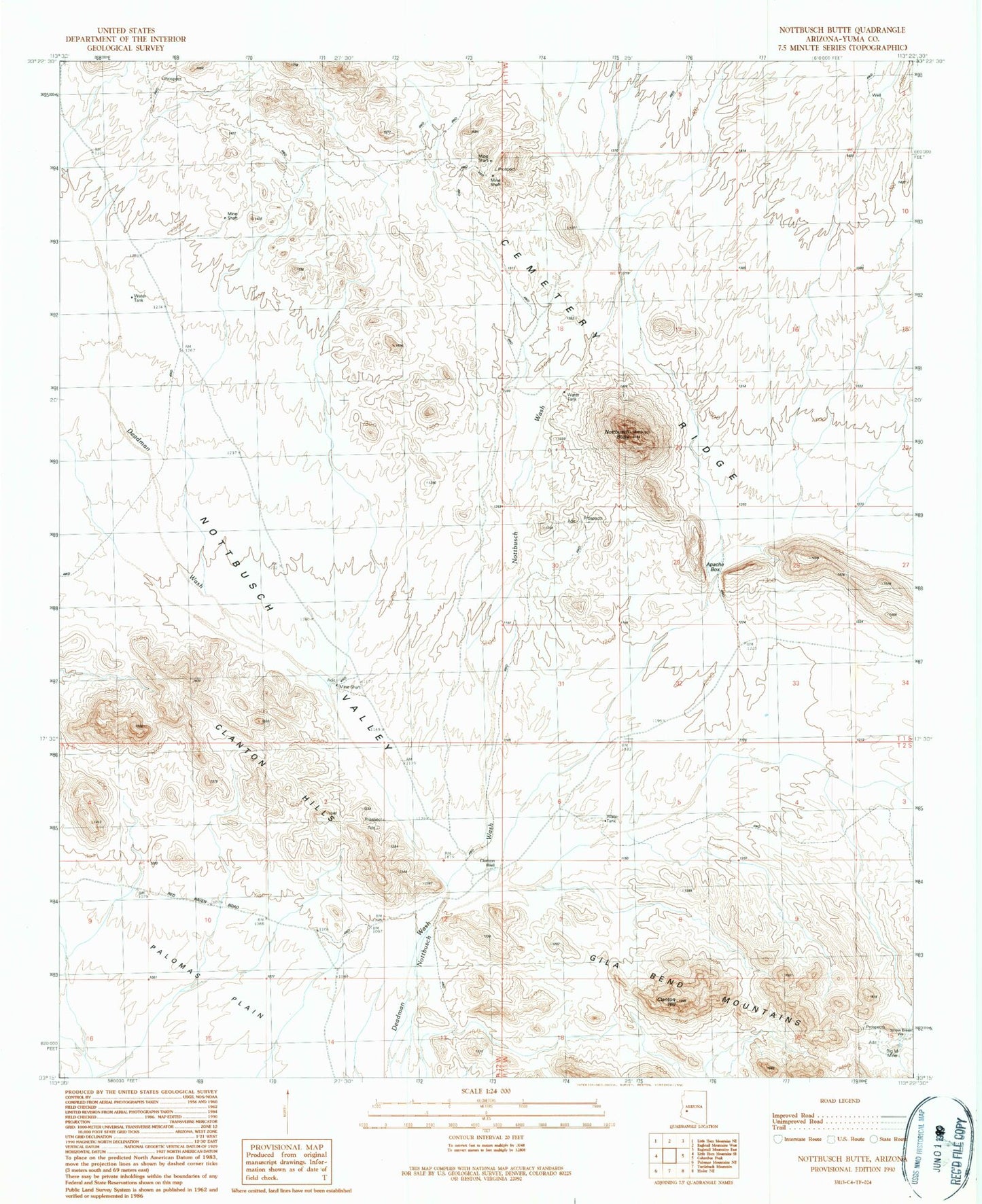
Historical USGS topographic quad map of Nottbusch Butte in the state of Arizona. Map scale may vary for some years, but is generally around 1:24,000. Print size is approximately 24" x 27"
This quadrangle is in the following counties: Yuma.
The map contains contour lines, roads, rivers, towns, and lakes. Printed on high-quality waterproof paper with UV fade-resistant inks, and shipped rolled.
Contains the following named places: Apache Box, Big M Mine, Cemetery Ridge, Clanton Hill, Clanton Hills, Clanton Well, Collins Mine, Deadman Mountain, Manganese Mine, Nottbusch Butte, Nottbusch Valley, Red Bird Mine, Road Tank, Yellow Brest Well