MyTopo
Classic USGS Nova Ohio 7.5'x7.5' Topo Map
Couldn't load pickup availability
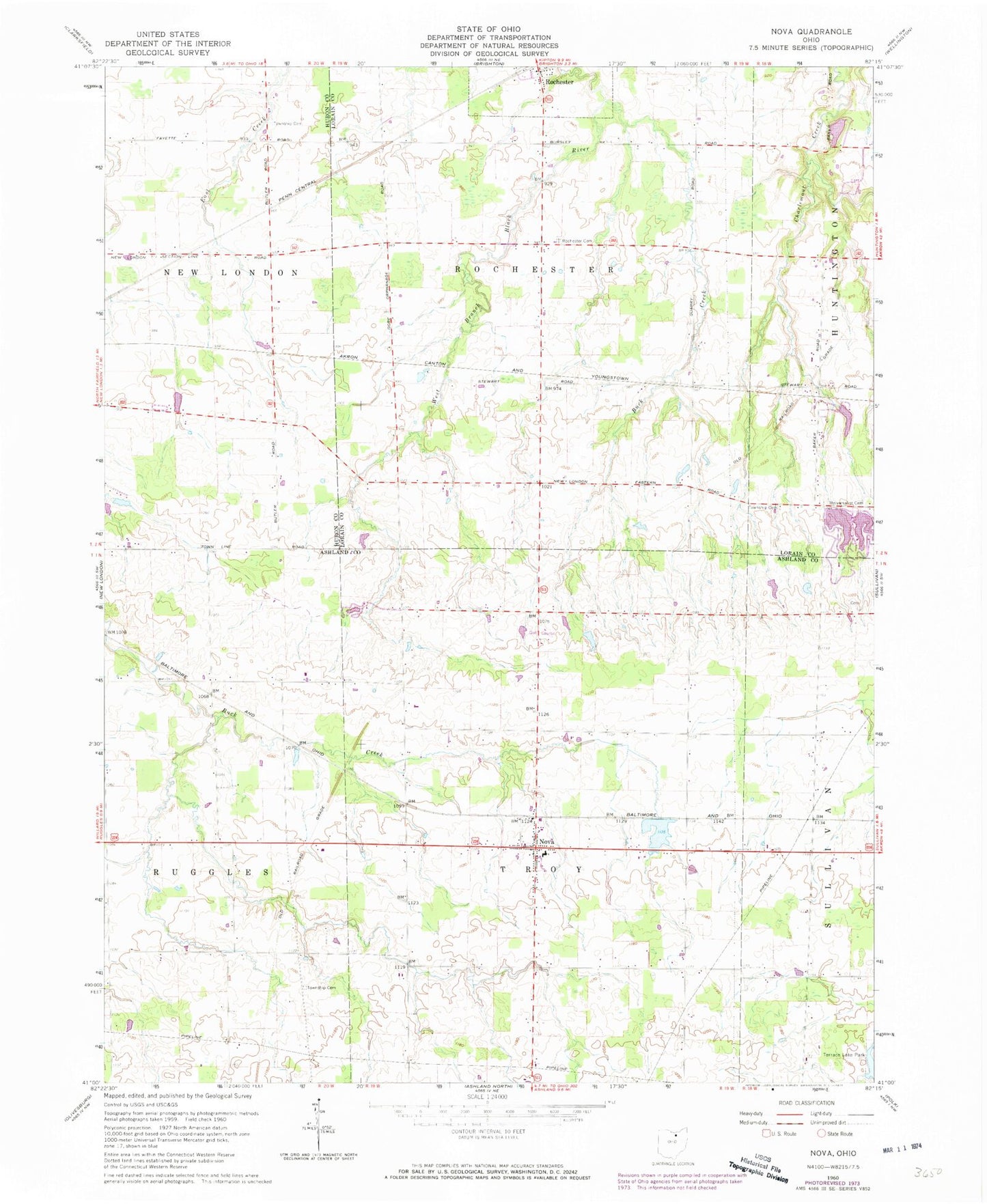
Historical USGS topographic quad map of Nova in the state of Ohio. Map scale may vary for some years, but is generally around 1:24,000. Print size is approximately 24" x 27"
This quadrangle is in the following counties: Ashland, Huron, Lorain.
The map contains contour lines, roads, rivers, towns, and lakes. Printed on high-quality waterproof paper with UV fade-resistant inks, and shipped rolled.
Contains the following named places: Avon Maple Farm, Bakers Crossing, Beckley Cemetery, Ber Al. Lake, Buck Creek, Buckley School, Clare Mar Camp Lake, Clare Mar Camp Lake Dam, Close Street Cemetery, Dirlams Store, East Creek Cemetery, Fay School, Galloway Farms, German Lutheran Cemetery, Lake Ber Al Dam, Nova, Nova Cemetery, Nova Pond, Nova Pond Dam, Nova Post Office, Rochester Cemetery, Rochester Volunteer Fire Department, Rohrs Lake, Rohrs Lake Dam, Rolling Acres Golf Course, Ruggles - Troy Volunteer Fire Department, Semples, Terrace Lake Park, Township of Rochester, Township of Troy, Ukranian Youth Camp Lake, Ukranian Youth Camp Lake Dam, Universalist Cemetery, Village of Rochester, ZIP Code: 44859