MyTopo
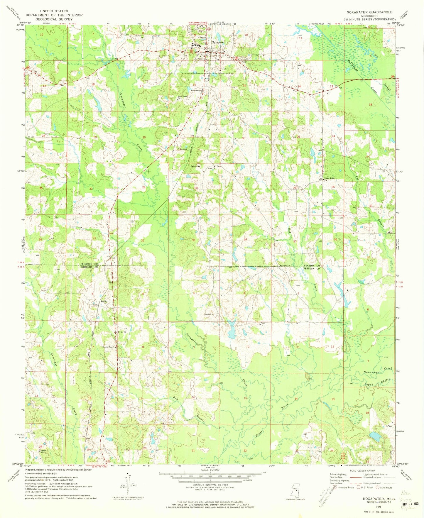
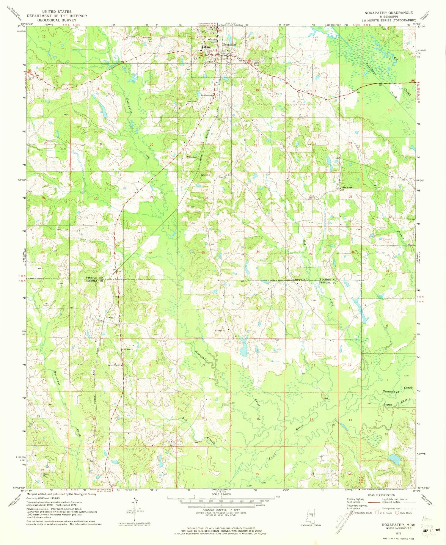
Classic USGS Noxapater Mississippi 7.5'x7.5' Topo Map
Couldn't load pickup availability
Historical USGS topographic quad map of Noxapater in the state of Mississippi. Map scale may vary for some years, but is generally around 1:24,000. Print size is approximately 24" x 27"
This quadrangle is in the following counties: Neshoba, Winston.
The map contains contour lines, roads, rivers, towns, and lakes. Printed on high-quality waterproof paper with UV fade-resistant inks, and shipped rolled.
Contains the following named places: Argo, Bell Branch, Bogue Chitto, First Pentecostal Church, Hight, Hight Cemetery, Hight Church, Jesus Name Church, Joe C Reese Lake Dam, Joel Creek, Kingdom Hall of Jehovahs Witnesses, Methodist Cemetery, Mount Ary Cemetery, Mount Ary Church, Mount Carmel Baptist Cemetery, Mount Pisgah Cemetery, Mount Pisgah Church, Mount Vernon Church, Nanih Waiya Creek, Narrow Way Church, Noxapater, Noxapater Creek, Noxapater Methodist Church, Noxapater Police Department, Noxapater Post Office, Noxapater School, Noxapater Volunteer Fire Department, Odell Barrier Dam, O'Neal Jackson Lake Dam, R Baskin Lake Dam, Salem Cemetery, Salem Church, Stallo, Stallo Volunteer Fire Department Station 1 Headquarters, Stallo Volunteer Fire Department Station 2, T J Barrier Lake Dam, Town of Noxapater, Union Ridge Baptist Church, Union Ridge Cemetery, Watkins Lake Dam, ZIP Code: 39346