MyTopo
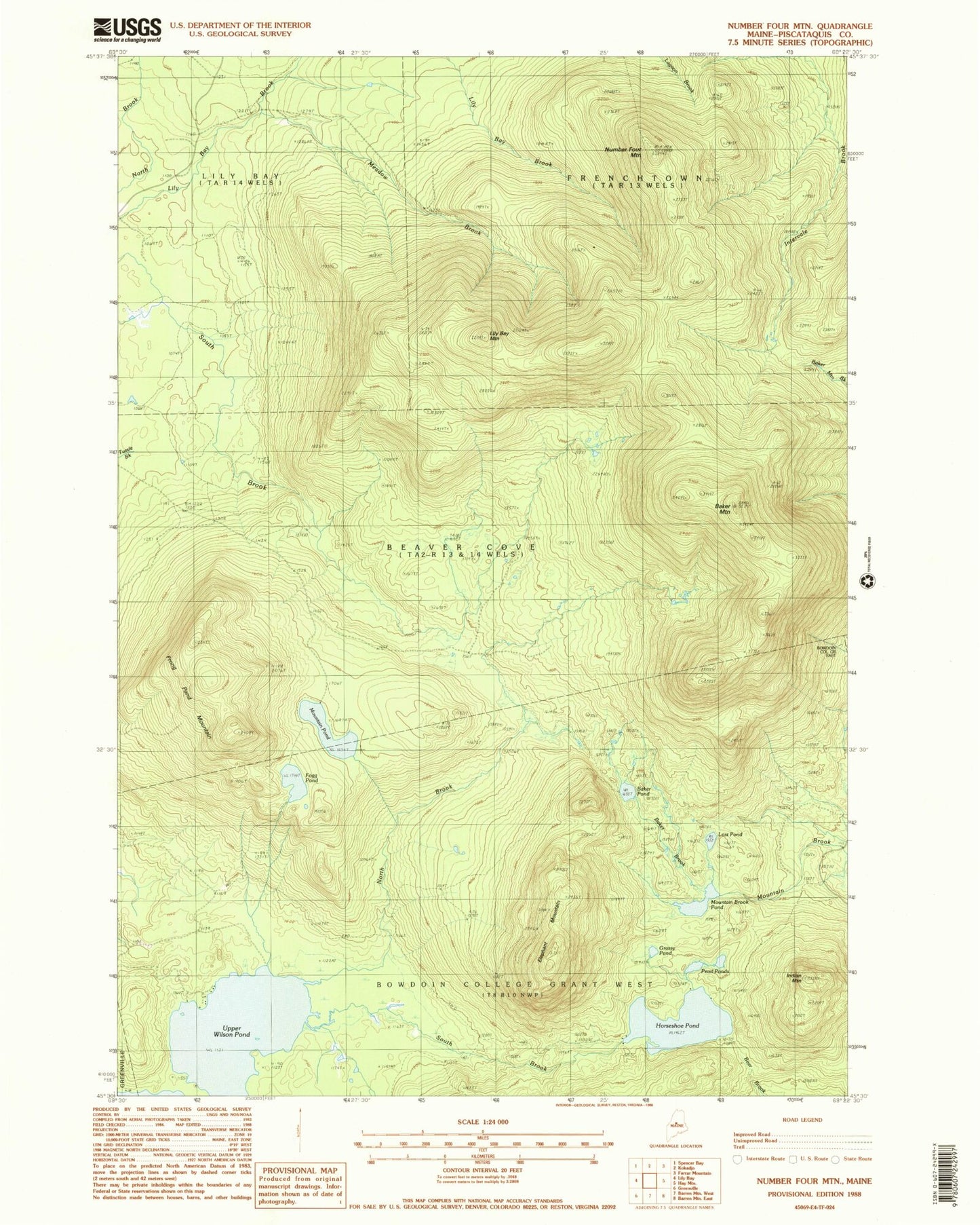
Classic USGS Number Four Mountain Maine 7.5'x7.5' Topo Map
Couldn't load pickup availability
Historical USGS topographic quad map of Number Four Mountain in the state of Maine. Typical map scale is 1:24,000, but may vary for certain years, if available. Print size: 24" x 27"
This quadrangle is in the following counties: Piscataquis.
The map contains contour lines, roads, rivers, towns, and lakes. Printed on high-quality waterproof paper with UV fade-resistant inks, and shipped rolled.
Contains the following named places: Baker Brook, Baker Mountain, Baker Pond, Elephant Mountain, Fogg Pond, Grassy Pond, Horseshoe Pond, Indian Mountain, Lily Bay Mountain, Lost Pond, Meadow Brook, Mountain Brook Pond, Mountain Pond, North Brook, Number Four Mountain, Pearl Ponds, Prong Pond Mountain, South Brook, Upper Wilson Pond, Town of Beaver Cove, Bowdoin College Grant West Township