MyTopo
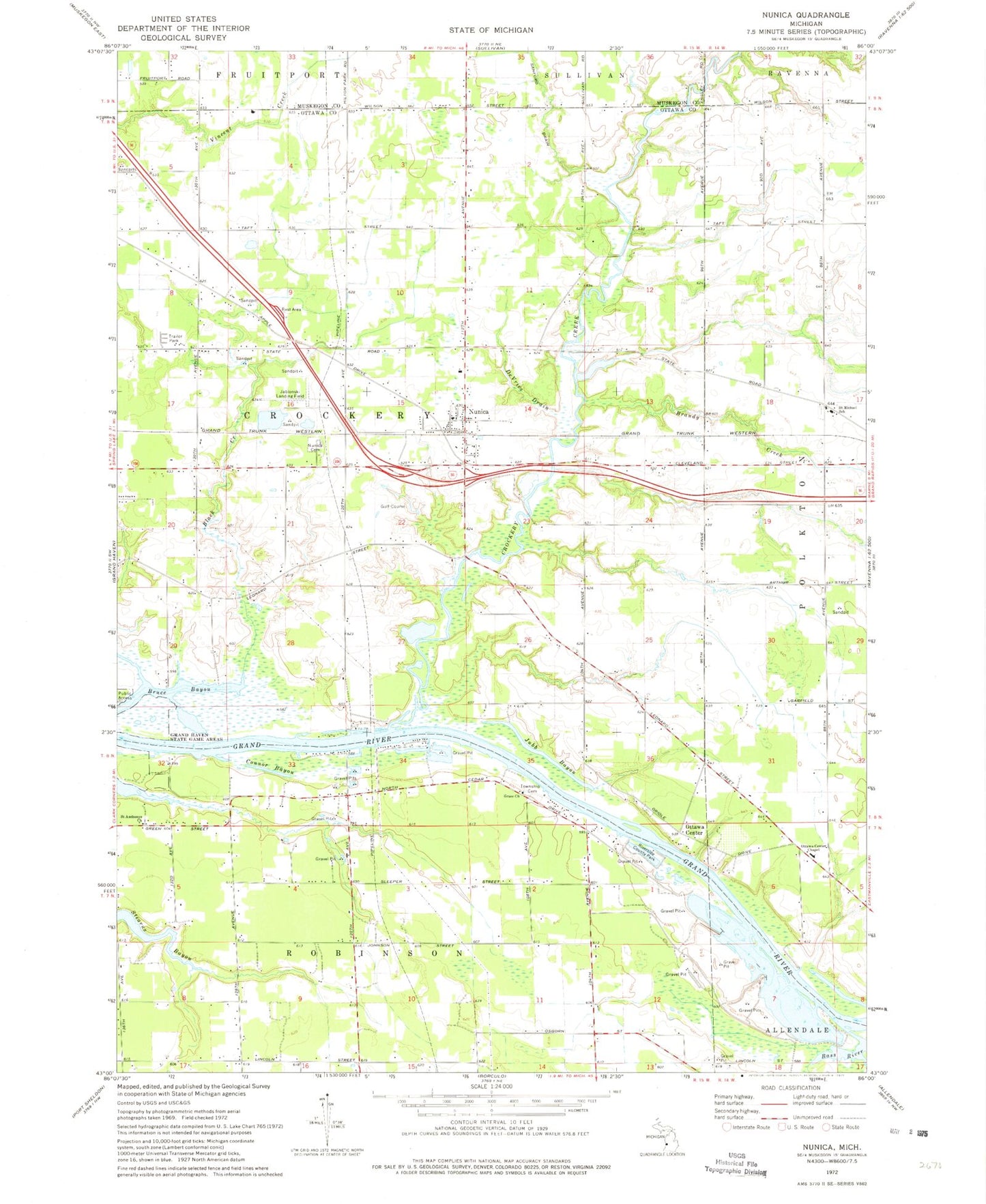
Classic USGS Nunica Michigan 7.5'x7.5' Topo Map
Couldn't load pickup availability
Historical USGS topographic quad map of Nunica in the state of Michigan. Map scale may vary for some years, but is generally around 1:24,000. Print size is approximately 24" x 27"
This quadrangle is in the following counties: Muskegon, Ottawa.
The map contains contour lines, roads, rivers, towns, and lakes. Printed on high-quality waterproof paper with UV fade-resistant inks, and shipped rolled.
Contains the following named places: Bass River, Bassriver Post Office, Black Creek, Brandy Creek, Conestoga Grand River Campground, Conner Pit, Connor Bayou, Crockery Creek, Crockery Mobile Home Park, Crockery Township Fire Department, DeVries Drain, Fishermans Island, Flying-A-Ranch Airport, Fruitport Rest Area, Grace Church, Hat Field, Jablonski Airport, Jubb Bayou, Nunica, Nunica Bible Church, Nunica Cemetery, Nunica Census Designated Place, Nunica Post Office, Nunica Station, Ottawa Center, Ottawa Center Cemetery, Ottawa Center Chapel, Riverside County Park, Robinson Cemetery, Saint Anthonys Church, Saint Luke Lutheran Church, Saint Michael School, Saint Michael's Catholic Church, Saint Michael's Cemetery, Terra Verde Golf Course, Township of Crockery, ZIP Code: 49448