MyTopo
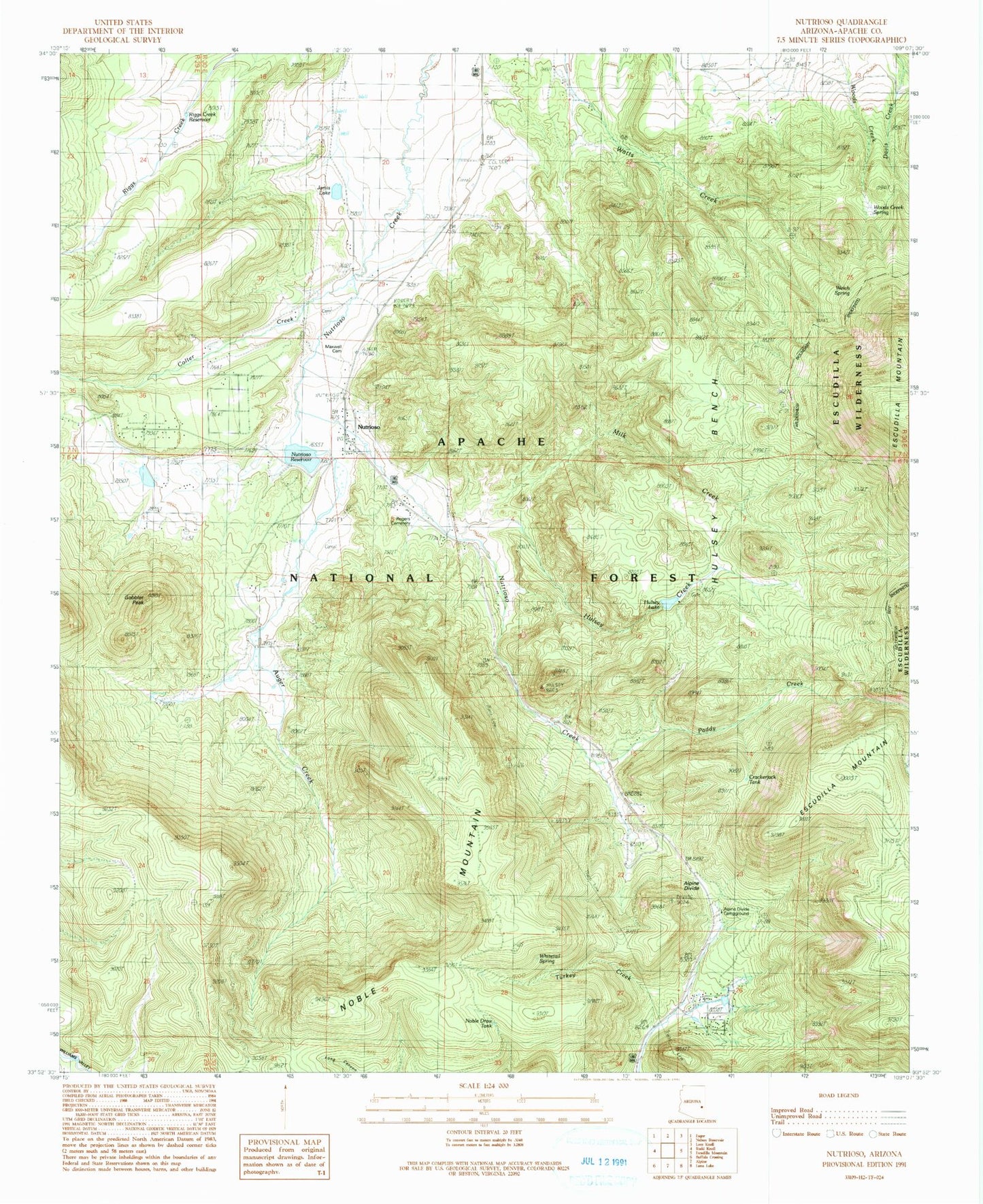
Classic USGS Nutrioso Arizona 7.5'x7.5' Topo Map
Couldn't load pickup availability
Historical USGS topographic quad map of Nutrioso in the state of Arizona. Typical map scale is 1:24,000, but may vary for certain years, if available. Print size: 24" x 27"
This quadrangle is in the following counties: Apache.
The map contains contour lines, roads, rivers, towns, and lakes. Printed on high-quality waterproof paper with UV fade-resistant inks, and shipped rolled.
Contains the following named places: Hulsey Bench, Maxwell Cemetery, Rogers Cemetery, Welch Spring, Alpine Divide, Auger Creek, Colter Creek, Escudilla Mountain, Gobbler Peak, Hulsey Creek, Milk Creek, Noble Mountain, Nutrioso, Paddy Creek, Riggs Creek Reservoir, Toolbox Draw, White Mountain Boys Ranch, Whitetail Spring, Alpine Divide Campground, Crackerjack Tank, Feaster, Greenhead Tank, Hulsey Fork Tank, Hulsey Lake, Hulsey Lake Dam, Jarvis Dam, Jarvis Lake, Long Tank, Miller Ranch, Noble Draw Tank, Nutrioso Dam, Nutrioso Reservoir, Paddy Fork Tank, Riggs Creek Dam, Tal-Wi-Wi Tank, Tal-Wi-Wi Ranch, Trail Tank, Woods Creek Spring, Corral Tank, West Section Thirty-five Tank, East Section Thirty-five Tank, Foster Ranch, Shane Tank, Long Draw Tank, Tal-Wi-Wi Lodge, Profanity Tank, Road Forks Tank, Husley Tank, Turkey Draw Tank, Sandy Spring, Charlies Spring, Divide Tank, Alpine Divide Spring, Carex Spring, Milk Flat Spring, Section 26 Tank, Nutrioso Census Designated Place, Nutrioso Post Office