MyTopo
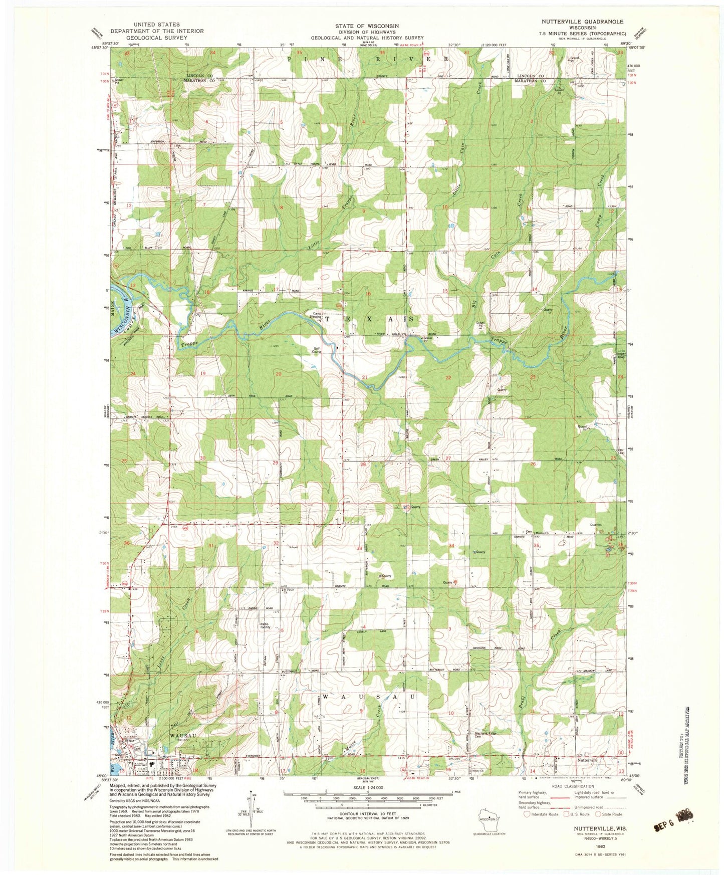
Classic USGS Nutterville Wisconsin 7.5'x7.5' Topo Map
Couldn't load pickup availability
Historical USGS topographic quad map of Nutterville in the state of Wisconsin. Map scale may vary for some years, but is generally around 1:24,000. Print size is approximately 24" x 27"
This quadrangle is in the following counties: Lincoln, Marathon.
The map contains contour lines, roads, rivers, towns, and lakes. Printed on high-quality waterproof paper with UV fade-resistant inks, and shipped rolled.
Contains the following named places: Big Cain Creek, Butternut Grove School, Camp Blessing, Camp Creek, Cold Spring Wausau Quarry, Forest Lawn Farm, Granite School, Hill Grove School, Husting School, Jefferson School, Lenroot School, Little Cain Creek, Little Trappe River, Marshall Hill School, Mechanics Ridge Cemetery, Mission Church, Nutterville, Red Granite Quarry, Riverhills Country Club, Riverview Elementary School, Saint Peter Evangelical Lutheran Church, Shady Lane Farms, Sweetwater Ranch, Texas Township Fire Department, Town of Texas, Trappe River, Trappe School, Trinity Cemetery, Trinity Church, Trinity School, Twin Oaks School, Wilke's Dairy Farm, ZIP Code: 54403