MyTopo
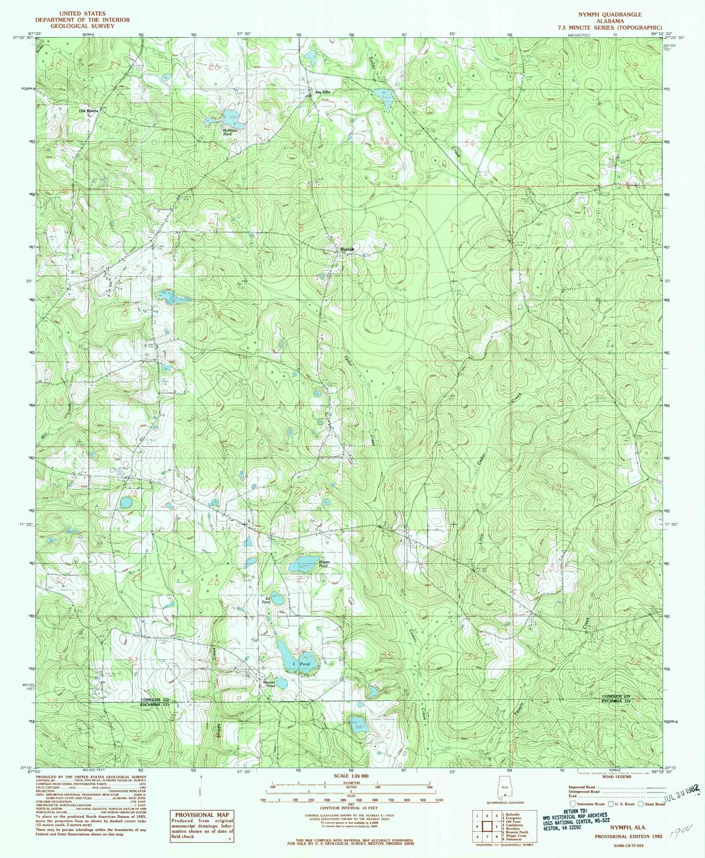
Classic USGS Nymph Alabama 7.5'x7.5' Topo Map
Couldn't load pickup availability
Historical USGS topographic quad map of Nymph in the state of Alabama. Map scale may vary for some years, but is generally around 1:24,000. Print size is approximately 24" x 27"
This quadrangle is in the following counties: Conecuh, Escambia.
The map contains contour lines, roads, rivers, towns, and lakes. Printed on high-quality waterproof paper with UV fade-resistant inks, and shipped rolled.
Contains the following named places: Albrest Cemetery, Bethel African Methodist Episcopal Church, Bethel Methodist Church, Cedar Creek Church, Covington County Courthouse, Davison Cemetery, Ed Pond, Feagin Creek, First Christian Church, First Presbyterian Church, Greater Nazarene Baptist Church, Greater Nazarene Cemetery, Holly Grove Cemetery, Jay Villa, L Pond, L Pond Church, Little Cedar Creek, McMillan Dam, McMillan Pond, Mount Olive Church, New Beulah Church, New Hope Cemetery, New Hope Church, Nymph, Nymph Volunteer Fire Department, Old Beulah Cemetery, Old Country Club Dam, Old Country Club Pond, Old Sparta, Saint Luke Church, Shipps Pond, Sparta Cemetery, Sparta Hill Cemetery, Sparta Hill Methodist Church, Union Grove Church, Weaver Pond