MyTopo
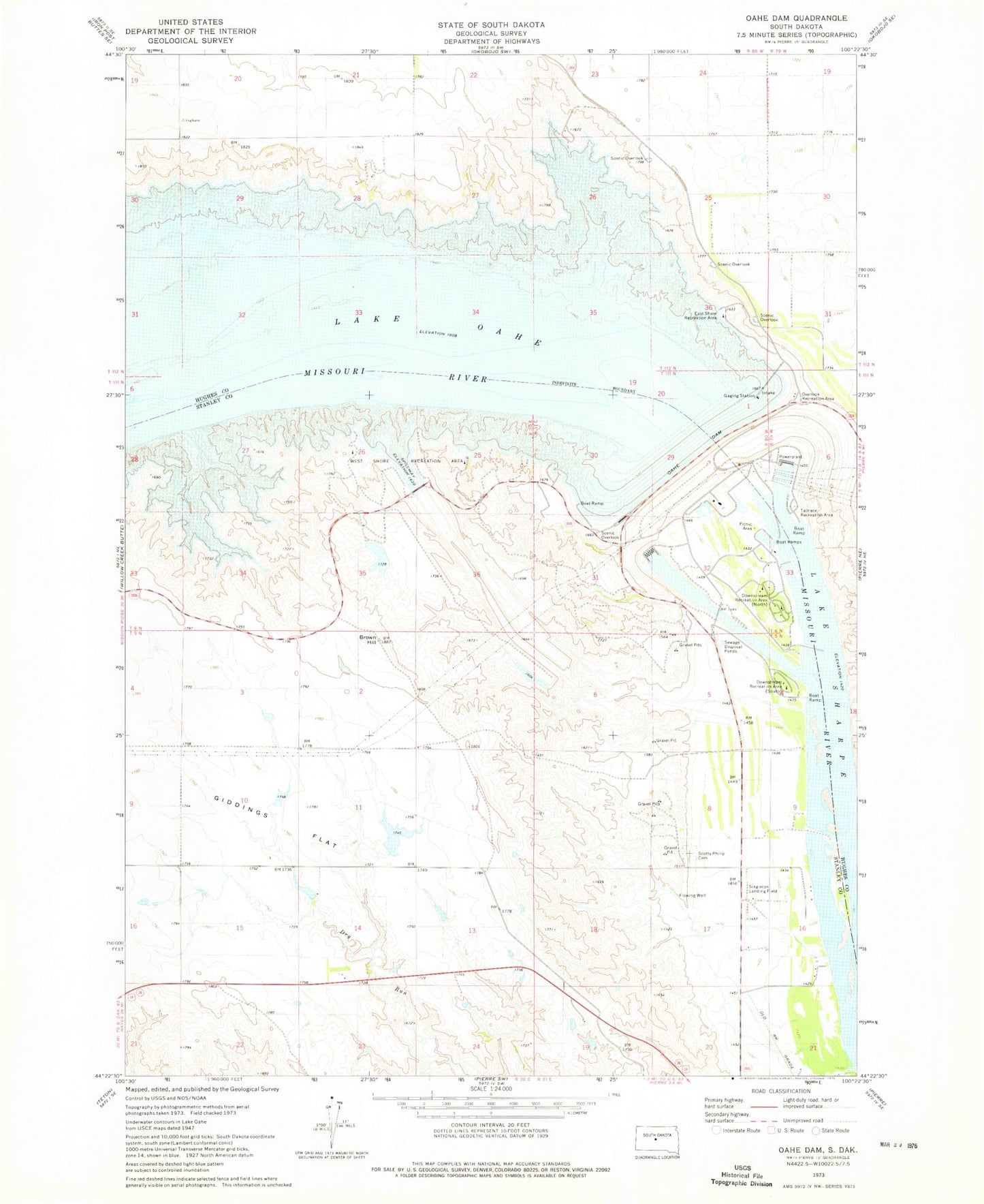
Classic USGS Oahe Dam South Dakota 7.5'x7.5' Topo Map
Couldn't load pickup availability
Historical USGS topographic quad map of Oahe Dam in the state of South Dakota. Map scale may vary for some years, but is generally around 1:24,000. Print size is approximately 24" x 27"
This quadrangle is in the following counties: Hughes, Stanley.
The map contains contour lines, roads, rivers, towns, and lakes. Printed on high-quality waterproof paper with UV fade-resistant inks, and shipped rolled.
Contains the following named places: Brown Hill, Buffalo Park, Downstream Recreation Area, East Shore Recreation Area, Fort Galpin, Fort LaFramboise Number Two, Fort Pierre Number One, Fort Pierre Number Two, Fort Primeau, Fort Tecumseh, Giddings Flat, Grandview School, Haskins Number 1 Dam, Lake Oahe, Medicine Butte, Oahe Dam, Overlook Recreation Area, Robinson Brothers Ranch, Sam Alleman Ranch, Scotty Philip Cemetery, Stony Hill, Strand Brothers Farm, Tailrace Recreation Area, Township of Peoria, West Shore Recreation Area, Willow Island, Wood Island