
MyTopo
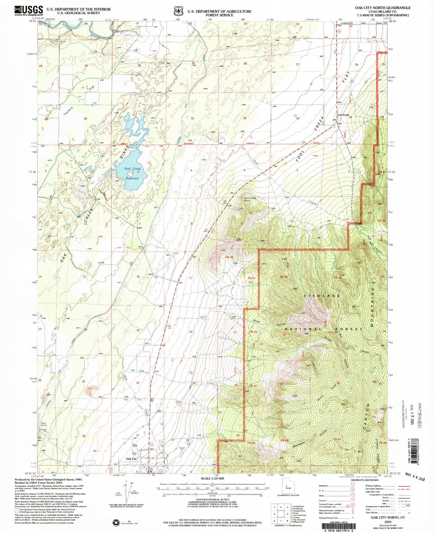
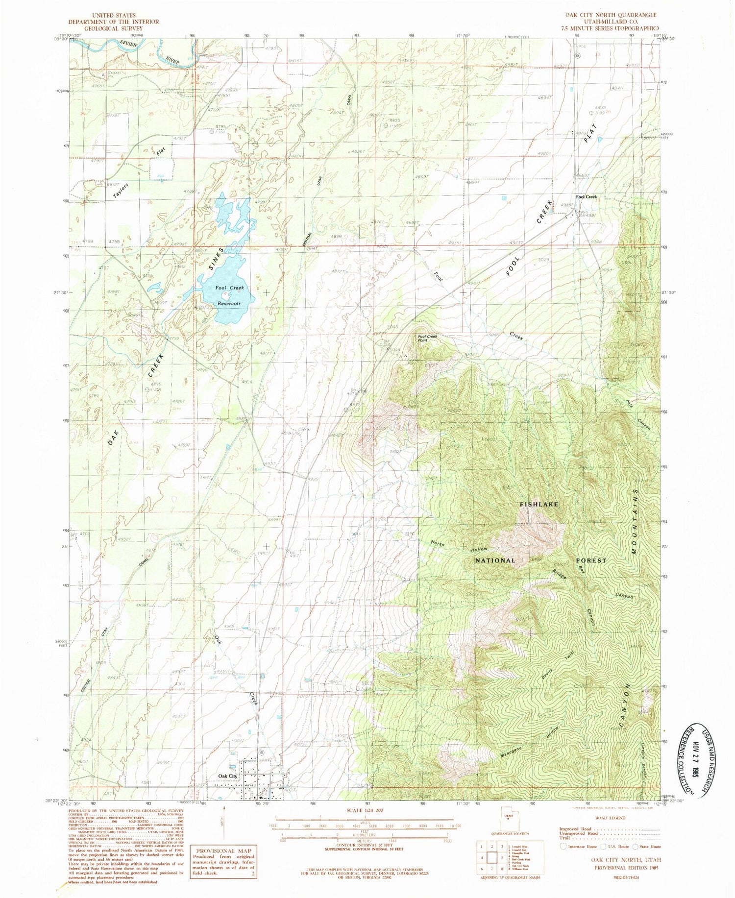
Classic USGS Oak City North Utah 7.5'x7.5' Topo Map
Couldn't load pickup availability
Historical USGS topographic quad map of Oak City North in the state of Utah. Map scale may vary for some years, but is generally around 1:24,000. Print size is approximately 24" x 27"
This quadrangle is in the following counties: Millard.
The map contains contour lines, roads, rivers, towns, and lakes. Printed on high-quality waterproof paper with UV fade-resistant inks, and shipped rolled.
Contains the following named places: Box Canyon, Bridge Canyon, Devils Twist, Fool Creek, Fool Creek Flat, Fool Creek Number One Dam, Fool Creek Number Two Dam, Fool Creek Number Two Reservoir, Fool Creek Point, Fool Creek Reservoir Number 1, Horse Hollow, Mahogany Hollow, Oak City Fire Department, Oak City Post Office, Oak Creek, Pauls Meadow, Pole Canyon, Taylors Flat, The Church of Jesus Christ of Latter Day Saints, Town of Oak City


